2- Old Waters Creek Campground to Turners Corner
Linked via: Nhdplus discovery 90% confidence Synced 6mo ago
Gauge Conditions
Runnable: 2,000.0 – 20,000.0 CFS
Data from American Whitewater & USGS
Run Map
Description
(Information from Robert Bridges of USFS/Chattahoochee National Forest.)
The lower section of Dick's Creek alternates between USFS and private property. Only the first half mile or so is visible from the Dick's Creek Road.
The familiar Waters Creek Campground is now gone, closed by USFS in favor of a day use area. Look for a grassy area on the right while traveling uphill on Dick's Creek Road. Parking is down the short dirt road across Dick's Creek Road from the old campground.
The fence beginning between the road and the river just upstream of the old campground creates an appearance of private property, but the river bank is in fact USFS property to just above the steep slide sequence/falls: a difficult-to-see red post in the foliage between road and river defines the actual boundary line.
The USFS property continues downriver a short distance from the old campground: look for a red post on the opposite side of Dick's Creek Road that defines that border. Do not use the old, closed steel bridge just off Dick's Creek Road: as the many signs indicate, it is on private property.
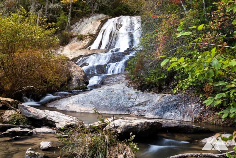
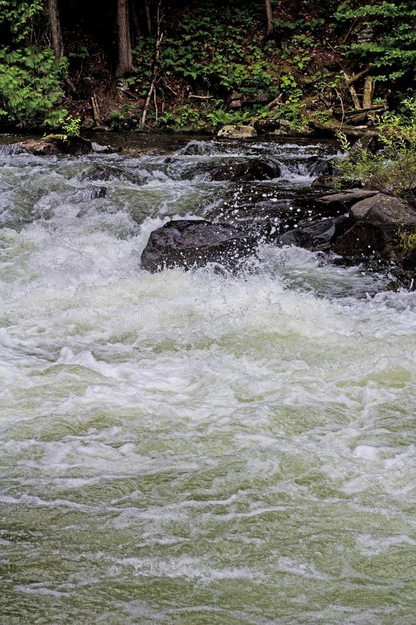
The big slide sequencefalls above the old campgound is followed some tight creeky drops, some rock gardens and some wood to be avoided. No information on the portion after the creek curves away from the road, but rumor has it there is a waterfall back there. The confluence of Blood Mountain Creek and Dick's Creek is also in this hidden portion of the run.
If you have information on the remainder of the run, please add to the "comments" below or email to the streamkeeper. If you're planning to run this reach, please let the streamkeeper know.
DIRECTIONS: From Turner's Corner, go west on Highway 19 just over a half mile to the turn onto Dick's Creek Road. Look for the "Mt. Pisgah Church" sign at the intersection.
Waterfalls (1)
Hazards & Portages (1)
Caution: The following locations may require scouting or portaging. Always check current conditions.
Difficulty
Class IV
Length
3.7 mi
Gradient
40 ft/mi
Rapids
0
1 Hazard
Access Points
Difficulty Classes
I Easy
II Novice
III Intermediate
IV Advanced
V Expert/Extreme
VI Unrunnable
Current Conditions
5-Day Forecast
Whitewater data from
American Whitewater
American Whitewater