2. Paper Mill Road to Susquehanna River (Cold Creek Park)
Muddy Creek (Susquehanna trib)
Linked via: Proximity 93% confidence Synced 6mo ago
Gauge Conditions
Data from American Whitewater & USGS
Run Map
Run Time Estimate
Select put-in and take-out to estimate time.
Unlock Advanced Trip Planning
See wind-adjusted speed maps, forecast planning, and detailed time estimates.
Sign in to generate an AI timing estimate for this run.
Whitewater timing varies with scouting, portages, and group pace. Use as a planning baseline.
Description
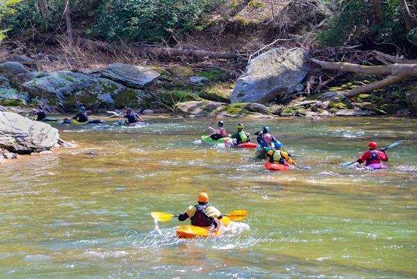
A surprisingly good whitewater run. It would really be first class if it wasn't for the 1.58 miles of flatwater on the end created by the Conowingo Dam. Muddy Creek is actually reasonably clear, and flows through a pretty laurel studded gorge that looks like it belongs in the Appalachians.
Put in at the Paper Mill bridge. Be aware that you can't leave a car at the Paper Mill Bridge put-in. (It will be towed. Stark-Moon outfitters runs a shuttle service so that all the cars can be at the take-out.)
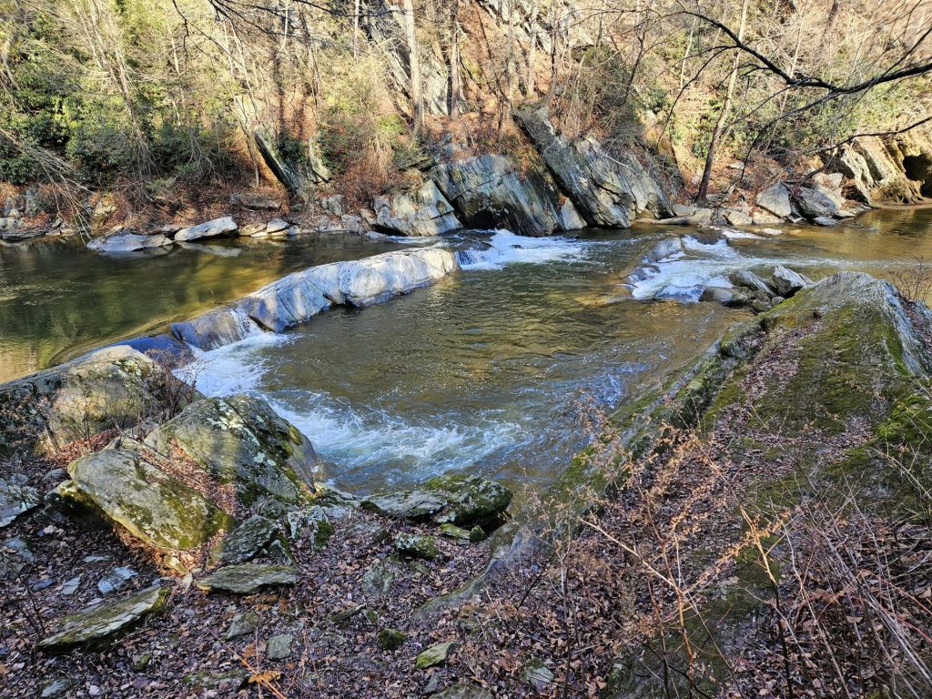
The first notable rapid, is Double Ledges(II-).
Ledge #1 (one - two foot drop) - Small surfing wave forms mid-stream at top of rapid. River left eddy is large, beginners should catch a breathe here. Smaller eddy on river left allows for easier access to small surf wave.
Ledge #2 (two-three foot drop) - Small side surfing ledge hole forms midstream to river left eddy. River left eddy is large. Smaller eddy on river right. Easiest to enter side surf hole from river right, bracing on right side(downstream). The main flow channel downstream of the Ledge #2 allows for stern squirts from the river left eddy. At higher levels(2 feet above normal) a creek wide surf wave(4 feet tall) forms.
The next small ledge is a small diagonal ledge (I) - This diagonal ledge will allow beginners to develop their surfing skills.
At about a mile into the run is 'Snap Falls' (III) - creek wide ledge (Right side, 4 foot drop; Left side, two step 4 foot drop). At lower levels run 'Snap Falls' on river right. The simplest line is approximately 10 feet left of large sloping rock. The current pushes to the right here, so a little left angle is advised. The corner can also be run here, but this is a harder line, because it has to be run with 45 degree left angle. Be prepared to brace on left side, and don't be tempted to put a hand brace on the rock face to the right. At moderate levels runs can be made river right (must consider at moderate and higher levels a nasty hole forms against rock face), river left is a straight forward staircase or center if middle rock is covered. At higher levels (flood stage), run river left. Play moves at lower and moderate levels in hole at bottom of river right drop of 'Snap Falls'. Both stern squirts and front enders and variations into rock splats can be performed. A campsite exist on river right, that overlooks 'Snap Falls'. The second smaller drop of 'Snap Falls' is best run by hugging the river right rock bank.
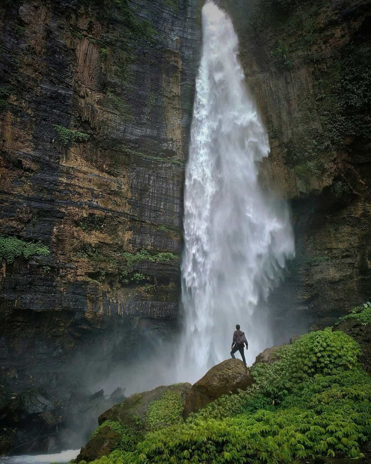
'Muddy Creek Falls' (V) The river necks sharply. Get over to the right, because you have reached 'Muddy Creek Falls', a nasty 15 ft or so drop which requires a 100 yard or so portage over rocks. A large roar of white water will warn you. Most paddlers should portage this Class V rapid, because there are undercuts and other pinning opportunities if you make a mistake! Eddy at least 100 yards upstream of the gorge on river right, there is a trail that will allow you to portage below the gorge. The trail is not the greatest and the rocks are slippery. Any boater attempting 'Muddy Creek Falls' should first land or boat scout. The Falls almost always have something in it (i.e. wood).
Below the falls, there is a gorge which offers two (2) places to launch from. The highest point to launch would be from the highest point of the large middle rock of the gorge. This is where you would typically would take a look into the gorge. It drops about 20 feet at about a 70 degree angle. It will take some plastic off your boat. The second launch point is probably 10 feet up. And is 100 feet downstream of the first launch point on river right. This one is easier and allows you to boof the surface of the water.
The next rapid (II-) takes a sharp right turn and is approximately 1/2 of a mile downstream of the gorge. This rapid you enter right of center, as you drop over the first small ledge which turns into the main flow. Catch the river left eddy above the large undercut rock the blocks the flow on the left side of the creek. At medium levels, you will find small surfing waves in the middle of the creek. The remainder of the rapid can be run starting from the river left eddy, peeling out into the main current and working your way to the middle of the creek. Below the large undercut rock, catch the large river left eddy. This eddy has a powerful upstream circulation to it and will keep you busy if you are trying to rest. From this left eddy you can execute stern squirts and there is also a neat attainment move that allows you to move slightly above the large undercut rock, where a small side surfing hole exists.
The next rapid is approximately 1/2 mile downstream and is called 'Screaming Left' (II+) for the need to make an increasingly strong left turn in the rapid. This rapid, at low levels, can be entered between the river right bank and the middle of the creek. Follow the river right bank through the rapid. If you can catch a river right bank eddy, you can turn upstream and ferry from river right to river left. As you continue down this rapid, which slowly bends to the left be prepared for the large slanting rock at the bottom. At lower levels it is best to avoid the rock by paddling hard to river left. Catching the river left eddy next to the rock provides easy access to a small surfing wave. At higher levels it is easy to splat the rock provided it has a pillow on it.
The next rapid, called 'Mumbling Right' (II) generally turns right against the left bank. At the bottom, it has a cool splat rock and is a nice play area, above and below the splat rock. Above the splat rock in the river left eddy, you can do stern squirts into the main flow onto the splat rock. Below the splat rock is a small surfing wave.
The next rapid, called 'Gumdrop' AKA 'Power Line' (II+), is a two drop ledge rapid, dropping in total a few feet. Eddies can be made between the first ledge and the second ledge on both the right and left, the right being the easier of the two. Peel out into the main flow and eddy after the second ledge drop on either the right or left. A small hole wave and a trailing diagonal surf wave form off the second ledge.
The next item of note in this beautiful refreshing gorge is a waterfall cascading down a channel cut into a rock face. The water fall is probably 25 feet high and if you paddle under it you'll receive a cool shower.
One ledge drop rapid remains: 'Triple Drop' (III). Paddlers running straight through will run to the river right of the center rock, but must hug the river right side of the rock (i.e. stay left) to avoid a flipping/pinning rock on the river right side of the main current. For players: the first ledge drop is approximately one-two feet high and provides a nice river wide side surfing hole. The surfing wave can be entered from a river left eddy. From the river left eddy ferry across the creek to the river right eddy to the next and best surfing hole on the creek. This creek wide surfing hole is steeper than the top surf wave and 360 degree spins can be done at medium water levels. At low water levels, straight on surfing with sharp cut backs can be carved. Below this the creek drops another ten feet in approximately four small steps. Each step has its own small surfing wave.
The remaining paddle is flat water on the Muddy (0.4 miles) out to the Susquehanna River, where you paddle downstream on the Susquehanna (a little more than one additional mile) to the Cold Cabin Park access (for a total flatwater paddle of 1.58 miles). A landmark for determining where the take out parking lot is the last two (2) homes on the river right bank. If unsure just paddle close to the shore, it only takes longer paddling the perimeter of the shoreline.
General Notes:
If you plan on boating the river in the winter, be prepared to do a palm portage at the end of the last rapid on Muddy Creek. The back water from the Susquehanna usually freezes in January or February, depending on how cold the winter is and how much the Creek and River levels have fluctuated.
Remember not to leave cars at the Paper Mill Bridge Put In because they will be towed.
For more information, see _Keystone Canoeing_ by Gertler, E.
Rapids in this Run (7)
Waterfalls (2)
Playspots (1)
Hazards & Portages (1)
Caution: The following locations may require scouting or portaging. Always check current conditions.
Difficulty
Class II(III)
Length
4.6 mi
Gradient
15 ft/mi
max 30
Rapids
7
1 Hazard
Access Points
Difficulty Classes
I Easy
II Novice
III Intermediate
IV Advanced
V Expert/Extreme
VI Unrunnable
Current Conditions
5-Day Forecast
Whitewater data from
American Whitewater
American Whitewater