2. Poor Farm Rd. (Rt. 623) to Hidden Valley
Linked via: Nhdplus discovery 90% confidence Synced 6mo ago
Gauge Conditions
Runnable: 300.0 – 3,000.0 CFS
Data from American Whitewater & USGS
Run Map
Run Time Estimate
Select put-in and take-out to estimate time.
Unlock Advanced Trip Planning
See wind-adjusted speed maps, forecast planning, and detailed time estimates.
Sign in to generate an AI timing estimate for this run.
Whitewater timing varies with scouting, portages, and group pace. Use as a planning baseline.
Description
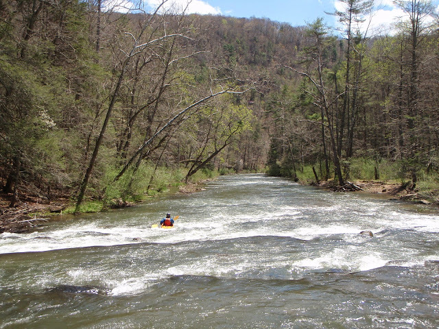
This is a great run if you are looking for scenery, solitude, and quiet with minimal whitewater. There's good public access at both ends and wilderness in between (there are some trails along the river however). Great for a tandem canoe trip. A couple of miles from the put-in bridge, there is a class II or low III ledgy rapid identifiable by a horizon line. You can scout/portage on river right. At most flows, enter far river left, with a right angle. However, this rapid is an outlier, and the rest of the trip is fairly mellow. Note that guidebook authors Grove and Gertler have described this section accurately, while Corbett says 'most of the rapids are solid Class 3' which is not accurate. Perhaps he paddled it at very high water or was thinking of Richardson Gorge downstream. In any case, this section is very much worth paddling, just don't expect much whitewater excitement.
See Also:
*Classic Virginia Rivers,* Ed Grove (1992 ed), p. 218.
*Virginia Whitewater*, Roger Corbett (2000 ed.), p. 268.
*Exploring Virginia's Waterways*, Ed Gertler (2022 ed.), p. 192.
Rapids in this Run (1)
Difficulty
Class I-II(III)
Length
7.0 mi
Gradient
21 ft/mi
Rapids
1
Access Points
Difficulty Classes
I Easy
II Novice
III Intermediate
IV Advanced
V Expert/Extreme
VI Unrunnable
Current Conditions
5-Day Forecast
Whitewater data from
American Whitewater
American Whitewater