2. Ramsey's Cascade trailhead to Porters Creek confluence
Linked via: Nhdplus discovery 90% confidence Synced 6mo ago
Gauge Conditions
Primary
Runnable: 1,100.0 – 4,000.0 CFS
Data from American Whitewater & USGS
Run Map
Run Time Estimate
Select put-in and take-out to estimate time.
Unlock Advanced Trip Planning
See wind-adjusted speed maps, forecast planning, and detailed time estimates.
Sign in to generate an AI timing estimate for this run.
Whitewater timing varies with scouting, portages, and group pace. Use as a planning baseline.
Description
Brad Roberts testifies:
Great creek run!!! Bring a short blunt boat, lots of rescue gear, and a big grin!! I would have to call the run a class 4 plus. Most of the run involves taking a duffek stroke to line up, then a boof stroke to launch - for just about the entire run. Not a whole lot of drops over 4 or 5 feet tall, but lots of drops about 8 feet apart.
The first rapid below the put-in bridge and the last rapid above the confluence were the most difficult. A high-water paddle out on the Middle Prong is a great way to cap off the run!!
This run is harder than it looks. There are also many bad spots spaced throughout the river. With good water this run is as or more difficult than upper Big Creek.
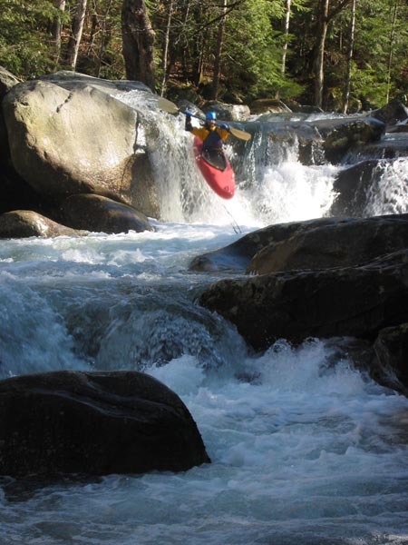
The first drop is right above the footbridge. To putin above this 8 foot boof, turn right off of the trail immediately before it crosses the footbridge. Go a hundred feet upstream and there will be a spot to put on. After sliding in, be ready for a little ledge above the big one that comes up quick. The big ledge is best boofed on the right, but keep your angle downstream so as to not land on a rock that sticks out on the right side of the drop.
The next rapid is the hardest on the run, with the possible exception of Pinball, near the takeout. Here the river squeezes down against the right bank and drops through a super steep boulder field for some distance. There are sick holes and rocks in here and its always bigger than it looked from the parking lot. After this set, eddy out and take a breath because it is non stop for the next half mile.
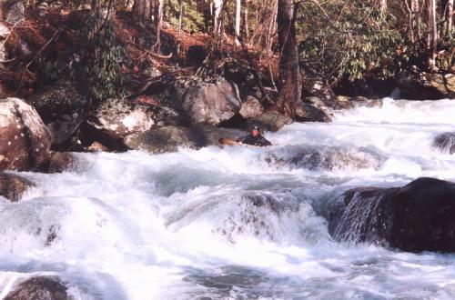
The gradient holds pretty steep through here and it tends to push you from one drop to another with little recovery time. Swimming doesn't look like fun. After several hard rapids be on the lookout for a large wall on the right signifying cave rapid. Half the river drives under this rock formation and the consequences of a missed line are of the worst type. A sneak is available on the left at high water, but at medium to low flows there aren't many options.
After the cave things get junky for a while. There are several twisting drops with unpleasant rock contact all the way down. Soon the road crosses, and be on the lookout here for river wide log jams that tend to wind up pinned against the bridge supports.
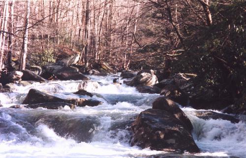
From here the creek relaxes a little to normal class 4 and winds through some good boulder gardens and braided areas. Keep an eye out for wood. Then the river picks back up significantly at Pinball, which is on the right side of an island and is easy to blunder into without knowing it. Down the middle is the line, trying to stay out of the big holes littering the pathway. Near the bottom stay center driving right to avoid several nasty pins and boulder piles where the left channel meets back up with the right one.
Below Pinball the creek is easy class 4 again for the last half mile to the takeout at the confluence with Porters Creek.
Waterfalls (1)
Hazards & Portages (3)
Caution: The following locations may require scouting or portaging. Always check current conditions.
Difficulty
Class IV-V
Length
1.5 mi
Gradient
240 ft/mi
Rapids
0
3 Hazards
Access Points
Difficulty Classes
I Easy
II Novice
III Intermediate
IV Advanced
V Expert/Extreme
VI Unrunnable
Current Conditions
5-Day Forecast
Whitewater data from
American Whitewater
American Whitewater