2) Rock Creek Dam to Rock Creek Powerhouse
Linked via: Proximity 96% confidence Synced 6mo ago
Gauge Conditions
Runnable: ? – ? CFS
Approximate reading: This gauge is 34.9 miles away on Feather. Use as a general reference only.
Data from American Whitewater & USGS
CDEC Flow Data California
Data from California Data Exchange Center (CDEC)
Run Map
Run Time Estimate
Select put-in and take-out to estimate time.
Unlock Advanced Trip Planning
See wind-adjusted speed maps, forecast planning, and detailed time estimates.
Sign in to generate an AI timing estimate for this run.
Whitewater timing varies with scouting, portages, and group pace. Use as a planning baseline.
Description
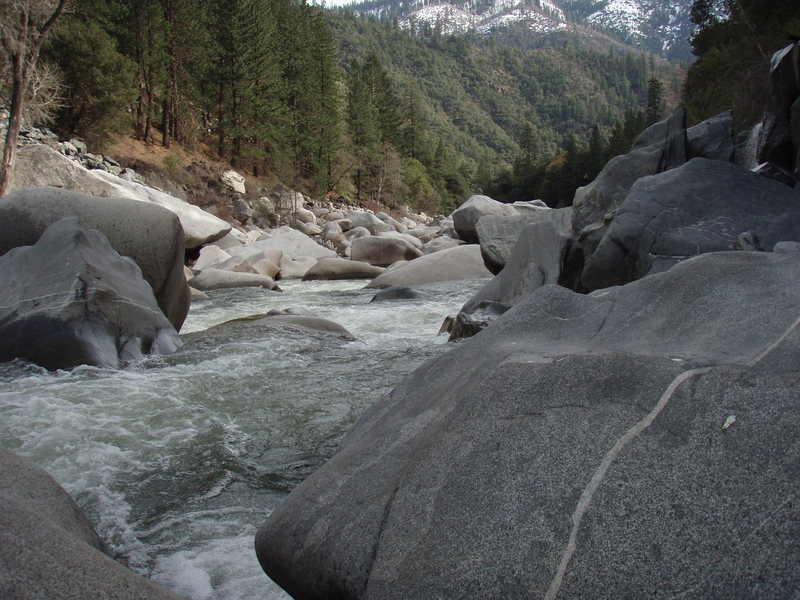
In the decades following construction of the Cresta Hydroelectric Project (FERC P-1962) flows were diverted for hydropower and only 50 cfs flowed through this reach of the North Fork Feather. Spring and winter releases were erratic and nearly impossible to catch. All this changed in June 2001 with the issuance of a new license for this project. The staff and volunteers of American Whitewater, Chico PaddleHeads, and Shasta Paddlers spent more than five years, thousands of dollars, and thousands of hours negotiating the new licence. The new license included increased base flows and recreation boating releases. The base flows were designed to bump up incrementally every five years. The third five year flow period began in 2015. The practical outcome for paddlers is that the Rock Creek reach, particularly the Tobin and Lobin sections, are now boatable every day in Wet, Normal, and Dry water years. For more information on specific flows, see the flow info tab on this page.
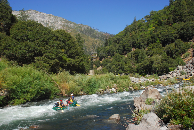
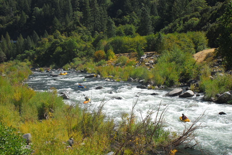
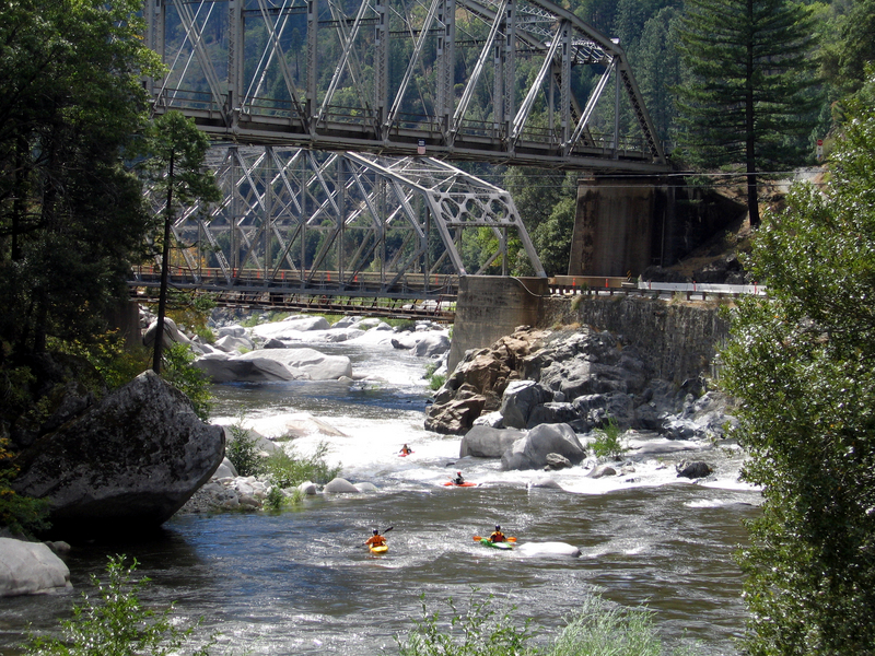
Although parking is limited there are several alternative access sites as the entire run parallels Highway 70. You can thus start at the top and run the whole section or you can just do a couple laps on the part that best suites your skills and interest. The run is generally divided into three sections which each offer a different character. These include Rodger's Flat, Tobin, and Lobin.
_Rodger's Flat Run_
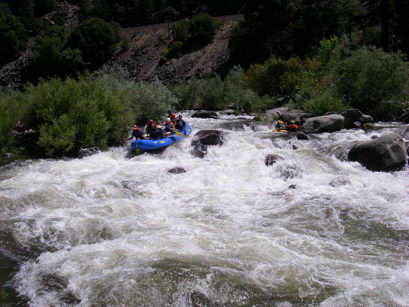
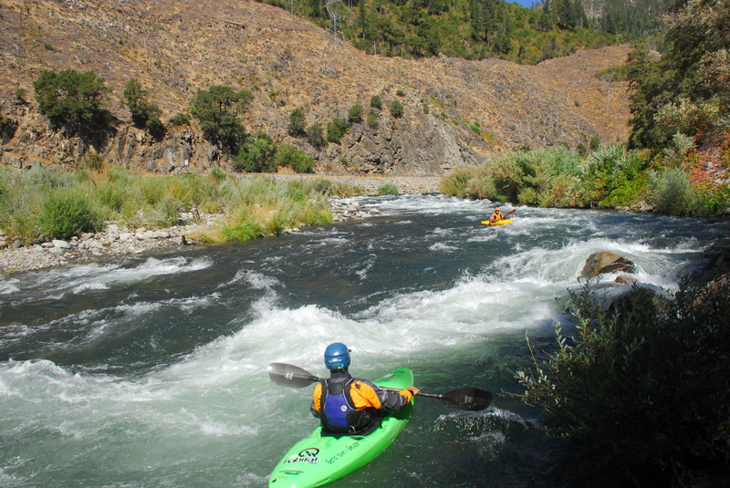
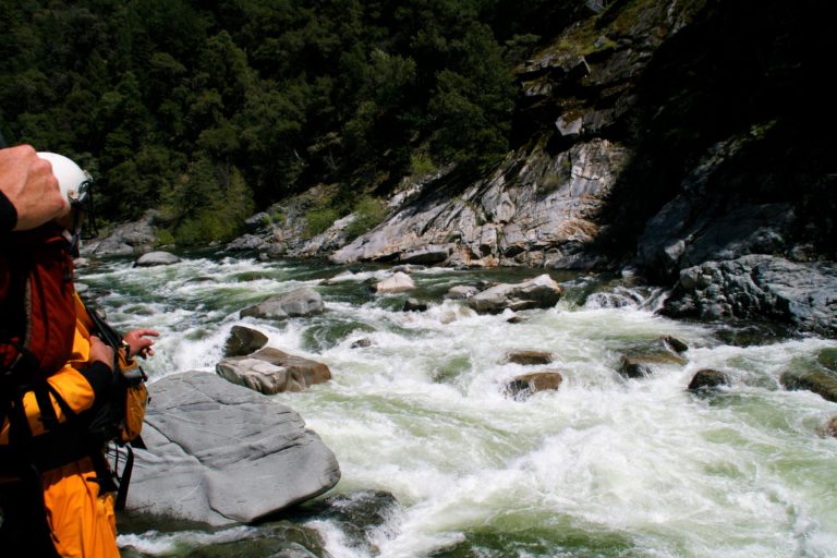
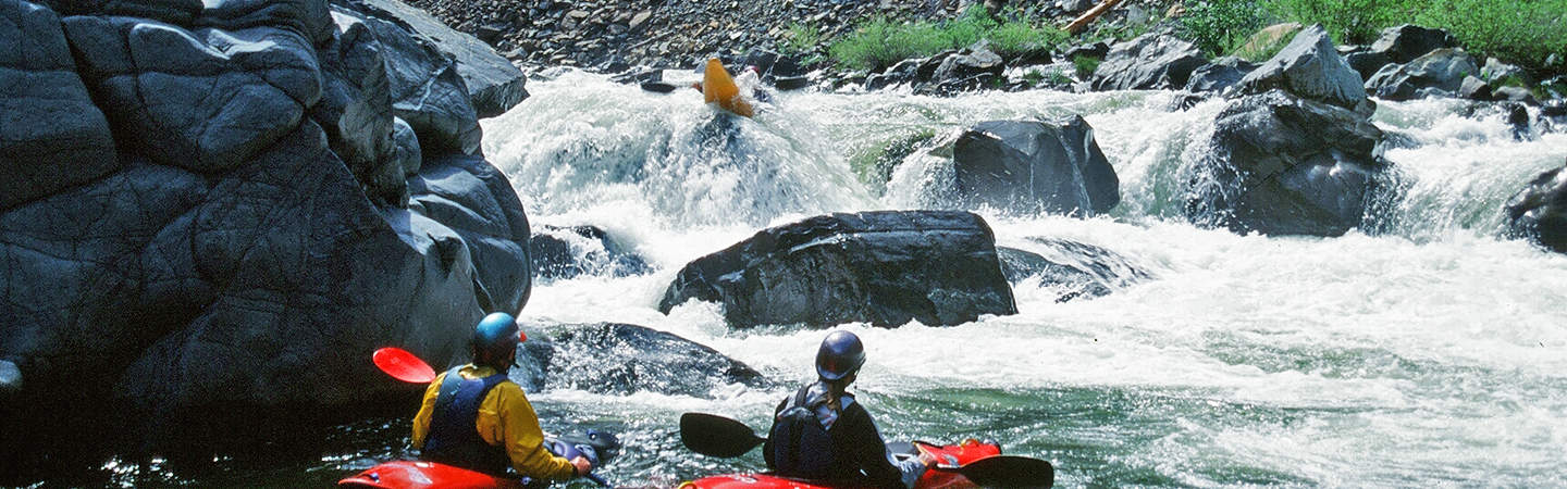
Rodgers Flat begins below the Rock Creek diversion dam and ends at the Tobin Vista river access. The run is approximately five-miles in length with an average gradient of 50 feet per mile. Overall the difficulty of this run is class III and the character consists of pool-drop rapids separated by intervening sections of calmer water. Although the most challenging rapids can be seen from the road, there are several additional rapids that are difficult to see and you will encounter more whitewater on this reach than first appears from a road scout.
Two rapids that should be approached with caution are Lisa's Ledge and Carl's Kitchen both of which are visible from the road and should be obvious as the more challenging drops on the run. There are multiple lines on Lisa's Ledge which include a left chute, left prow, and the right line boof. Carl's Kitchen starts over on river left but you want to work your way back to the right side of this main channel. A boulder jumble on river left is best avoided. There is also a sneak route on the right side of the island. Several additional fun rapids characterize this section and you just need to remain heads up for a couple of holes that come up quick.
Keep your eyes open for the take-out on river right at either Indian Jim Campground or Tobin Vista unless you are planning to continue on downstream through the more challenging Tobin Run.
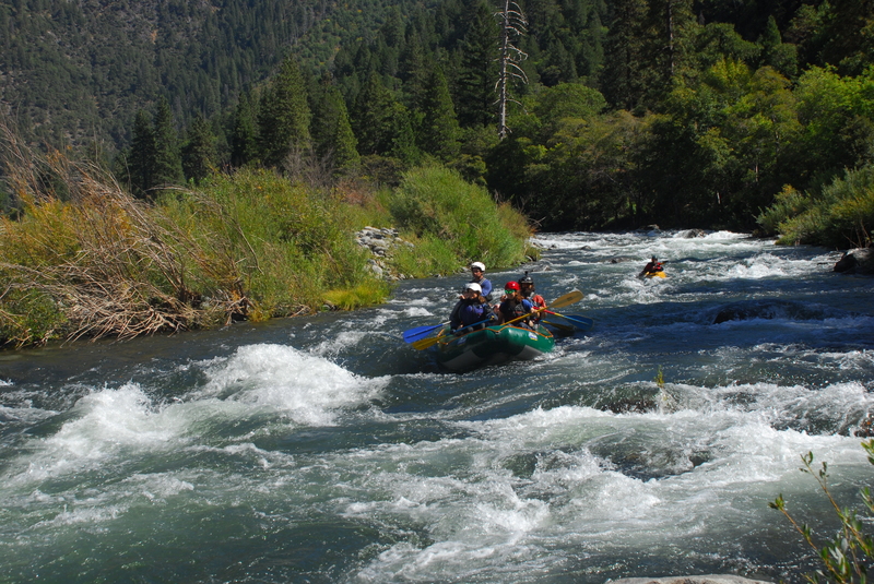
_Tobin Run_
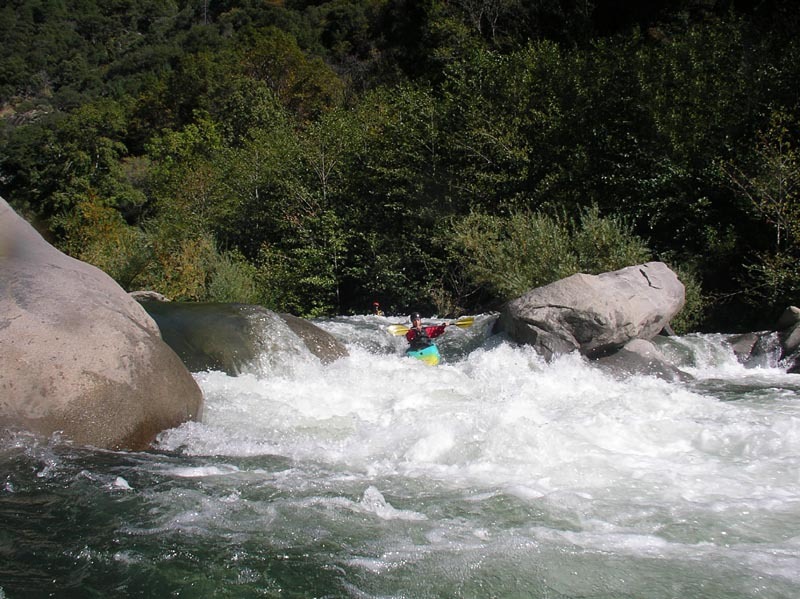
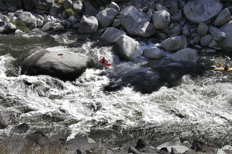
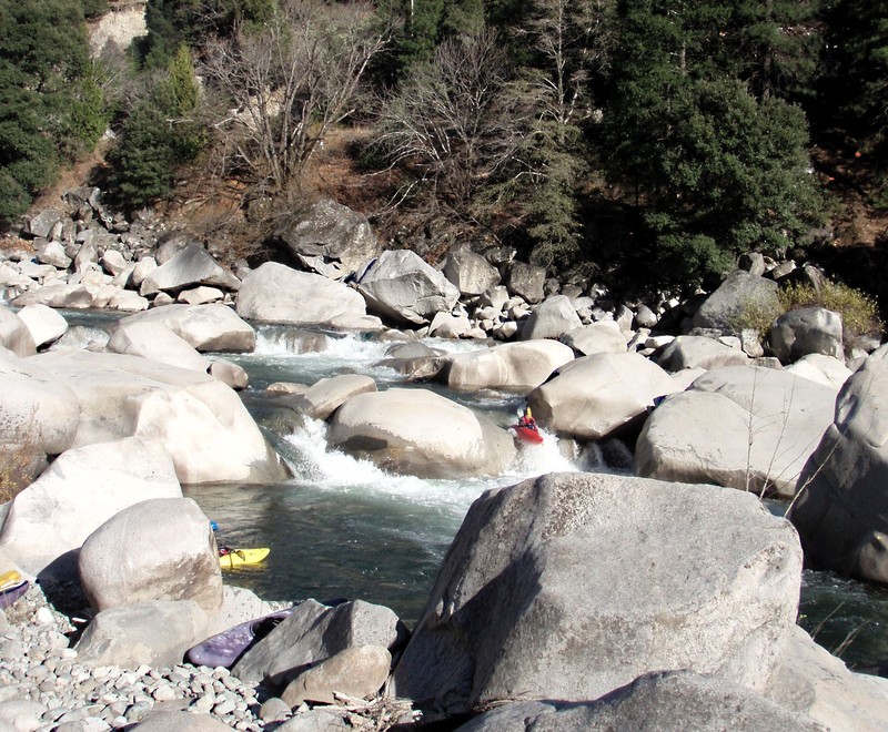
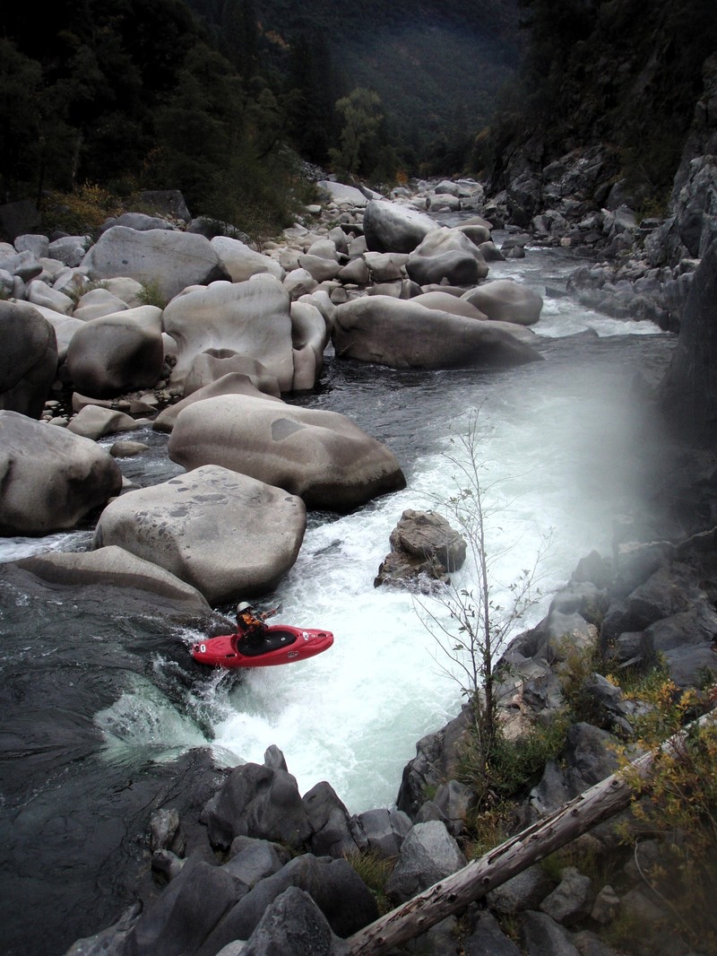
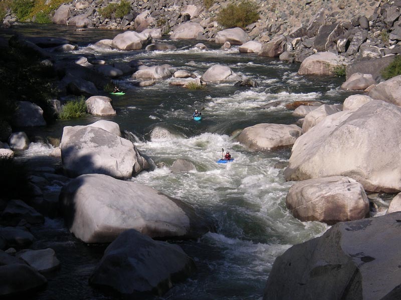
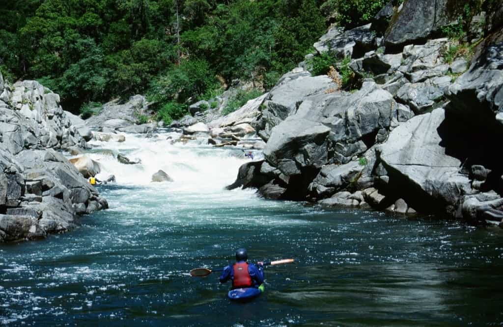
The Tobin section begins shortly after the Tobin Vista access site. The next 1.2 mile drops 150 feet through a large boulder field complete with undercuts and sieves. At higher releases (~1,200 cfs) this section moves fast and contains some stomping holes and you should be prepared for a class V experience. At lower releases (~1,000 cfs) you have more time between drops and generous eddies, and although many of the moves are class IV+, the consequences of a swim are still very significant. At any level a guide is helpful for your first trip down as the best lines through the rapids are not always obvious. You can view much of this section from the road on river left but the only way to really see the lines is at river level.
While this section can generally be characterized as a mile of great boofs, there are a couple of named rapids. Kevin's Gate is the rapid under the bridge that forms the entrance to the challenging drops that await below. No Brainer is a great auto boof that comes soon after. Cleaver is a fun drop that runs down the right side. The last drop on this section before the Rock Crest Bridge (the private one-land bridge) is Piece of Risa. You want to start in the main current towards the left and then move your way over to the right before you get to the big undercut boulder at the bottom. Just don't go right too early or you'll find yourself in the nasty bit midway down the drop on the right.
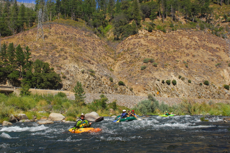
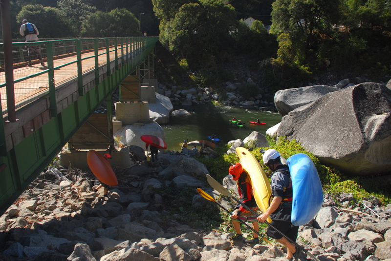
A good take-out is availalble on the beach on river left under the Rock Crest Bridge and many take out here to head back upstream and run another lap or two. The rest continue on downstream to the Lower Tobin run, otherwise known as Lobin, which begins downstream of the bridge. Paddlers continuing on down are joined by those who put in for Lobin.
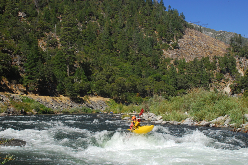
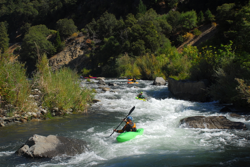
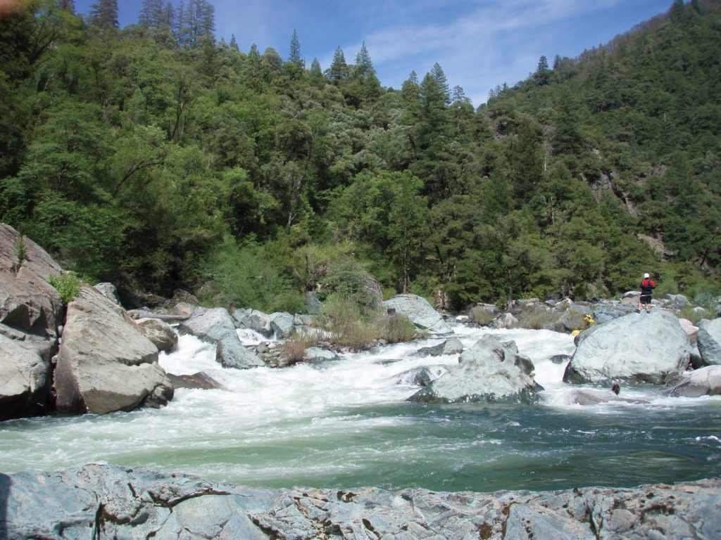
_Lobin Run_
From the Rock Crest Bridge, the Lobin Run starts out with a couple of stout class IV drops but as you pass the Storrie Bridge (where Highway 70 crosses over to river right) the gradient eases and the difficulty level drops to a more reasonable III - IV. Those who don't want to run the first couple drops of Lobin can put-in at the Storrie Bridge. Several fun rapids characterize this section. Additional flows enter the river at Bucks Creek powerhouse. Don't hang out in front of the powerhouse as the pipes have 2,000' of head on them and in the event of an emergency shutdown the flow would bypass the generator and vent across the river under very high pressure. The good news is you pick up a bit more flow here for the last bit of the run. The final rapid just past the Rock Creek Powerhouse can be challenging and varies with flows (depending on how much flow is coming out of the powerhouse which changes by the minute). Take out on river right downstream of the powerhouse.
Logistics:
The Feather River Canyon is a short drive from most Northern California locations and a high quality resource. The meeting place for runs on this section is Tobin Vista which is 36 miles south of Quincy and 41 miles north of Oroville on Highway 70.
Primary access points are as follows designated by Plumas County mile markers on Highway 70 along the way:
Rock Creek Powerhouse, Mile 3.9: This access point is on the downstream side of the Rock Creek powerhouse and is the lowermost take-out before the river stalls out in the flatwater of the Cresta Reservoir. A rough trail through the rip rap along the highway heads up from the river.
Storrie Bridge, Highway 70, Mile 5.65: The Storrie Bridge is an alternate access point used as a put-in for Lobin for those who want to skip the first couple rapids. Access is on the upstream river left side of the bridge.
Rock Crest Bridge, private PG&E road, Mile 6.3: This one-lane bridge is the traditional divding point between the Tobin and Lobin runs serving as a take-out for the class V run or a put-in for the class IV+ run. A rough trail down the upstream river left side of the bridge leads down to a beach and a good eddy. If you want to add one more challenging rapid to your Lobin run, you can also walk up along the shoulder about 100 yards and scramble down to an eddy to set up for a run of Piece of Risa.
Highway 70 pull-out, Mile 6.9: This pull-out is along the Tobin Reach and although it is not an access point for boaters, it offers a view of the reach and is a popular access point for spectactors who want to scramble down to the river.
Tobin Vista, Mile 7.5: This is the traditional dividing point between the Rodger's Flat run and the Tobin run serving as the take-out for the class III run and the put-in for the class V run. This is also one of the most popular meeting spots for boaters (keep in mind that no cell coverage in the canyon means you need to coordinate your meeting point before you drive up the canyon).
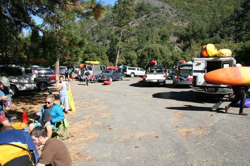
Indian Jim Campground, Mile 8.22: The Indian Jim School is no longer an active school and has been demolished. The Forest Service has neglected the adjoining campground that was damaged in floods. It still remains the most popular place for boaters to camp and is the site of the annual Feather Fest. The campground has no running water or toilet facilities. Fire danger can be extremely high in summer so avoid open fires.
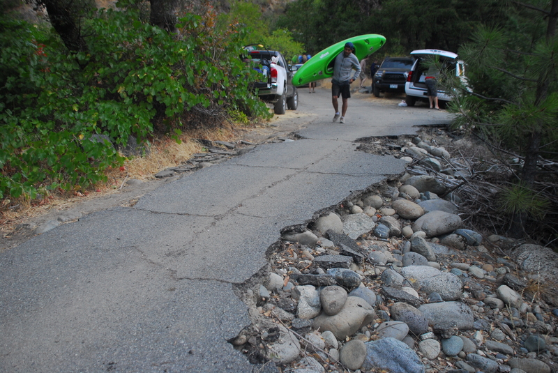
Rodger's Flat put-in, Mile 11.8: For many years boaters had to park in the small pull-out along the highway and spring across the road dodging traffic to access the river. As recreational mitigation for the impacts of the hydropower project, American Whitewater negotiated a parking facility and sanitation. It is undersized for big release weekends and the trail to the river is inadequate but it is better than what existed before.
Rock Creek Dam, Mile 12.1: Not an access point but the upstream limit of this section where water is released from the dam.
Rapids in this Run (26)
 Rapid
II+
Rapid
II+
Gaging Station
 Rapid
III+
Rapid
III+
Lisa's Ledge
 Rapid
II+
Rapid
II+
Brexit
 Rapid
III+
Rapid
III+
Karl's Kitchen
 Rapid
II+
Rapid
II+
Eddy Catcher
 Rapid
II+
Rapid
II+
Sharknado
 Rapid
II+
Rapid
II+
Chambers Creek
 Rapid
III
Rapid
III
Dump Truck
 Rapid
II+
Rapid
II+
Indian Jim Rapid
 Rapid
Rapid
Indian Jim Campground
 Rapid
Rapid
Tobin Vista
 Rapid
IV
Rapid
IV
Dave's Drop
 Rapid
IV
Rapid
IV
Dancing Boy
 Rapid
IV+
Rapid
IV+
Kevin's Gate
 Rapid
Rapid
No Brainer
 Rapid
Rapid
Cleaver
 Rapid
IV+
Rapid
IV+
Tobin Ledge
 Rapid
Rapid
El Patron
 Rapid
Rapid
Piece of Risa
 Rapid
Rapid
Rock Crest Bridge - Lobin Put-in
 Rapid
III
Rapid
III
Rock Crest Bridge Rapid
 Rapid
IV
Rapid
IV
Terrarium
 Rapid
III
Rapid
III
S-Turn - Lobin Third Rapid
 Rapid
IV
Rapid
IV
Storrie Rapid
 Rapid
IV
Rapid
IV
ABC Above Bucks Creek
 Rapid
III+
Rapid
III+
Little Knarly
Hazards & Portages (1)
Caution: The following locations may require scouting or portaging. Always check current conditions.
Difficulty
Class III-V
Length
8.2 mi
Rapids
26
1 Hazard
Access Points
Difficulty Classes
I Easy
II Novice
III Intermediate
IV Advanced
V Expert/Extreme
VI Unrunnable
Current Conditions
5-Day Forecast
Whitewater data from
American Whitewater
American Whitewater