2. Top - Swallow Falls Rd. (Bridge above Swallow Falls [State Park]) to Hoyes Run.
Linked via: Proximity 94% confidence Synced 6mo ago
Gauge Conditions
Runnable: 180.0 – 1,000.0 CFS
Data from American Whitewater & USGS
Run Map
Description
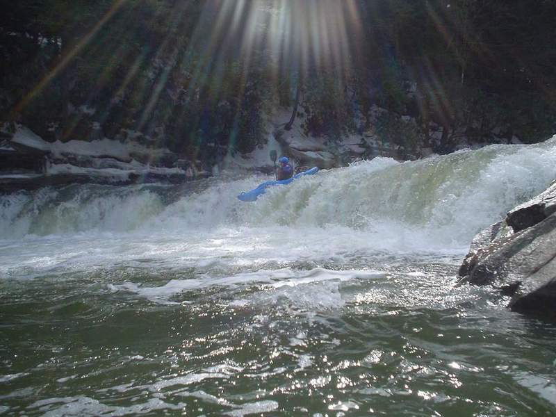
_Photo: Richard Hopley runs Swallow Falls, by Pete Martin. Photo courtesy of the Monocacy Canoe Club._
For a helmet-cam view of the run, check out this video from the Top Yough Race in April of 2011. http://www.youtube.com/watch?v=R3uD704nj5U&feature=related
_American Whitewater_ editor Bob Gedekoh writes:
I just learned that several days ago a boater swam above the siphon on Suck Hole on the Top Yough and his boat went down it. Fortunately the boater managed to avoid going down the siphon too. (I was not there when it happened, but heard about it from those who were.) The boat disappeared completely. It was down in there for a couple of days, but has since been recovered. At any rate, the logs, etc that had been blocking the siphon for the past few years have shifted... and the siphon is once again open for business. I think a lot of younger boaters dont even know where the Suck Hole siphon is, or how dangerous it can be, since it has been blocked by debris for so long. Be careful and spread the word. Bob G (FYI the siphon drains the eddy that most people catch at the top of the rapid on the right. This is the eddy just above the huge midstream rock. Look behind you next time you are in that eddy and you will see it.)
Alternate takeout: paddle an extra 4 miles of flatwater and run the Upper Yough!
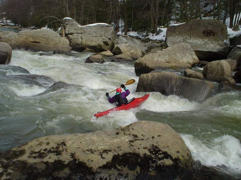
This one's maybe a little smaller and tighter than the Upper Yough. On balance, it's a bit easier, because the continuous rapids aren't quite so big. Nonetheless, it deserves respect and it's a lot of fun.
Gradient, from putin to takeout: 110, 110, 30. In other words, you have two very busy miles before it flattens.
Rapids of note:
Swallow Falls. This is the first rapid, a long slide into a hole. You don't want to go upside-down here, or your paddling clothing and/or skin might suffer. In addition, the hole can be a keeper at higher levels (~3.5'?). Though it looks intimidating, it's not that tough. Call it a Class IV.
Note: recently, a paddler sustained a back injury here. See this photo for a look at the piton rock which can cause injury.
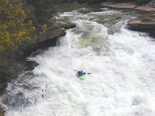
Swallow Tail. This 6-foot riverwide ledge comes right after a large pool following Swallow Falls. A good read of the tongue and a few strong strokes should help you avoid some unintentional cartwheeling action. Call this a IV at low levels (less than 3.0?), because it's really a one-move pony; IV+ at higher water, because a successful run requires some precision.
Suckhole. This one is a fairly long, very technical rapid with holes and a sieve at the bottom of the big inviting eddy on the right. It's mostly a read-and-run rapid. Call it a 5.0 at 3.0+, because it's complex and there is that sieve.
Directions: To the putin: From I-68, get off at the Friendsville exit. Head South on Rte. 42 about 7 miles.
Head South on Rte. 219 for about 7 miles.
Turn Right on Mayhew Inn Rd.
After about 4 miles, bear left onto Oakland Sang Run Rd. Go about a mile, and park on the left, just before the bridge across the river.
To the Takeout (from the highway):
From I-68, get off at the Friendsville exit. Head South on Rte. 42 about 5 miles.
Head Right onto Gap Run Rd.
After about 0.7 miles, make a Left onto Bishoff Rd.
Head Right onto Sang Run Rd.
After a mile, turn Right onto Crabtree Bottom Rd.
After a mile, turn Right onto Hoyes Run Rd.
Make a Right onto Oakland Sang Run Rd.
The takeout is an easy walk from where you see the road (River View Terrace) from the river. If you see Gap Falls, you've paddled too far.
To get from the putin to the takeout, or vice versa, check the linked Google map.
A nice description of this run can be found at GORP.
Other related or nearby streams:
Lower Yough (Class III)
Bear Creek (Class IV)
Upper Yough (Class IV-V)
Middle Yough (Class II)
Rapids in this Run (2)
Waterfalls (1)
Playspots (1)
Hazards & Portages (1)
Caution: The following locations may require scouting or portaging. Always check current conditions.
Difficulty
Class IV-V
Length
2.8 mi
Gradient
83 ft/mi
max 110
Rapids
2
1 Hazard
Access Points
Shuttle Info
**Directions:** To the putin: From I-68, get off at the Friendsville exit. Head South on Rte. 42 about 7 miles.
Head South on Rte. 219 for about 7 miles.
Turn Right on Mayhew Inn Rd.
After about 4 miles, bear left onto Oakland Sang Run Rd. Go about a mile, and park on the left, just before the bridge across the river.
To the Takeout (from the highway):
From I-68, get off at the Friendsville exit. Head South on Rte. 42 about 5 miles.
Head Right onto Gap Run Rd.
After about 0.7 miles, make a Left onto Bishoff Rd.
Head Right onto Sang Run Rd.
After a mile, turn Right onto Crabtree Bottom Rd.
After a mile, turn Right onto Hoyes Run Rd.
Make a Right onto Oakland Sang Run Rd.
The takeout is an easy walk from where you see the road (River View Terrace) from the river. If you see Gap Falls, you've paddled too far.
To get from the putin to the takeout, or vice versa, check the linked Google map.
Difficulty Classes
I Easy
II Novice
III Intermediate
IV Advanced
V Expert/Extreme
VI Unrunnable
Current Conditions
5-Day Forecast
Whitewater data from
American Whitewater
American Whitewater