2) US 231/79 to CR 160
Linked via: Nhdplus discovery 90% confidence Synced 6mo ago
Gauge Conditions
Runnable: 2.2 – 6.0 FT
Upper limit for best boatability uncertain. Please help your fellow boaters with a comment or report.
Data from American Whitewater & USGS
Run Map
Description
PUT IN INFORMATION
The 'NEW' putin is on the north side of the US 231/79 Bridge near Blountsville. Put in on the RIVER RIGHT side now. Boaters used to launch on the south side, but that putin is now off limits as the owners are not friendly to trespassers. Please spread the word. Put in on the north (river right) side of the bridge.
TAKE OUT INFORMATION
The take out is on river right at the CR 160 bridge. The hike up the hill is short but steep. There isn't much room for parking here. There is an optional take-out at Swann Bridge that skips Powell Falls and Ender Hole, but also skips the steep hill at the 160 takeout. If you take out at Swann Bridge, park on river right and take out there.
RIVER DESCRIPTION
The Locust Fork is an excellent and popular whitewater run in northern Alabama. The late, great William Nealy even got his start here back in the 1970s and highly recommended the run should you find yourself in the area.
The river is mostly Class II+ at levels of 2.2'-3.5' and transitions to Class III around 3.5' and up, though they say things get pretty pushy but not too washed out at levels between 4'-6'. Above Swann Bridge, 1.8' is the absolute minimum, and 1.6' is the minimum to scrape down from Swann to CR 160.
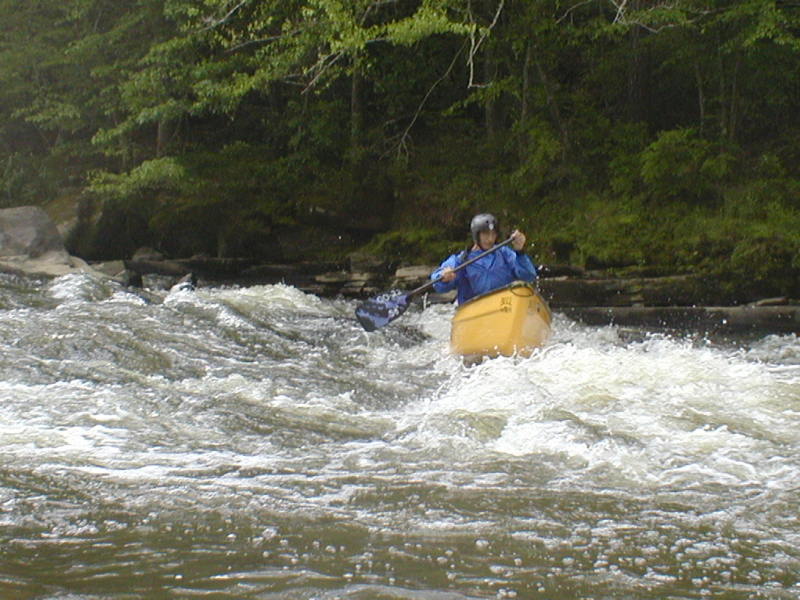
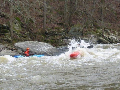
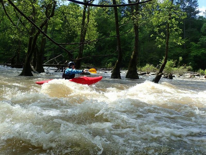
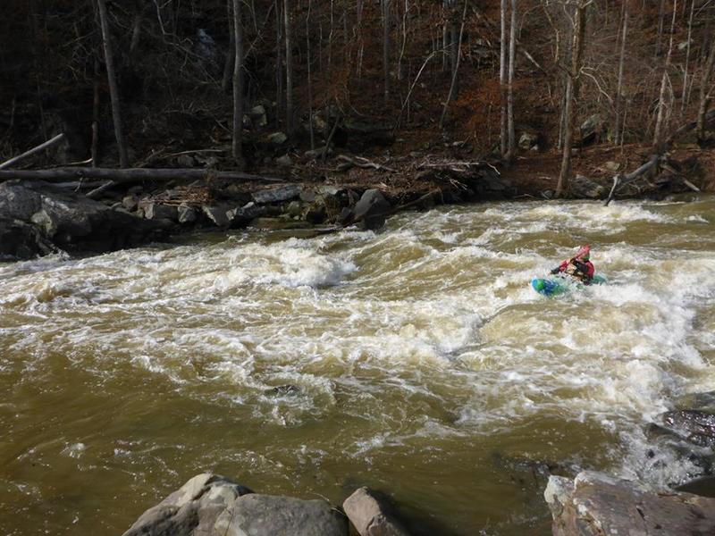
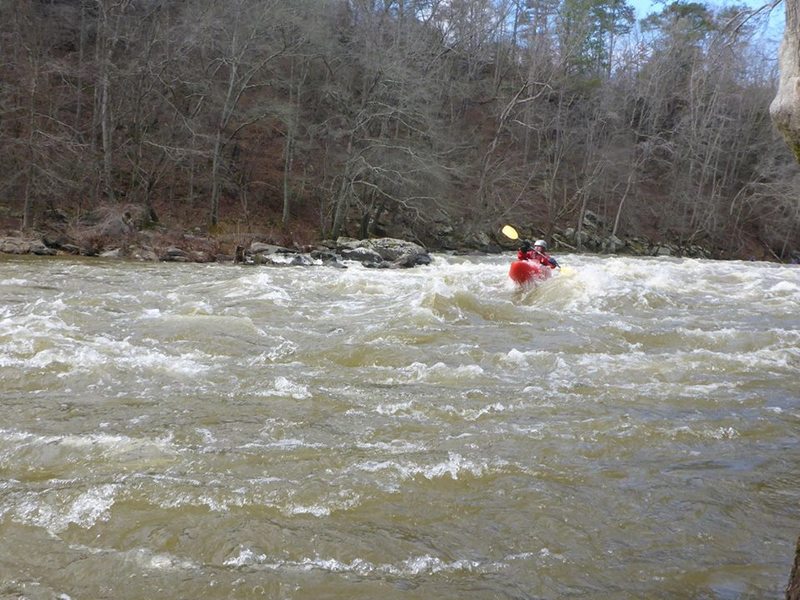
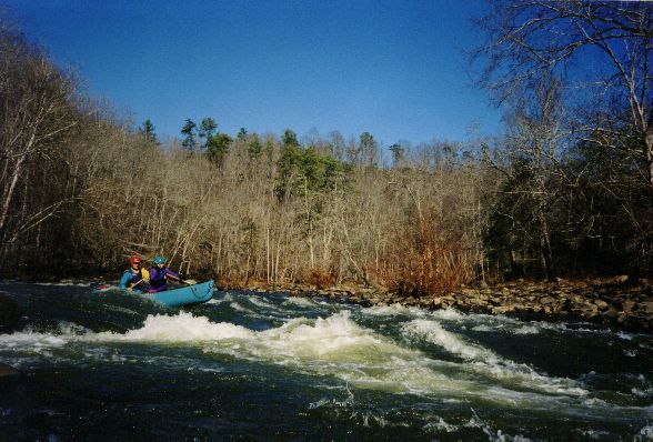
After the put in there are a few Class II warm up shoals before the first named rapid, House Rock. House Rock is undercut and the main flow pushes right into it, so best to ferry right and catch the eddy before House Rock catches you. Next up is Tilt-a-Whirl which features some boulders with a pour over on river right and a nice big wavetrain below. Just above Double Trouble the river will widen with trees scattered in the middle. Follow the main flow on river right working your way left to miss the rock at the bottom of the turn; this is S-Turn or Tree Rapid. Land on the island to scout Double Trouble. At higher water you can sneak DT left of the island. The main concern at Double Trouble is the undercut ledge the main current flows by. Some folks run DT starting right and ferrying left into the large eddy on the left below the first drop, others stay left the whole way. If you get flipped after the first drop and swim, swim to river left and not right because there is a sieve in the boulder jumble near the second drop. Below DT there is a wavetrain or two before Bullard Shoals, which is rocky, shallow and technical but can grow some huge waves at higher water. There is a large rock wall on river left just above the Swann covered bridge.
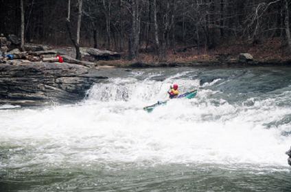
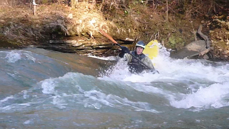
Below Swann things mellow out a bit until Powell Falls. Before you arrive at Powell there will be another large rock wall on river left you can see from upstream. Land on river right or at levels below 5' land on the middle island to scout. Most run Powell Falls about 5'-10' right of the center scouting island. The hole/haystack at the bottom tends to flip those who don't brace. The left side does get run on occasion, but there is a nasty hole that develops at high water which has worked many a non suspecting boater. For that matter there is a nasty hole that develops on the right side too at higher water, between the now covered island some boof over and the standard right line. Paddlers have gotten worked here as well, and separated from some of their gear leaving them to paddle out with makeshift paddles fashioned out of sticks and any river booty they find useful. Skirum Creek rapid is just below Powell and is a great place to catch eddies or ferry. Skirum Bluff is on river right, with a sandy beach on river left. There is a great play spot after Skirum Bluff called Ender Hole; on good water days there is usually a large congregation here. There are a couple more wavetrains before the 160 bridge, which can be surfed at appropriate levels.
William Nealy did a classic map of this run.
CAMPING AND ACCOMMODATIONS
Boogie Bottoms: offers cabins and primitive camping, 4 miles from take out: http://www.boogiebottoms.com/Rentals.html
Rickwood Caverns offers RV camping, open March-October, 19 miles from take out: http://www.alapark.com/rickwoodcaverns/Camping/
Stoney Lonesome OTV Park in nearby Cullman County offers cabins, tent and RV camping. 35 miles from take out: http://www.stonylonesomeohv.us/
Smith Lake Park in Cullman County offers 9 cabins; 219 full service sites; 5 water and electric sites; and 61 tent sites, 28 miles from take out: http://cullmancountyparks.com/smithlake.html
Horse Pens 40 in Blount County: offers rustic cabins and camping, 26 miles from take out: http://horsepens40.tripod.com/index.html
Rapids in this Run (6)
Waterfalls (1)
Playspots (1)
Difficulty
Class II-III+
Length
5.6 mi
Gradient
23 ft/mi
Rapids
6
Access Points
Difficulty Classes
I Easy
II Novice
III Intermediate
IV Advanced
V Expert/Extreme
VI Unrunnable
Current Conditions
5-Day Forecast
Whitewater data from
American Whitewater
American Whitewater