2. US Route 281 to Lake Jocassee Scenic
Linked via: Proximity 88% confidence Synced 6mo ago
Gauge Conditions
Runnable: ? – ? CFS
Approximate reading: This gauge is 9.3 miles away on Horsepasture. Use as a general reference only.
Data from American Whitewater & USGS
Run Map
Put-in
Take-out
Rapids/Hazards
Scenic
Recreational
Run Time Estimate
Select put-in and take-out to estimate time.
Unlock Advanced Trip Planning
See wind-adjusted speed maps, forecast planning, and detailed time estimates.
Sign in to generate an AI timing estimate for this run.
Whitewater timing varies with scouting, portages, and group pace. Use as a planning baseline.
Description
Local expert Ron Stewart
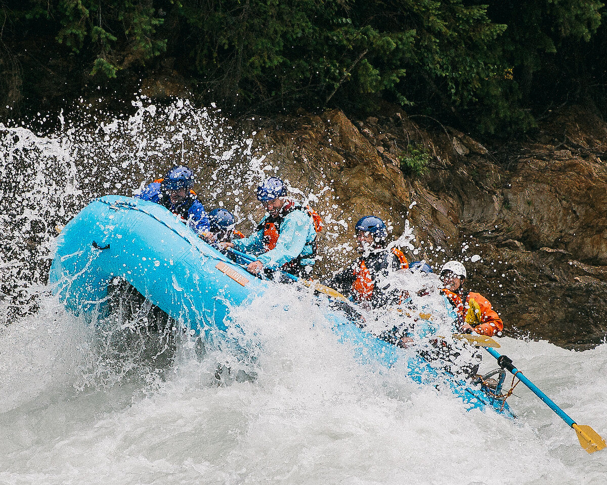
Class: III-VI
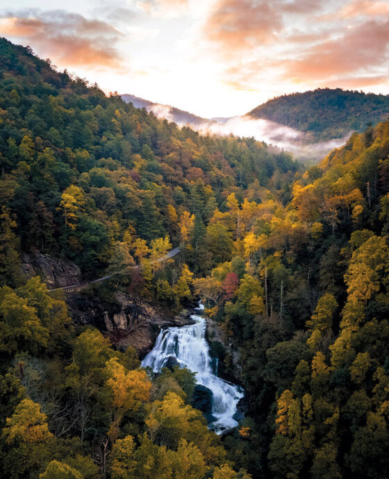
The Horsepasture has been designated a Wild and Scenic river from Hwy 281 toLake Jocassee. For more info click here.
Gorges State Park
First mile is 387ft, 467ft, 782ft, 42ft
Steepest half mile is 1200 feet starting at Windy Falls.
There are a several options on how to run the horsepasture. Putting in at 281 is not recommended due to a hostile landowner and past disputes. The first option is to put in above turtleback, and run down to just above rainbow falls, then hike back out. The trail out from rainbow is rather good. The problem here is you are hiking 3/4 mile one way to run a 20 foot slide, and then hiking 3/4 mile back out. This is a hike and huck, and is alot of effort for one drop.
The second option is to use the same put-in and run down to Stairstep falls, then hike back out. The trail from Stairstep falls to rainbow is not as good as rainbow to the parking lot. Below Stairstep falls is where the river get really steep.
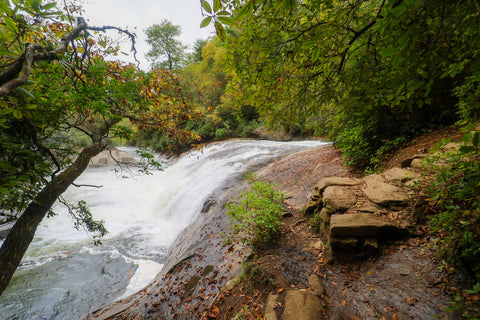
The most popular option is to put in above turtleback and paddle to the brink of Windy Falls and then hike 3 miles and around 1000 vertical feet out of the gorge. The hike is tough, but if you are paddling the horsepasture, then you should be in good enough shape in the first place to hike out. There is only really one bad stretch that is really steep, and it lasts for about 3/4 mile. This gives you all the best whitewater, and though it is action ppacked, is really only a mile and a half from the putin. Right below turtleback, an easy slide with an off vert 15 foot drop at the end, get out on river left, because the class 6 150 foot Rainbow falls is right below. You will die if you go over it! Portage on the left and then putin at the bottom, after gaining a sense of why they call it rainbow falls.
The very next rapid is one of the hardest and nastiest on the run. Called ugly sutff, this rapid is an unpleasant pile of boulders that comprise the breakdown detritus of Rainbow Falls. This new pile of rocks is very unfriendly. The top is a boulder garden with undercuts. At the crux most run a line on the left that is critical to run properly. Stay high on the ridge of rock and don't fall into the nasty crack in the center to your right. A higher water line on the right is cooler but as critical. Hit a nice tight 8 foot boof angled right, just missing the rocks all round you. you are then flushed back together with the left line and funnel through a tigh slide into a pool above the next rapid, Slab Falls.
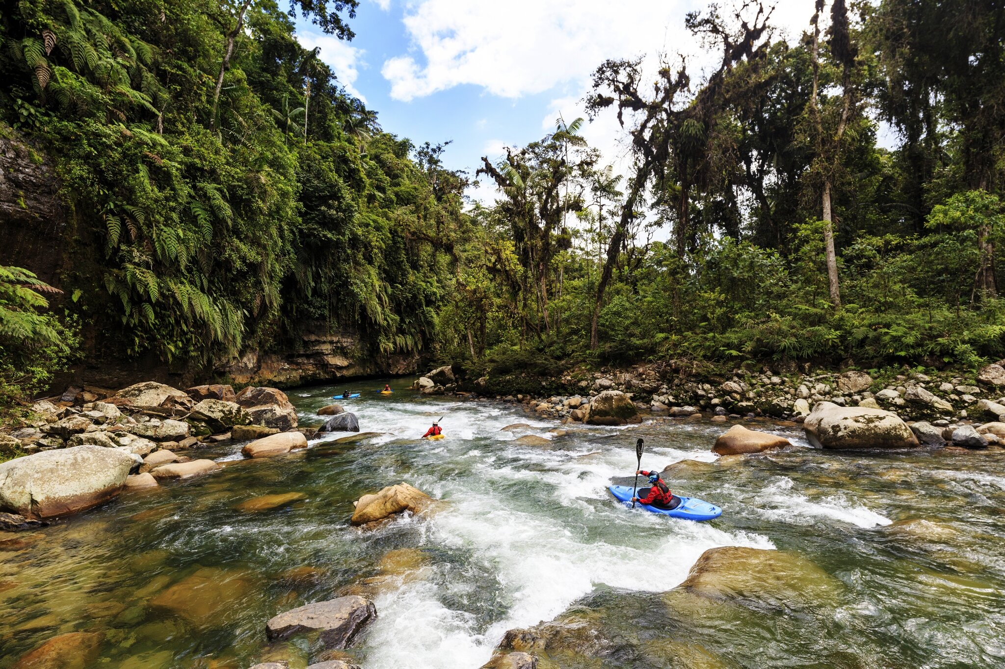
This one is pretty straightforward. Its a 12 foot drop that lands on bedrock. Run further to the left for a smoother hit. Don't boof it too hard, just drop your nose a little for smoother transition. Below here you enter the first set of class 4-5 boogie water, with technical and difficult boulder gardens. After a few of these you come out above the best rapid ever.
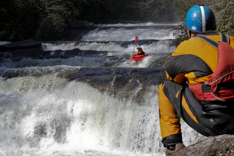
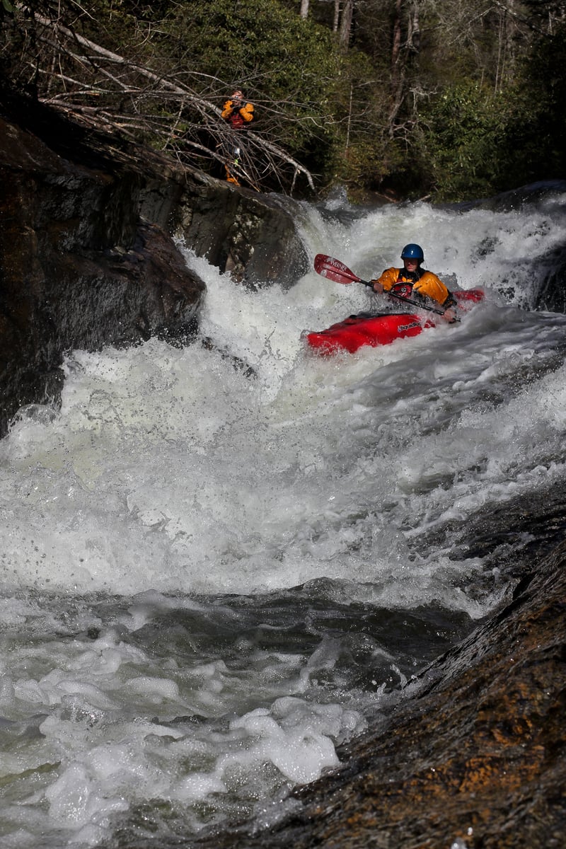
Stairstep falls could be the best rapid out there. Its 6 or 7 off vertical slide/falls ranging from 6 to 20 feet high. The whole rapid drops around 60 or 70 feet, and barring possibly dangerous holes at high flows, not much can go wrong in here. The only problem with this one is that it seems a hike back up for a repeat would be difficult and time consuming. At the bottom, the river turns 90 degrees to the right and enters the hard stuff.
Below Stairstep, the river gets even more difficult. There is high difficulty and high quality class 5 boogie for a while, with boulder drops that would be very big named deals on any other river. Scouting is hard but recommended if no one knows the run. There are bad spots in here. These culminate at One of the hardest rapids in the gorge.
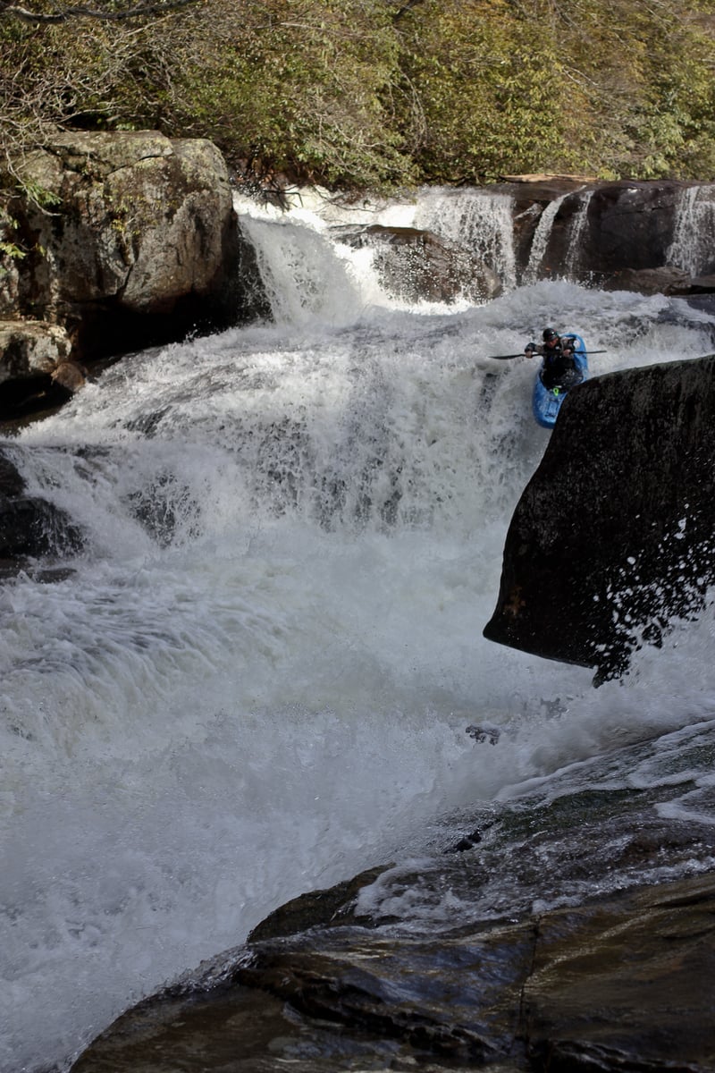
Corner pocket is a tricky drop with a cave halfway down on the right and a surgy boulder jam at the bottom. Enter driving super hard left to carry away from the cave on the right. Some do catch the cave eddy to break it up as well. Then head down against the gigantic bowling pin rock in midstream and boof into the pool below.
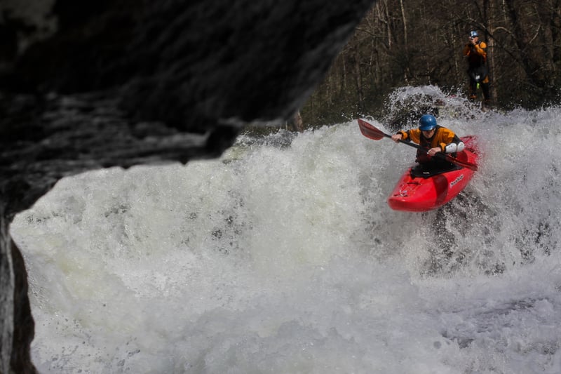
Now for the big ones! Names vary, but we'll just call them sidepocket falls as they are called by non whitewater enthusiasts. The first drop of sidepocket falls should be run center to left, avoiding the channel on the right that turns both parts into one direct scary experience. You don't want to go left too early as the first part can hurt, but smoothely transition the first 8 foot ledge center and then join the rest of the flow to ramp off a great 10 foot melter into the pool below. Now you are above the most intimidating drop on the run.
While the first drop was pretty straight forward, the second drop of sidepocket is tough and has the potential for carnage. The line is to ferry into the flow on the right and drop off a 15 foot clap onto a bedrock slide. This bedrock slide piles down a sluice into a big nasty hole and a bad piton on the right. At high flows you can go right of the piton and the hole, but at normal flows, you can't. So go far left at the bottom. You are going into the hole either way, its just a matter of whether you want to go in the hole perpendicular with momentum or sideways after pitoning your lights out. Fight out of the hole, its friendlier than it looks or feels.
Next is another whitewater fantasy known as highway to heaven. Right after Sidepocket the river bends left into this gigantic low angle slide. Down the middle is the way and its pretty easy, but when you get to the lower midpoint, there is a slight pool, and the second part deserves caution. You want to right the bottom converging slide high on the left to avoid an epic piton. The tradeoff is that you end up in the backwash of a feature that is similar to the speed trap below gorilla, but bigger. The good thing is that there is not hole, just a big gyrating whirlpool of an eddy. Just point it into the gut and peel out to the pool below. I have been in there with 2 other boaters before, and my buddy and I went around for a minute before noticing the paddle, boat and helmet of another paddler who had been in there the whole time with us. Laughs were had by all.
After this, there are several more class 5's before windy falls. The first has a huge boulder in the middle of the river with a difficult line to the left of it avoiding some nasty wood. This one changes, so take a quick look. Then there is a double ledge that can be boofed on the right. After another smaller drop comes the last drop before the git out.
The final drop where most people get out is a nasty one. It is a 12 foot ledge that has a bad curl at the lip that throws you to center, where you don't want to be. A nasty hole develops and the outflow hides a subsurface pinch sieve that has caused problems before. The seal launch on the right is fine.
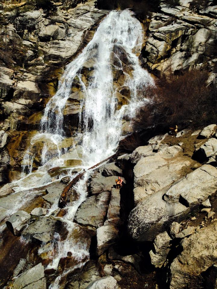
Below here most will exit their boats in the first break in the verical river left wall and hike to the campsite at Windy Falls. This involves handing boats up a 10 foot step in the rock. I like to use myboat as a ladder. The two drops above Windy Falls have seen some action. Look in Leland's book for some good pics. The first is a spout with big contact at the bottom. It drops 20 feet. The second one is a diagonal ledge down and to the left and you wanna be right to say the least. This one is almost 20 feet too.
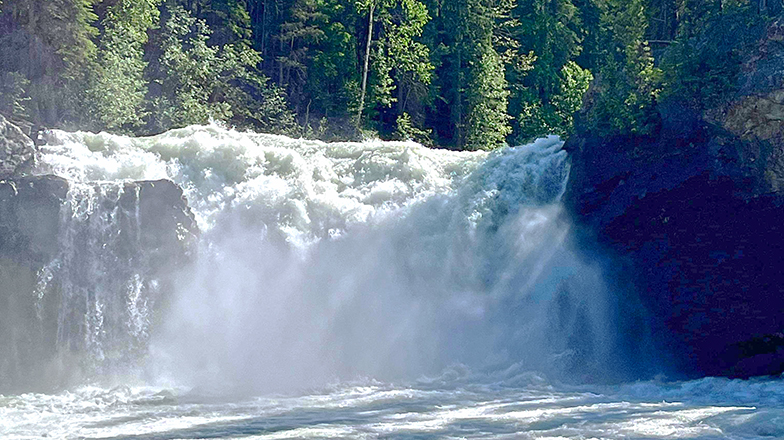
Take a peer off the lip of Windy Falls. It is the most rugged place in the east!
Now eat some poewrbars and gear up for the hike out. From the Campsite, head up the trail straight up the mmountain. After a few hundred yards, you hit a more level grade and begin to wrap south around the side of the gorge, and then east through some ropy but relatively level grade. After a mile you hit Powerline road (not marked), which is a nice gravel grade that you make a left on, heading up hill. From here is 2 more miles of huffing. There is a middle stretch that climbs 600 feet or more in under a mile. This is the crux. Go slow and breathe. Top out and then go another 3/4 mile to the parking area where you started. This last stretch has some uphill but is mostly level or downhill.
You can also portage Windy Falls. When you hit the smoother grade after a few hundred yards from the Windy Falls site, you will see a ridge that breaks off down the mountain on your right. It is on a bend to the left away from the river. Take this trail down,down,down. When you hit an old road, go right and back upstream to the river.
You can also portage through the falls, but I only know of 2 groups that have ever done it, one having to spend the night. Bring minimal climbing gear for this.
Paddling down to the lake takes on a minor expedition feel. You can either paddle the 7 miles across lake jocassee, or hire a boat to pick you up at the confluence. Hiring a motorboat is the preferred option. The main problem here is portaging the 400 foot double falls of Windy Falls, which is quite dangerous, and then portaging more at Roostertail and the massive rock flow below it. There are some more really fun rapids below here before it quickly subsides into calss 3, but this is a real expedition.
Rapids in this Run (3)


Waterfalls (10)
 Waterfall
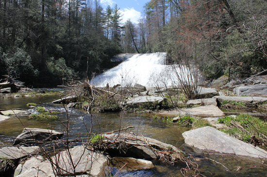
Bust Your Butt Falls aka Drift Falls
 Waterfall
Turtleback Falls
 Waterfall
Rainbow Falls
 Waterfall
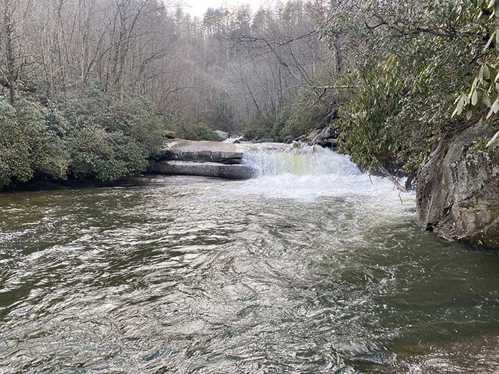
Slab Falls
 Waterfall
Stairstep Falls
 Waterfall
Thrasher Pike A (First drop of Sidepocket Falls)
 Waterfall
Thrasher Pike B (Sidepocket Falls)
 Waterfall
Sieve Rapid
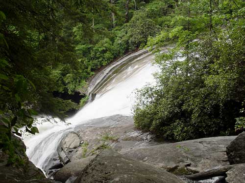 Waterfall
Windy Falls
 Waterfall
Slovakian Wax Job aka Rooster Tail Falls
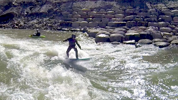
Playspots (1)
Hazards & Portages (9)
Caution: The following locations may require scouting or portaging. Always check current conditions.
Difficulty
Class V
Length
5.4 mi
Gradient
400 ft/mi
max 1,200
Rapids
3
9 Hazards
Access Points
Difficulty Classes
I Easy
II Novice
III Intermediate
IV Advanced
V Expert/Extreme
VI Unrunnable
Current Conditions
5-Day Forecast
Whitewater data from
American Whitewater
American Whitewater