2. WV 26 Bridge to Cheat River
Linked via: Nhdplus discovery 90% confidence Synced 6mo ago
Gauge Conditions
Runnable: 1,000.0 – 10,000.0 CFS
Data from American Whitewater & USGS
Run Map
Run Time Estimate
Select put-in and take-out to estimate time.
Unlock Advanced Trip Planning
See wind-adjusted speed maps, forecast planning, and detailed time estimates.
Sign in to generate an AI timing estimate for this run.
Whitewater timing varies with scouting, portages, and group pace. Use as a planning baseline.
Description
Put In: At the junction of Highway 26, Woolen Mills road and a smaller road, There is a large open area between Woolen Mills road and Muddy Creek. Paddlers tend to park here or further north along Woolen Mills Road.
Take Out: The Cheat Festival site is on creek left at the confluence of Muddy Creek and the Cheat River. There are parking areas, informational kiosks and changing rooms. From Interstate 68, head South on Route 26. After about ten miles, take a sharp right into Teter's Campground. Drive through Teter's campground to land owned by Friends of the Cheat. This is an AW paddlers' easement.
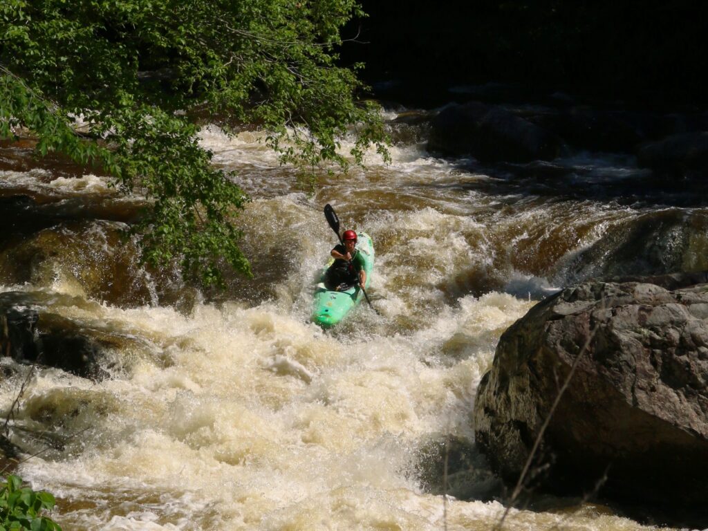
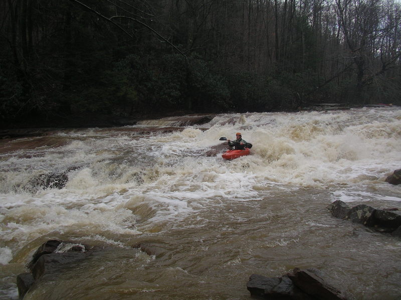
Kevin Williams relates:
Fun run with 2 slides- one narrow and reminiscent of the last slide on Meadow Run (but not as steep). Watch out for the undercut ledge along the left side and a piton rock near the bottom. The other slide (right at the old furnace) is 25 meters long with a ledge on the left side, a consistent slide on the right and what looks to be a really nasty pinning rock jumble right in the middle. Portage on the right. . The run was pretty low for us. Take a look at the 2nd slide at the furnace; if there is enough water to run the right side, it will probably be a nice level. Take out at the Cheat putin.
Water Quality Improvments:
For years, heinous water quality deterred paddlers form running the lower section of Muddy Creek. This Creek had been severely impacted by Acid Mine Drainage (AMD) from abandoned coal mines for decades. The volume of AMD, commonly known as “yellowboy” was overwhelming after the 1994 blowout at the T&T Mine. However, this stretch of whitewater is now runnable again with excellent water quality.
In 2018 the West Virginia Department of Environmental Protection (WVDEP) in cooperation with Friends of the Cheat (FOC) implemented a watershed scale restoration project on Lower Muddy Creek. This includes an AMD Treatment plant at the old T&T mine, as well as In-stream lime dosing systems throughout the watershed. The water quality on lower Muddy Creek has improved dramatically over the last year.
Attached is a youtube video about the project. https://youtu.be/EFUpVFdPWCY
Friends of the Cheat
Stream Gauge Project:
Friends of the Cheat (FOC) has
installed an OTT RLS Stream Gauge near the mouth of Muddy Creek, close to the
Cheat Fest Site. The stream gauge is similar to ones used by the USGS
throughout the state, however it is maintained and managed by FOC. It
measures stream stage (water level), as well as the following water quality
parameters; pH, conductivity, DO and temperature. Eventually, the stream stage will be embedded
in this page in place of the Big Sandy correlation that is currently used. For now, in order to view this gauge, follow
this link: \* https://www.cheat.org/our-work/mapping-monitoring-program/muddy-creek-gauge-live-data-stream/\* and click “Muddy Creek” on the left side of the page, and then
click “RLS Level (ft)” in the resulting drop down menu. This link will also provide the opportunity to download an app. If you have any trouble accessing this gauge via mobile phone, some users may find it helpful to first access the link via wifi and download the app.
Flow data will be useful for folks paddling Muddy Creek and
other nearby steep creeks (Daugherty, Roaring, and Elsey) that don't have gauge
stations, but often run when Muddy Creek runs high. Other recreationalists will find
the information useful as well. If you’d like to contribute to the development
of runnability correlations, please e-mail your observations of runnable flows in
Muddy Creek or other nearby creeks to owen@cheat.org, and/or leave this feedback as a comment here. Please be sure to include date and time, as
well as your interpretation of the flow, being as objective as possible.
Rapids in this Run (2)
Difficulty
Class II-III+(IV)
Length
3.1 mi
Rapids
2
Access Points
Difficulty Classes
I Easy
II Novice
III Intermediate
IV Advanced
V Expert/Extreme
VI Unrunnable
Current Conditions
5-Day Forecast
Whitewater data from
American Whitewater
American Whitewater