2. WV 55 Bridge 3.7 miles above Wardensville to WV 259 Bridge below Wardensville
Linked via: Nhdplus gnis 95% confidence Synced 6mo ago
Gauge Conditions
Runnable: 55.0 – 250.0 CFS
Data from American Whitewater & USGS
Run Map
Run Time Estimate
Select put-in and take-out to estimate time.
Unlock Advanced Trip Planning
See wind-adjusted speed maps, forecast planning, and detailed time estimates.
Sign in to generate an AI timing estimate for this run.
Whitewater timing varies with scouting, portages, and group pace. Use as a planning baseline.
Description
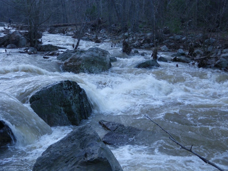
The Lost River Dry Gorge is up only in the winter, spring or after a prolonged wet period. Much of the river literally "sinks" above the gorge, only to reemerge on the other side of the mountain from large springs. Because of this, the riverbed is mostly dry much of the year. A large bridge for the Corridor H project has been built just downstream of the putin bridge, and a long stretch of parking was added along the edge of route 55 .
The first few miles are characterized by closely-spaced Class II-III rapids. Strainers can be a problem. There is a low-water bridge 2/3 of the way through that should be scouted. At favorable levels, one can run hard right or line up with the jet currents flushing through culverts under the bridge to ride the flow out of the hydraulic. Portage and scout on the right.
Landslide is the final and major rapid on the run (Class IV due to undercut rock on the right, part way through the drop) and should be scouted from the river left island. The rapid is a steep chute featuring offset holes, squirrely current and that undercut. Run center left working right to avoid a large boulder at the bottom center. The channel remains choked below, so swimming can be a bruiser.
Portage a second low-water bridge on the right and proceed to the takeout below Wardensville.
Rapids in this Run (1)
Hazards & Portages (1)
Caution: The following locations may require scouting or portaging. Always check current conditions.
Difficulty
Class II-III(IV)
Length
7.1 mi
Gradient
40 ft/mi
Rapids
1
1 Portage
Access Points
Difficulty Classes
I Easy
II Novice
III Intermediate
IV Advanced
V Expert/Extreme
VI Unrunnable
Current Conditions
5-Day Forecast
Whitewater data from
American Whitewater
American Whitewater