*2025.07.11 WOOD ALERT* Krueger Park to Hoyt Park (0.5 - 3.5 miles)
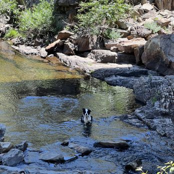
Underwood Creek
Linked via: Unknown Synced 6mo ago
Gauge Conditions
Runnable: 225.0 – 625.0 CFS
Too low. Boat and paddle abuse (scraping down a cement ditch and rocky rapids).
Data from American Whitewater & USGS
Run Map
Run Time Estimate
Select put-in and take-out to estimate time.
Unlock Advanced Trip Planning
See wind-adjusted speed maps, forecast planning, and detailed time estimates.
Sign in to generate an AI timing estimate for this run.
Whitewater timing varies with scouting, portages, and group pace. Use as a planning baseline.
Description
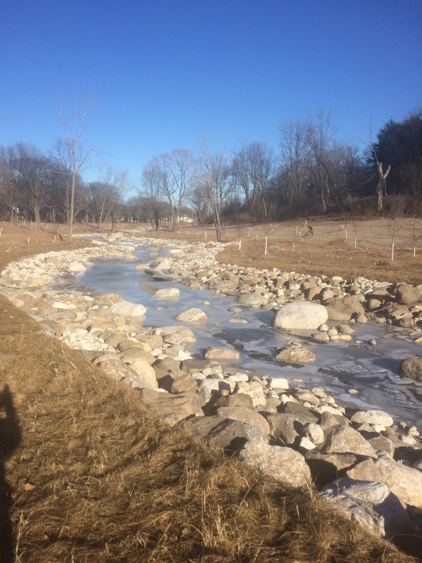
MMSD *'remediation projects'* have greatly diminished this once very fun run. They've removed cement channel, laid back the banks, meandered the streambed, and emplaced erratic boulders ( *totally out of character* with anything which exists in any *natural* stream in S.E.Wisconsin!) in what they consider to be *'restoring'* the river.
A half-mile (from under the expressway at Mayfair Road to nearly the confluence with the Menomonee) was 'restored' December 2017, and the prior half-mile was completed a few years earlier.
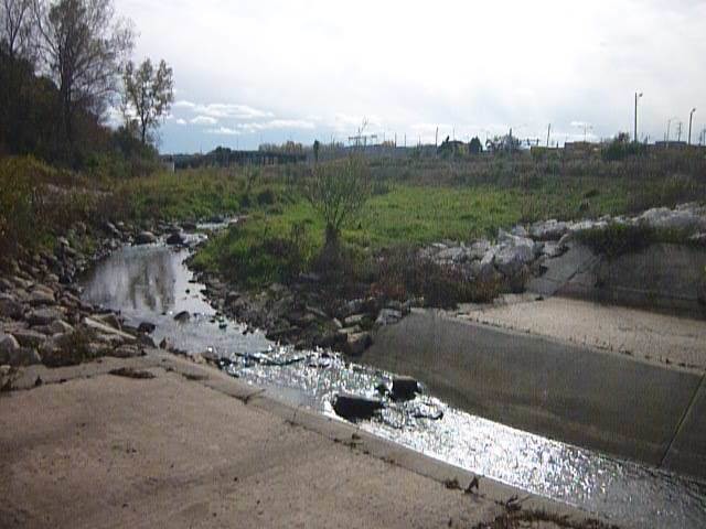
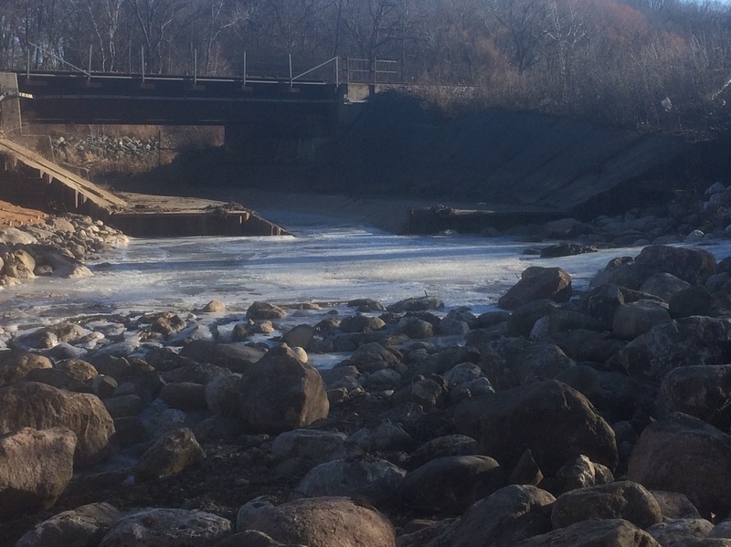
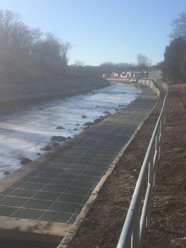
At this time, only the half-mile stretch from 115th Street to Mayfair Road contains ledge/drops (just 1-2 feet in height). The rest of the run is flatwater in a cement ditch, swiftwater in man-made meanders, and 'splishy-splash' class II (at moderate-to-high flows) or rock-dodging/rock-bashing (at low-to-moderate flows) in the lower remediated section.
*The 'remediation' has made it take much higher flows to make this run even worth considering, and has made this section far more dangerous for anyone who flips or is out of their boat! DO NOT ATTMEPT TO STAND UP OR WALK IN THE STREAM AT ANY ELEVATED FLOWS . DO AN INTERNET SEARCH TO LEARN ABOUT THE DANGERS OF 'FOOT ENTRAPMENT'!*
---
Quick Facts:
Location: Elm Grove/Wauwatosa
Shuttle Length: 4.4 miles (or 5.6 miles to the take-out for the MenWesTosa run, or 8.15 miles to the take-out of the MenTosa run).
Character: VERY flashy city run; Cement ditch with ledge-drops (diminished as indicated above) for first half, 'restored' meanders and boulder-dodge (piton-hell/'broach-city') in the later going.
Drainage area at gauge (midway on run): 18 square miles.
Put-in elevation is approximately 720'.
Take-out elevation is approximately 660'.
Thus total elevation change is approximately 60'.
NOTICE! This run is so flashy that runnable occasions are seldom measured in days but in hours! Nearly half the runnable occasions are 1.5 hrs or less, which means *it is generally futile to rely on the gauge for this run!*(That also means nearly half the potentially runnable occasions will happen during darkness!)
Also be aware that USGS gauges are not 'real-time'. Online values are typically updated only once an hour (at best), and there is a lag before values are posted. USGS readings are typically 30 minutes old by the time they are posted! If you are sitting at home, watching *until* a runnable level posted (whether on AW or on USGS directly), by the time you can drive there, gear up, set shuttle and get on, *you're likely be too late to catch the best flows!*
For the best chance to catch more of the best flows, you have to *watch the weather radar*, and *time things to be there when the rains are about to finish*! Then you have to be prepared to be skunked on this run (willing to run something else less interesting) if the rains prove insufficient to bring it up, and (flipside) be prepared to kill some time if rains bring it up too much! The only way to reslly know the actual conditions you'll encounter is to scout a few locations while setting shuttle. (SCOUTING IS ALWAYS RECOMMENDED!) But, again, flows change so quickly that features will be different by the time you get to them in your boat!
General Overview
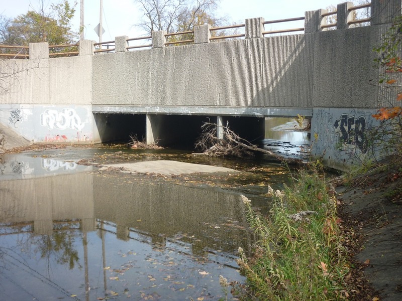
Boaters have been warned on more than one occasion that this is illegal to access this run *from within Milwaukee County*. The listed put-in for this section is in a Waukesha County, in a park with porta-johns (at least in summer) and a slat-fence enclosure which affords a possible *almost*-modest (not entirely private) change area (even if/when portajohns are not present). About a mile of uninteresting ditch leads to the first (very minor) sloping pitch at 115th Street. (Alternate put-in could be from the parkway road just west of 115th Street, but this is a surprisingly high-traffic location, so a 'stealth put-in' is not easy accomplished there.)
The water quality in this cement ditch might best be categorized as 'urban sewer'. Flows consist of runoff from streets, parking lots, over-fertilized yards, areas where folks have walked their pets (and not picked up the 'waste'), and so on. As a result water is full of such nasties as E.coli, fecal bacteria, oils, heavy metals, and who knows what. Ideally, anyone in the water should be wearing a full-body condom, diver's mask, scuba gear, and ear plugs (to reducee the possibility of a splash of water entering any facial orifice).
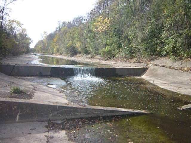
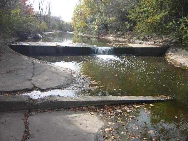
More is the pity, because this stretch contains a few interesting 'hydraulic jumps' (cement-ledge/pourovers) and a funky/fun wave which otherwise offer some quick in-town fun. The 'jumps' may have sticky-looking hydraulic reversals at some flows. Approach with some momentum, land a 'boof', and immediately employ a *strong* forward stroke to draw out of the grips of reversals. (Do not just drift over the drop, or drop over sideways, and do not raise your arms and paddle into the air, failing to paddle out of the drop!) If caught by the reversal, DO NOT PANIC! All of these are shallow enough that if you end up caught in them and have to exit your boat, you can very likely stand, grab your boat, and walk to the shore!
With the 'restoration' projects, the final mile (+/-) of the river has been filled with large rocks. At low water this may look like it could make great whitewater. However, at low flows it will be nothing but rock-bashing (boat and body busting), and when flows are high enough to cover the rocks it will barely merit a class II rating. Additionally, at any boatable flow, this area will be replete with ***danger of foot-entrapment for anyone out of a boat and in the current*. While there may be *significant risk to anyone inexperienced and uneducated in the special concerns present with whitewater,*** there would be nothing overly dangerous to properly trained, experienced boaters.
Rapids in this Run (7)
Waterfalls (8)
 Waterfall
1st Hydraulic Jump (Warm-up Jump) (12 inches)
 Waterfall
2nd Hydraulic Jump (Wake-up Jump) (27 inches)
 Waterfall
3rd Hydraulic Jump (WPR Jump) (25 inches)
 Waterfall
4th Hydraulic Jump, Railroad Jump
 Waterfall
Remediation Rips
 Waterfall
Narrowing
 Waterfall
Walled In Terrace
 Waterfall
Hoyt Park; Drainage area: ~110 sq.mi.
Playspots (2)
Hazards & Portages (2)
Caution: The following locations may require scouting or portaging. Always check current conditions.
Difficulty
Class II(III)
Length
3.6 mi
Gradient
17 ft/mi
max 30
Rapids
7
2 Hazards
Access Points
Shuttle Info
Shuttle directions have been a bit convoluted due to road construction projects (at the Zoo Interchange and surrounds). Alternate routes are likely to be used. (Good luck!)
Be aware that if you are headed west on Blue Mound Road, it is NOT possible to turn left onto Columbia Blvd. You need to continue to a left turn lane for Elm Grove Road. (Careful! The turn-off lane is _well-before_ the intersection, but _after_ an oncoming turn-off lane.) Heading south on Elm Grove Road, look for the third (3rd) road to the left. Golf Road will take you right into the parking lot in the park. Head to the back end of the lot and walk (largely due east) a paved path to the creek to put-in under a bridge.
It may be worth using a completely different shuttle route to have a chance to look at the 'hydraulic jump' right under Watertown Plank Road, immediately west of Hwy.100/Mayfair Road. You will have to park briefly in a business parking lot and hike up the bike path under Watertown Plank Road to have a look here.
Anyone who risks arrest and disease to do this run is likely to continue beyond the listed take-out of this run to run the Menomonee River 'MenTosa' section, therefore it is highly unlikely that the default shuttle directions below have any relevance what so ever. To get shuttle directions for the extended run (Underwood Creek plus MenTosa), enter (cut/paste) the coodinates for MenTosa's take-out ( **43.0415, -87.9681** or just the address W.Monarch Place) into the text-entry box below. Again, other routings may be preferable.
Difficulty Classes
I Easy
II Novice
III Intermediate
IV Advanced
V Expert/Extreme
VI Unrunnable
Current Conditions
5-Day Forecast
Whitewater data from
American Whitewater
American Whitewater