3. Boyden Cave to Middle Fork confluence
Kings, S. Fork
Linked via: Unknown Synced 6mo ago
Gauge Conditions
Runnable: ? – ? CFS
Approximate reading: This gauge is 15.6 miles away on Kings. Use as a general reference only.
Data from American Whitewater & USGS
Run Map
Run Time Estimate
Select put-in and take-out to estimate time.
Unlock Advanced Trip Planning
See wind-adjusted speed maps, forecast planning, and detailed time estimates.
Sign in to generate an AI timing estimate for this run.
Whitewater timing varies with scouting, portages, and group pace. Use as a planning baseline.
Description
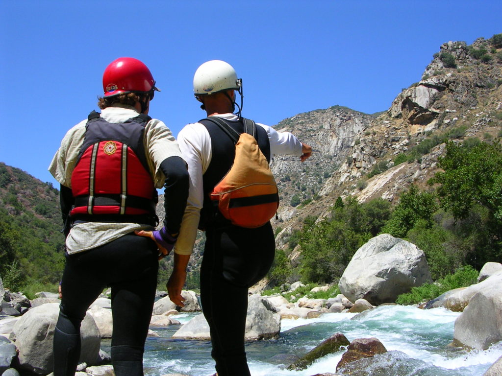
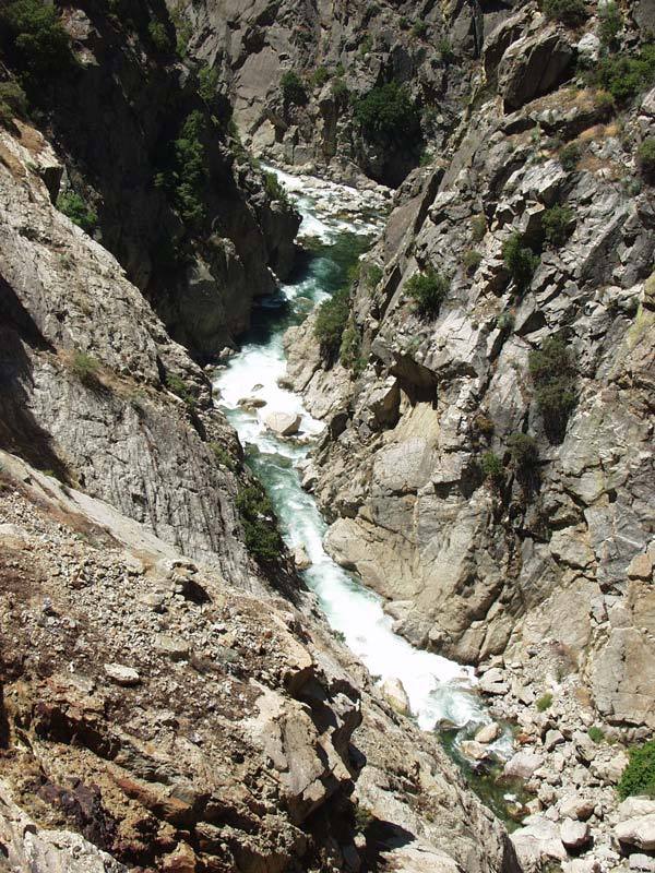
Horseshoe Bend of the SF Kings is a super scenic gorge. It is normally paddled in conjunction with the downstream Garlic Falls section. This makes an excellent 2 day trip through fantastic scenery that has been compared to the Black Canyon of the Gunnison.
If you do not have time to continue downstream or if you wish to stay in the South Fork, Cedar Grove area, there is a steep 2 mile carry out from the confluence of the middle fork to Yucca Point on Highway 180.
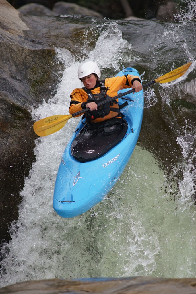
As reported, there are two mandatory rapids that cannot be portaged in the heart of the gorge. These two rapids can be scouted from the road and from river level. Recent trips (2012) report that the difficulty of these rapids is in the easy class 5 to 4+ range at moderate flows, so they should no longer be called "Fear and Loathing". Big floods in 1997 cleaned up "Fear and Loathing" so that it is much less difficult and dangerous than in the past. Two or three drops further downstream is the next mandatory run. Scout from river right. There are bigger rapids both upstream and downstream, but all others can be walked if desired.
Taylor Cavin writes: "The horseshoe bend of the Kings gave me the feeling of being in a deeper canyon than I have experienced elsewhere in California, with more vertical, craggy, and lichen-painted walls..... It has some challenging rapids, but I would rate the run over-all as class V, not V+. I feel that it is comparable in difficulty to Garlic Falls (aka King's Canyon), the continuation of the river downstream of the confluence with Middle Kings.
What I do wish to make known is that there is no longer a crux or "crucible" moment in the run. I don't think that there is a need to hike out above or hike in below "fear and loathing." Anyone who has made it that far in the run will not find inordinate challenge in that rapid. I also think that the rapid could be re-named, much as "old scary" on the SF American was re-named following its re-arrangement. Maybe "old fearful" would be a fitting revision.
I was frustrated in the difficulty of persuading people in joining me on the trip, given the specter of "fear and loathing" that has lingered. This is why I want to share this information." Taylor Cavin, 2012.
Getting There: From Fresno, take highway 180, Kings Canyon Avenue, east, into the mountains, through Grant Grove towards Cedar Grove. The distance is approximately 75 miles on excellent highway, but still allow at least 1.5 hours driving time. Better yet, allow time for sightseeing along the way. Highway 180 is closed to automobile traffic during the winter, usually from November 1 to April or May.
Put in: Highway 180 reaches the river at Boyden Cave. Park in a large turnout downstream of the bridge, not in the cave parking lot. There is a snack bar, souvenir shop and pit toilets at the cave parking area. The cave tour takes about an hour and is pretty nice.
Alternate put in: Paddlers can also put-in below the mandatory rapids, about halfway through Horseshoe Bend by a short but rough route down from Convict Flat. This trail requires some bushwacking and also lowering boats down a short cliff. It reaches the river in the heart of the gorge but below the mandatory rapids. Big rapids remain, but all can be portaged if necessary.
Other information Sources:
Hume Lake Ranger District
35860 East Kings Canyon Road
Dunlap, CA 93621
559-338-2251
Monday through Friday, 8:00am - 4:30pm
Sequoia National Forrest
Friends of the SF Kings
Fishing regulations
Kings Canyon Lodge, cabins & eatery at 180 &Ten Mile Creek, near Yucca Point, (559) 335-2405
A GUIDE TO THE BEST WHITEWATER IN THE STATE OF CALIFORNIA, HOLBEK & STANLEY, 1988
Rapids in this Run (5)

Waterfalls (1)
Difficulty
Class V
Length
4.5 mi
Rapids
5
Access Points
Difficulty Classes
I Easy
II Novice
III Intermediate
IV Advanced
V Expert/Extreme
VI Unrunnable
Current Conditions
5-Day Forecast
Whitewater data from
American Whitewater
American Whitewater