3. Bridge below Jared's Knee to Ranger Station
Linked via: Proximity 93% confidence Synced 6mo ago
Gauge Conditions
Runnable: 1.4 – 4.0 FT
Data from American Whitewater & USGS
Run Map
Description
For much of 2023 through June 2025 the Tellico was closed due to bridge construction at Bald River Falls. This new bridge is wider, has improved parking, and provides safer pedestrian movement but paddlers should be aware that this section of the road is still highly congested and boaters should politely slow down and cruise through so as to illustrate the best qualities of our community.
Logistics: From Tellico Plains head east on Highway 165 out of town and at mile 5.3 you will come to the Oosterneck Day Use Area that is generally used as the take-out for this reach due to the ample off-road parking. Continue on up the road another 0.1 mile and turn right on FR 210. The Ranger Station access is at mile 0.4 but there are numerous roadside pullouts and any of the ones in the first two miles make good alternative take outs particularly for those who are continuing from the ledge run that starts above this one. The great thing about this run is you can pick your access point depending on how much time you have and what you want to run. The traditional put-in for this middle reach is at the bridge at FR 210 mile 5.3. Put-in on upstream river left where you will find a good pullout. If you want to run 2 miles of quality class IV you can check out the next run upstream that includes Baby Falls and several fun ledge drops.
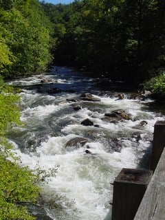
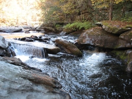
Description: The Middle Tellico provides paddlers with a unique opportunity to choose from one of several different possible runs by selecting from multiple access points. Those looking for more of a challenge start their runs further upstream, while those who don’t want to get things started right away with challenging class III drops can find an access a short distance downstream. The convenient roadside access makes it easy for folks to join the group wherever they feel most comfortable. The gradient over the 5 miles of this run averages 50 fpm but gradually ramps down in the one mile segments as follows: 80, 53, 45, 40, and 32.
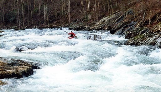
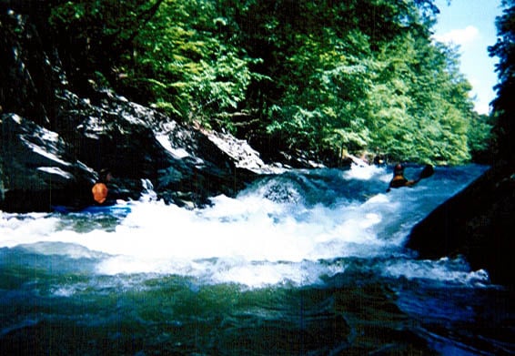
The run starts right off with a bang at the first class III rapid at the bridge. The hole under the right side of the bridge can get mean at higher flows. Only a short distance downstream you will find the next class III known as Ledges. The next rapid is Bounce off Boulder (BOB), notable by a large sloping rock on the left. Old School long boats can get enders in the hole at the base of the boulder, short boats can get nearly looped. Turkey Creek which enters from river right 0.8 miles into this run serves as an alternate access that avoids these more challenging drops and is also an alternate take-out for those running the upper run.
Below this point the run is, at gauge readings close to 2.0ft, mostly class II with occasional class III drops including Crack in the Rock (class III), Gregs Nose (class III), Submarine (class III-), and Pylon Rapid (class III-). Reeders Rock is another named class II that comes after these. There is a small, aging, 'Keep Right' highway sign on river left as you enter the rapid but as of 2025 shrubs and trees make it difficult to see. The nasty undercut is the rock that the sign is on, but the walls downstream are undercut as well. There was a drowning here in 1989. In another mile you will reach the Ranger Road access. Paddlers typically continue another half mile downstream to the access at the Oosterneck Day Use Area.
The Tellico is a great river for a group as just about everyone can find something to enjoy, and even if the water gets high you can check out other sections. In addition to a couple of tributary creeks, the other Tellico runs include:
\[1. Trout Hatchery to Bridge above
Bald River\]() (Class II-III+),
\[2. Bridge above Bald River to
bridge below Jerod's Knee (Upper Tellico)\]() (Class III-IV+)
\[4. Ranger Station to Tellico
Plains\]() (Class I-III).
Rapids in this Run (3)
Hazards & Portages (1)
Caution: The following locations may require scouting or portaging. Always check current conditions.
Difficulty
Class II-III
Length
5.3 mi
Gradient
50 ft/mi
max 80
Rapids
3
1 Hazard
Access Points
Difficulty Classes
I Easy
II Novice
III Intermediate
IV Advanced
V Expert/Extreme
VI Unrunnable
Current Conditions
5-Day Forecast
Whitewater data from
American Whitewater
American Whitewater