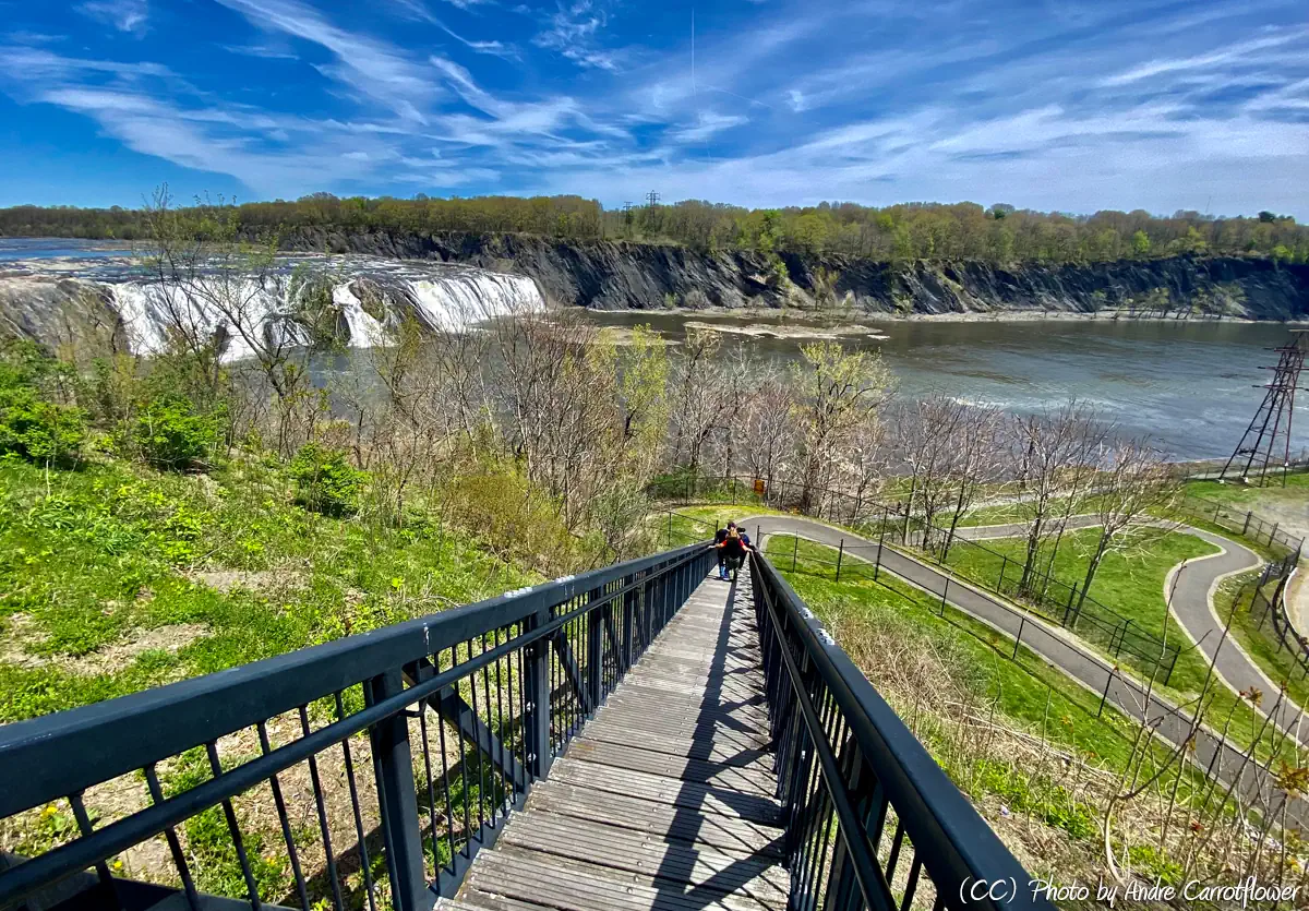
3. Cohoes Falls to Hudson River
Linked via: Nhdplus discovery 90% confidence Synced 6mo ago
Gauge Conditions
Runnable: 15.0 – 28.0 FT
Certain lower levels also have play spots
Data from American Whitewater & USGS
Run Map
Run Time Estimate
Select put-in and take-out to estimate time.
Unlock Advanced Trip Planning
See wind-adjusted speed maps, forecast planning, and detailed time estimates.
Sign in to generate an AI timing estimate for this run.
Whitewater timing varies with scouting, portages, and group pace. Use as a planning baseline.
Description
Rumor is that Cohoes Falls was run in 2012 on the river left side which is (acessable by continuing up the path); however, the main attraction for this section are the high water waves. These features fully form above 15.5 ft and increase in size as the river continues to rise. The main wave is easily comparable to Inner-City Strife on the Black River in Watertown.
While there is a very large (800ft long) straight-forward eddy that forms behind the waves, missing it is not an option and will result in having to run the river to the power dam below Saratoga Ave to take out on the river left eddy. Similarly, a swim could be disastrous.
If you are in the neighborhood and the level isn't quite right it can still be worth the trip to check out the waves. When the Lower Cohoes Wave isn't in there will sometimes still be a shallow surf wave at this location. Also at slightly lower levels the main wave will form a hole.
Bring a 50ft rope so there is plenty of slack to tie your boat with.
Here is a video at low water (11ft)
Capital Region Area Reaches
Basic Creek Batten Kill Claverack Creek
Cobleskill Creek Fox Creek Hannacrois Creek
Hoosic Hudson (Lock 2) Kinderhook Creek (1.)
Kinderhook Creek (2.) Kinderhook Creek (3.) Kline Kill
Normans Kill (1.) Normans Kill (2.) North Chuctanunda Creek
Mohawk (Upper Cohoes Wave) Mohawk (Cohoes Wave) Poesten Kill (0.)
Poesten Kill (1.) Poesten Kill (2.) Quacken Kill
Schoharie Creek Stony Kill Wyant's Kill
Google Map of New York Whitewater
New York Whitewater Paddlers Facebook Group
Waterfalls (1)
Playspots (1)
Difficulty
Class II-IV(V+)
Length
0.6 mi
Rapids
0
Access Points
Shuttle Info
Reaching these waves is a bit of a challenge and is part of the reason no one seems to know about them:
1. From 787 north turn right onto Saratoga Ave
2. Take an immediate left at the light after crossing the bridge over the Mohawk onto Clifton Rd
3. Take a left at the first stop sign onto River St.
4. Park by the fence where the road hits the cliff overlooking the river.
5. There is a trail that goes upstream to the right. Follow it and at the third or so overlook will be a tree 10 ft in with a rope or two on it.
6. From here lower your boat and then yourself onto the "beach" below. Use extreme caution scaling the cliff, the rock is loose and probably wet. This deposits you in the eddy, and in front of you will be the waves.
Difficulty Classes
I Easy
II Novice
III Intermediate
IV Advanced
V Expert/Extreme
VI Unrunnable
Current Conditions
5-Day Forecast
Whitewater data from
American Whitewater
American Whitewater