3. Kings River Powerhouse to Big Creek Cove Wild
Linked via: Nhdplus discovery 90% confidence Synced 6mo ago
Gauge Conditions
Runnable: ? – ? CFS
Approximate reading: This gauge is 18.0 miles away on Kings. Use as a general reference only.
Data from American Whitewater & USGS
CDEC Flow Data California
Data from California Data Exchange Center (CDEC)
Run Map
Put-in
Take-out
Rapids/Hazards
Wild
Run Time Estimate
Select put-in and take-out to estimate time.
Unlock Advanced Trip Planning
See wind-adjusted speed maps, forecast planning, and detailed time estimates.
Sign in to generate an AI timing estimate for this run.
Whitewater timing varies with scouting, portages, and group pace. Use as a planning baseline.
Description
This section of the Kings River is usually only available when Pine Flat reservoir gets very low. When storage in Pine Flat is 300,000 acre feet or less, most of this river section returns. The reservoir can get low in late summer and fall of dry years. During these periods the outflow from the Kings River Powerhouse can provide enough flow for fun boating. Sometimes the reservoir will still be low during the winter when big storms provide large flows. Some years the reservoir may remain low enough to make the run worthwhile during the early spring snowmelt season. The reservoir will quickly rise during spring runnoff and during wet winters.
The army corp page for Pine Flat gives the exact reservoir surface elevation. The normal take-out at the mouth of Big Creek is 750' elevation. Since the gradient is around 17 feet per mile near Big Creek, you should be able to estimate how much flat water you have to paddle at any lake elevation.
Mileage and Elevations:
Location
Mile
Elevation
Drop
Kings River Powerhouse
0
910'
0'
Mouth of Big Creek
7
750'
160'
Mouth of Sycamore Creek
8
730'
180'
Trimmer
9
715'
197'
Take-out: Drive around Pine Flat reservoir on Trimmer Springs Road. Beyond Trimmer Springs, the road goes around and crosses two major inlets. The first is Sycamore Creek, the second is Big Creek. Just as the road leaves the main reservoir and turns north into the Big Creek inlet, there are some turnouts and a dirt road/trail leading back down towards the main reservoir. Park there. GoogleMap of Take-out hike When the lake elevation is 785', the hike is about 1/3 mile with 300 feet of elevation gain up a fairly gradual slope.

Put-in: Continue on Trimmer Springs Road towards the Kings River. After the road goes over Cottonwood Ridge and comes down to the river, you will see the Kings River powerhouse and pipes leading to it. (These pipes carry water from the North Fork Kings River). Turn right at the powerhouse and you can drive all the way down to the tail race at the base of the powerhouse. There is only a small sandy area next to the tail race, so use it only for unloading only. Leave cars up at the obvious large parking area.

The shuttle is about 15 or 20 minutes each direction.
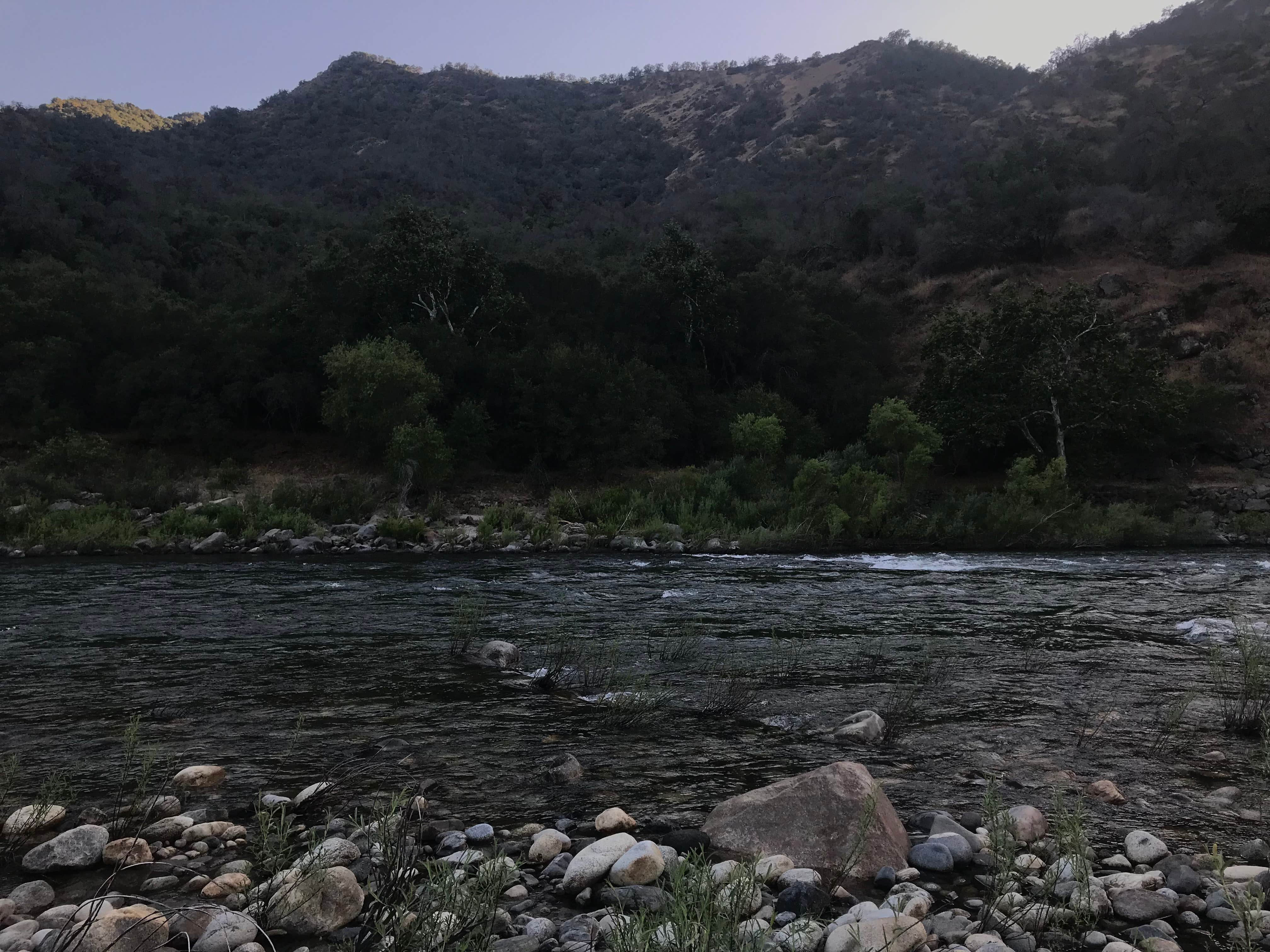
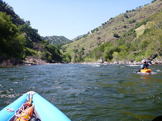
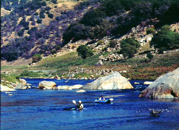
The run starts off with a few long stretches of flat water interspersed with interesting and fairly long class 2 rapids.

In a couple miles the rapids come closer together as the run approaches Cottonwood Gap. A prominent cliff, high on river left marks this gap. Huge boulders have fallen into the river below the base of this cliff.

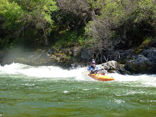
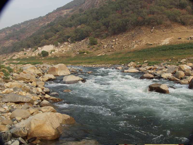
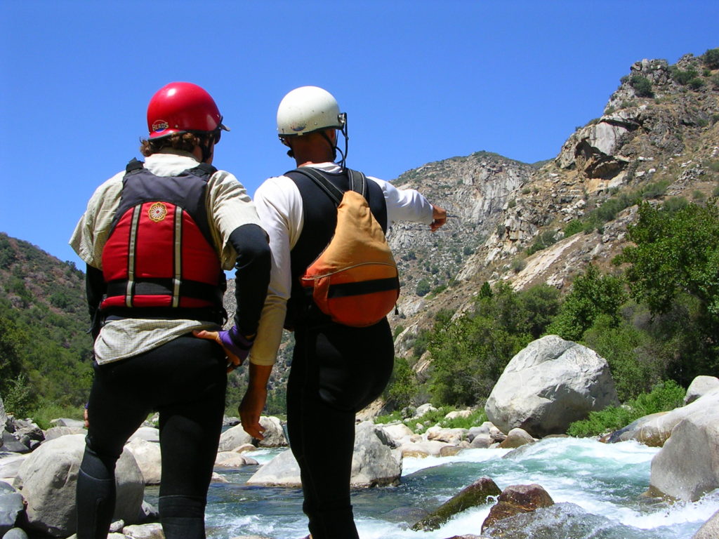
Just downstream of these boulders is the entrance to the one big class 3 rapid on the run. This rapid starts with a number of shallow entrances on river left combining into a powerful chute leading right. This chute gains water and power along its length and ends with several river wide breaking waves. It is guaranteed to intimidate beginning kayakers and swamp open canoes! This rapid can be scouted or portaged on either side.

Below Cottonwood Gap, the rapids are less steep and the pools between are a bit longer.
In the fall of 2001, when Pine Flat storage was 276,000 acre feet, we hit silt flats about 1 mile below Cottonwood Gap. The silt is good in some ways, because it smooths out the small gradient and the current moves along at a steady clip. The water here becomes brown and roiling. There are many ghostly dead trees along the banks and snags pushed down from upriver. There is also a distinct, musty, lake bottom smell. Early in this section we had plenty of depth, but as we neared the lake, the river spread out more, got more shallow,and it was harder to see the deeper channels. In the last 50 or 100 yards to the lake the flow slows down, the depth diminishes and it is very hard to avoid grounding out. People should expect to push their boats for a short distance as they paddle from the river onto the lake.
We had about 1 mile of paddling on the lake to Big Creek Cove. Then there was several hundred yards of hiking up a hill to the road. One advantage of having some flatwater paddling was that the lake extended back into Big Creek Cove a bit and we did not have to carry our boats as far up the hill as from the true river bed.
In succeeding years the river steadily cleaned out the silt all the way past the mouth of Big Creek. During big water years, this run will remain covered and lots of new silt will be deposited.
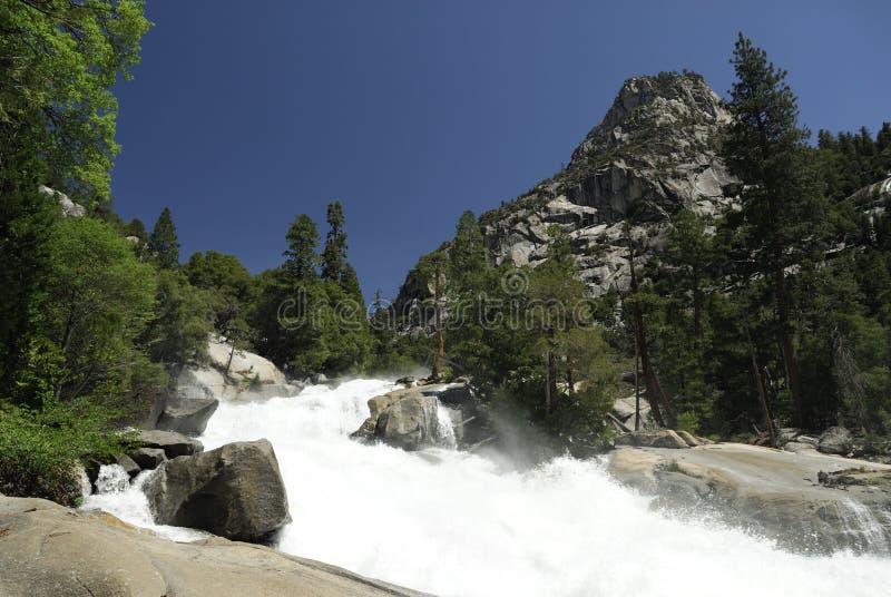
This run is suitable for experienced open canoe boaters and novice kayakers. There are many wonderful beaches, the water is usually a pleasant temperature for swimming, and the scenery is nice with a desert feel.
Google Earth has high resolution images of this section of river with the river bed exposed during low reservoir conditions. (Sept. 2005)
Paul Martzen


Difficulty
Class II(III)
Length
7.3 mi
Gradient
22 ft/mi
max 25
Rapids
11
Access Points
Shuttle Info
The shuttle is fairly easy and short, but windy. Expect 15 minutes driving time each way.
[GoogleMap of Take-out hike](http://maps.google.com/maps/ms?ie=UTF8&hl=en&msa=0&msid=115268427110841907461.0004572b682d096aec71f&ll=36.892707,-119.247483&spn=0.012476,0.019312&t=h&z=16)
Difficulty Classes
I Easy
II Novice
III Intermediate
IV Advanced
V Expert/Extreme
VI Unrunnable
Current Conditions
5-Day Forecast
Whitewater data from
American Whitewater
American Whitewater