3. Lake Branch to Punchbowl Falls
Linked via: Nhdplus gnis 95% confidence Synced 6mo ago
Gauge Conditions
Runnable: ? – ? CFS
Approximate reading: This gauge is 10.4 miles away on Hood. Use as a general reference only.
Data from American Whitewater & USGS
Run Map
Run Time Estimate
Select put-in and take-out to estimate time.
Unlock Advanced Trip Planning
See wind-adjusted speed maps, forecast planning, and detailed time estimates.
Sign in to generate an AI timing estimate for this run.
Whitewater timing varies with scouting, portages, and group pace. Use as a planning baseline.
Description
The West Fork Hood is the best Class IV run in the Columbia Gorge. It's known for its fun Class IV rapids that build up in intensity. Most of the rapids occur in 2 basalt gorges that are spectacularly beautiful to journey through.
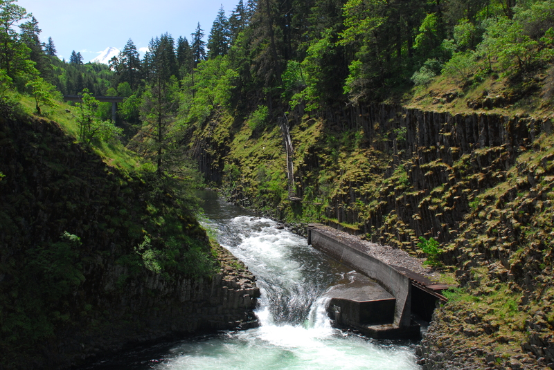
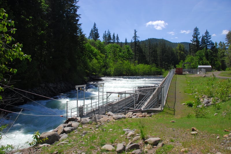
Launch at the confluence of the West Fork and the Lake Branch of the Hood River. About a mile downstream is the first basalt gorge with a number of classic rapids. Shortly below the gorge boaters pass under a road bridge which can serve as an alternative putin if the road has too much snow. Below this bridge the rapids are more spread out with more gravel bars and boulders than upstream. 2 miles below the bridge be on the lookout for the mandatory portage around a large fish ladder. Several hundred yards above the fish ladder you should see the water intake for the sorting facility. Takeout in the small eddy on the left and walk downstream to a short climb back down to the river directly below the last tier of the fish ladder.
Below the fish ladder, the rapids pick up in intensity. The most difficult rapid on the West Fork is about a half-mile below the fish ladder and is a long, complex rapid that goes around a right bend and enters a long, complex bouder garden culminating in a couple large features at the bottom. You can scout most of this rapid from the right. Rapids come in quick succession after that, but have short pauses in between them. The last rapid goes underneath the high bridge directly above the takeout. This rapid is best scouted from the bridge before you head up to launch, though as you probably already know, you can't tell how steep it is from overhead.
Eddy right below the high bridge rapid, then find the second right eddy where the takeout trail leaves the water. This take out is above Punchbowl Falls. The 'goat path' climbs up and left, ascending the bluff above the falls, from which you can view the 10-foot drop into a gnarly hole. It is runnable, but the hole is deep and a swim here would be no fun. This is an amazingly beautiful and powerful place, with beautiful basalt walls, views of Mount Hood, and awesome wildflowers in the spring. It's a nice hike up the hill to the parking lot.
Waterfalls (1)
Hazards & Portages (1)
Caution: The following locations may require scouting or portaging. Always check current conditions.
Difficulty
Class III-IV+
Length
5.7 mi
Gradient
82 ft/mi
Rapids
0
1 Hazard
Access Points
Shuttle Info
From Hood River head to the hamlet of Dee. Cross the East Fork of the Hood and then veer right. Follow this road to a dirt parking area on the right. This is take-out. If you cross a bridge you've gone too far.
From take-out, head back the way you came and drive back to Lost Lake Road. Take a right on Lost Lake Road and follow it for about 5 miles. You'll cross the West Fork a few times. The put-in is at a parking area on the left side just past a bridge that crosses the Lake Branch. Hike down the Lake Branch from the dirt parking area and put-in just before it meets the West Fork.
Difficulty Classes
I Easy
II Novice
III Intermediate
IV Advanced
V Expert/Extreme
VI Unrunnable
Permit Required
No Permit
Current Conditions
5-Day Forecast
Whitewater data from
American Whitewater
American Whitewater