3. Loop 360 to Zilker Park (Austin) (3.75 miles)
Linked via: Proximity 99% confidence Synced 6mo ago
Gauge Conditions
Runnable: 250.0 – 3,500.0 CFS
Runnable: 250.0 – 3,500.0 CFS
Data from American Whitewater & USGS
Run Map
Run Time Estimate
Select put-in and take-out to estimate time.
Unlock Advanced Trip Planning
See wind-adjusted speed maps, forecast planning, and detailed time estimates.
Sign in to generate an AI timing estimate for this run.
Whitewater timing varies with scouting, portages, and group pace. Use as a planning baseline.
Description
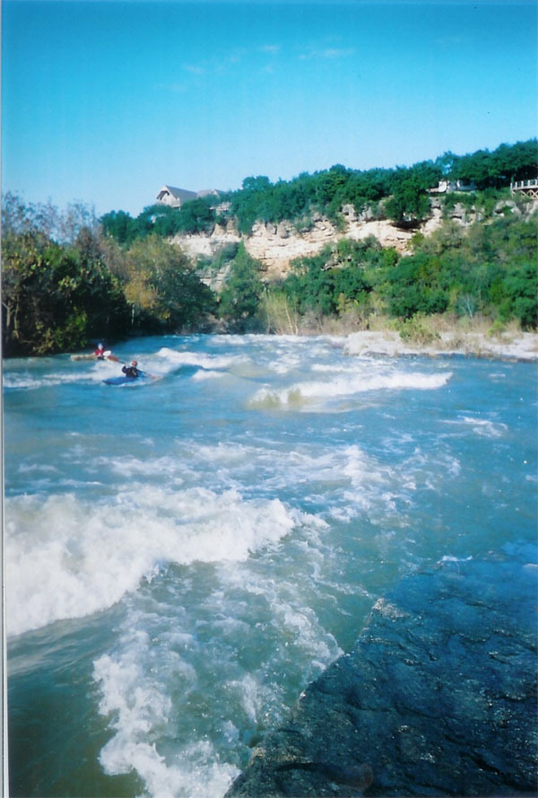
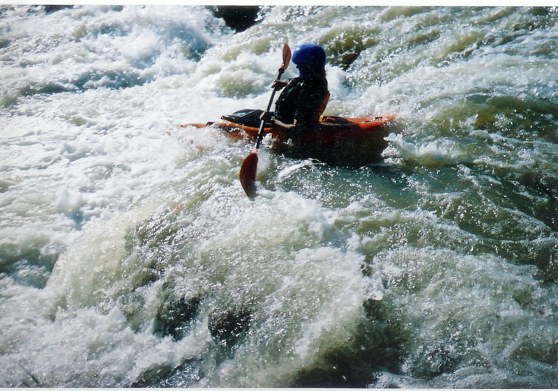
Barton Creek doesn't usually have enough water to be runnable, but when it does, it creates one of the best Class III runs in the state of Texas, right through the heart of Austin. Barton does not generally rise as quickly as other area creeks, but it can definitely go from low to raging in a matter of hours after a heavy rainfall. Because the creek does not always flow, there are often trees and strainers throughout the run, particularly if the creek has been recently dry. This stretch in particular contains several Class III rapids that are formed by trees growing close together in the creek bed. The lines through these rapids are not always visible from the top, and fallen trees do occasionally create hazards to navigation.
Put-in parking is available at the Barton Creek Greenbelt trailhead next to the Loop 360 Bridge where Mopac and Highway 360 intersect. If the trailhead parking area is closed (which it sometimes is after a heavy rain), then parking is also available in the adjacent dirt lot. There is a trail to the left of the fence that leads directly down to the water.
The takeout for this run is at Zilker Park, in the parking lot for Barton Springs Pool. Paddlers usually take out at river left just above the dam at the upper end of Barton Springs Pool. It is technically illegal to paddle over this dam and into the pool, and if you do that, you will usually get yelled at by a lifeguard and may be hassled by police or fire officials in some cases. The dam creates a nasty hydraulic at some levels, and the bypass grate that is supposed to divert the normal flow of the creek around Barton Springs Pool becomes a potentially deadly strainer at high water.
On at least one occasion, boaters have been skunked on this stretch, because a flood bubble had reached the put-in but had not yet reached the takeout (which was still bone dry.) This created a bizarre situation whereby the paddlers literally reached the end of the river and had to wait 10-15 minutes in each successive pool for the water to rise high enough to activate the next rapid. If you are paddling a runoff event (which, on Barton, is more often the case than not), then check both the put-in and takeout gauges to make sure that the entire stretch has water.
A note about boating bans:
As a result of the July 3, 2002 accident at the low-head dam near the Hill of Life that killed Austin firefighter Rob Horne, AFD instituted a policy whereby boating could be banned on area creeks during periods of high flow. Throughout the rest of the 2000s, however, there was reportedly a handshake agreement between the fire chief and the Texas Rivers Protection Association (TRPA) whereby boating bans would be issued only if the creeks were exceptionally high and dangerous. Unfortunately, this handshake agreement was seemingly abandoned with the appointment of a new fire chief in 2009. In 2010, the City of Austin began issuing blanket boating bans on all area creeks during heavy rainfall runoff events. These boating bans are not always well-publicized, and historically speaking, they have rarely been reflective of actual navigability dangers. After Tropical Storm Hermine, for instance, a boating ban was issued and was not lifted until Barton Creek dropped to 150 cfs (below runnable.) During Hurricane Harvey, a preemptive week-long boating ban was issued before rain even began falling, and since the hurricane largely missed Austin, few creeks within the city limits even became runnable during that ban. The city seems to be basing its authority to issue these bans on § 31.092 (a) of the Texas Water Safety Act, which allows the "governing body of an incorporated city or town, with respect to public water within its corporate limits and all lakes owned by it" to "make rules and regulations relating to the operation and equipment of boats which it deems necessary for the public safety." As of this writing, the Austin Homeland Security and Emergency Management Dept. considers issuing boating bans whenever the creek is above 1500 cfs. At times, Barton Creek has run clear at 2000 cfs on a sunny day, and it has been safely navigated at much higher flows than that, so local boaters are of the opinion that automatically closing the river at levels above 1500 cfs represents a regulatory overreach on the part of the city. However, that's not an argument that can be won on a river bank, so if you intend to paddle the creek at flows above 1500 cfs, check for a boating ban announcement on the HSEM web site first. If the creek is running really high (thousands of cfs) and there is a boating ban in place, then there will often be police or fire officials stationed at the Zilker Park takeout (river left.) They can issue fines or even impound boats in certain cases if they catch paddlers breaking the ban.
Distances and gradient measured using GIS tools in 2015.
This video shows local paddlers running various parts of Barton Creek below Lost Creek. This was mostly shot after the Halloween Flood of 2013 when the creek was running about 2000 cfs.
Rapids in this Run (2)
Playspots (1)
Difficulty
Class III
Length
3.9 mi
Gradient
17 ft/mi
Rapids
2
Access Points
Difficulty Classes
I Easy
II Novice
III Intermediate
IV Advanced
V Expert/Extreme
VI Unrunnable
Current Conditions
5-Day Forecast
Whitewater data from
American Whitewater
American Whitewater