3 - Masemore Road to Monkton Road
Linked via: Proximity 98% confidence Synced 6mo ago
Gauge Conditions
Runnable: ? – ? CFS
Approximate reading: This gauge is 0.7 miles away on Gunpowder Falls. Use as a general reference only.
Data from American Whitewater & USGS
Run Map
Run Time Estimate
Select put-in and take-out to estimate time.
Unlock Advanced Trip Planning
See wind-adjusted speed maps, forecast planning, and detailed time estimates.
Sign in to generate an AI timing estimate for this run.
Whitewater timing varies with scouting, portages, and group pace. Use as a planning baseline.
Description
There are a number of access points on this run. Starting from the top (Access - river miles) they are: Masemore Road - 0.0, Bunker Hill Road - 1.3, York Road - 2.1, Big Falls Road - 4.4, Blue Mount Road - 5.4, Monkton Road - 7.5. This river length is not necessarily what might be a usual run. Usual runs might be from Masemore Road to Big Falls Road (a total of 4.4 miles), or Blue Mount Road (a total of 5.4 miles) or Monkton Road (a total of 7.8 miles). Summer Parking can be an issue at many of the accesses. As of Summer 2020, Baltimore County has eliminated all potential parking anywhere near the river at Blue Mount Road and while there is parking at Monkton Road, either the County or State has reduced the amount of parking that once was there. In any case, it's wise to get a spot early. Big Falls Road access has plenty of roadside parking, and Quarry Rapid (II-) -- the run's only rapid is immediately downstream from the Big Falls Road access.
Tom Resch shared:
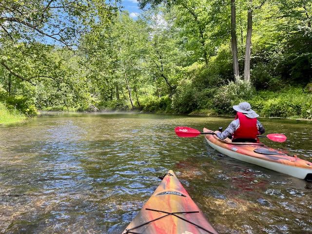
Paddled from Masemore Road to Blue Mount Road on May 10, 2004. Level was right around 2' (~100-120 cfs). Lots of dead wood down but everything was passable. Thanks to the kind soul or souls who cleared paths through the strainers that previously had to be portaged. For those who have never paddled this stretch, it's a very scenic PN run...most of your trouble will come from the dead wood but anyone with good boat control should have no problems. Quarry Rapid, at the end of the run, will delight the novice paddler.
Ed Evangelidi testifies:
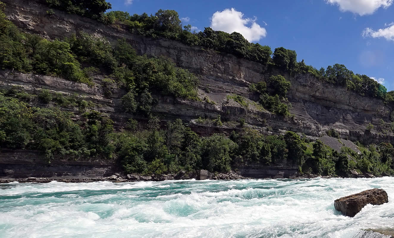
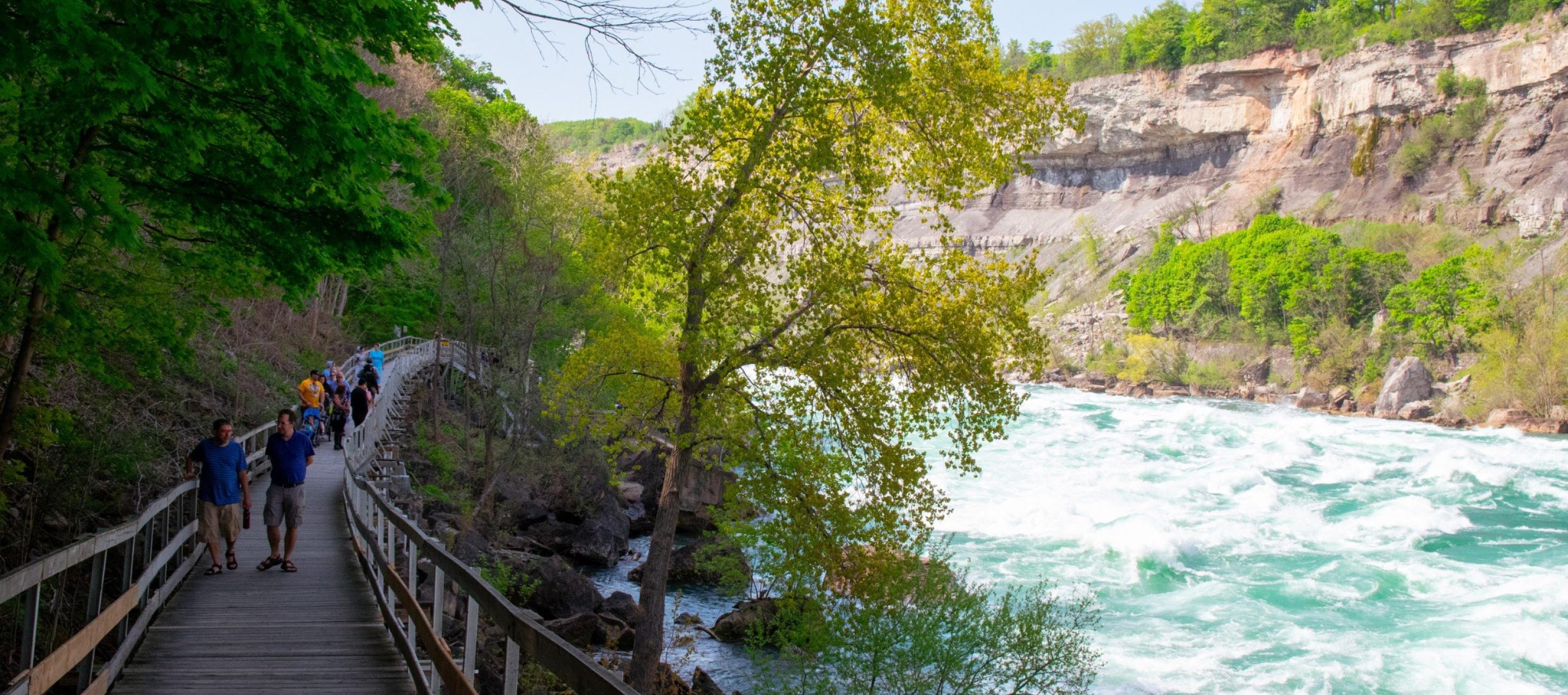
No question that the short whitewater stretch \[Below Prettyboy to Falls Rd.\] is also the prettiest part of the run. However, on a hot summer day, it is hard to beat the rest of the run \[running down to Big Falls, Blue Mont or Monkton Rds.\]. It takes less water to negotiate the shallow spots here and it is in a pretty state park from Falls Road to Big Falls Road. Then comes a stretch through an active quarry with man made Class 2 rapids and finally a very long stretch of fairly easy water but with bikers whizzing by on a nearby bike path and floating tuber congestion in season. The confluence of the creek and Little Falls has a great swimming hole on river left where the cold Gunpowder water mixes with the warmer tributary.
Buddy Hihn access comments 2025:
Macemore Rd.
North down to River. No restrictions till 150 feet prior to bridge. Two spots, one on the East side and the other on the West side before restrictions. Be careful as there is soft, saturated and deep mud along the shoulders.
South of the bridge is the parking lot for maybe 10 well placed vehicles. There are no other parking areas near the bridge. The rest of the road is too narrow though there are no signs.
Bunker Hill Rd North.
This road is a single lane and thus no parking. At the river there is a small parking lot with room for five cars. This is the trail head for the Jim Gracie trail section of the North Trail. Jim Gracie was a Trout Unlimited member that we can thank for the minimum summer time flow that allow us to paddle.
Bunker Hill Rd South.
This has a huge lot. The drawback is the walk between the lot and the water. This used to be a popular put in. Be watchful around the bridge abutments as the protected copperhead snakes have been reported.
Bunker Hill South is also the site of a small amphitheater and more importantly, Camp Woods. Camp Woods is a youth group camping area that in the summer can be quite useful for Scout Troops.
York Rd
North side of bridge has no parking and no shoulders so forget this side.
South side has two designated parking areas. One on the east supports five cars. The West lot can hold eight cars. Be careful to use only the paved area, tickets have been issued to folks squeezing in.
The shoulders does not appear to have any restrictions.
This is a popular area with typical tourists and their dogs. The area is known as Hillbilly Beach.
Big Falls Rd.
North Side. The road is not conducive to parking as the shoulder are deep gullies. There is space for one care next to the gate. The gate used to lead to one of the Ranger houses located within the park.
South side had two parking areas. The first has space for five cars and the second further up hill has space for three cars. The riverbank has been modified for easy access and to limit damage to the bank.
This is the last road crossing in this section of the Gunpowder State Park. Beyond is private property. Be respectful.
Blue Mount Rd.
Private Property.
From 0.3 miles North to the bridge is posted. This extends to the bridge over Little Falls. No parking until the sharp bend where the NCRR boundary sign is. This is just a small pull off. This includes the small lot at the bridge. Not sure what the status of the lot is as technically the lot is not part of the road.
On the south side, there is no parking.
Note: This is near camp Dancing Bear. With a little logistics, this can make a nice place to end the day's paddle and spend the night. For more information visit: camprunningbear.com.
Monkton Rd.
This is super crazy on weekends. Often patrolled with ticket issued. Be sure to park diagonally to maximize parking. Pay attention to all signs that restrict parking. This is the hub of the NCRR trail aka the Torrey C. Brown Trail.

Difficulty
Class I-II
Length
7.8 mi
Rapids
5
Access Points
Difficulty Classes
I Easy
II Novice
III Intermediate
IV Advanced
V Expert/Extreme
VI Unrunnable
Current Conditions
5-Day Forecast
Whitewater data from
American Whitewater
American Whitewater