3 - McKenna to Yelm Hydro Plant
Linked via: Proximity 95% confidence Synced 6mo ago
Gauge Conditions
Runnable: 900.0 – 3,000.0 CFS
Data from American Whitewater & USGS
Run Map
Run Time Estimate
Select put-in and take-out to estimate time.
Unlock Advanced Trip Planning
See wind-adjusted speed maps, forecast planning, and detailed time estimates.
Sign in to generate an AI timing estimate for this run.
Whitewater timing varies with scouting, portages, and group pace. Use as a planning baseline.
Description
With its origin on the slopes of Mt. Rainier, this is a great little float along a lowland river that has not been extensively developed. The first part of the run passes through some residential areas interspersed with patches of forest but as the run passes along the Fort Lewis Military Reservation mature forests border both sides of the river. Wildlife and birds can be seen along this section of the river. Most of the rapids are class II and there are several good boulder gardens that make ideal training areas for those who want to practice eddy turns. Although are some sections of flatwater the river moves along at a good pace and the rapids are fairly evenly distributed. A couple of the rapids push class III particularly as flows increase.
As you see the powerhouse on river left, continue just past it to the boat ramp on river left. Alternative take-outs are available downstream for those who want to continue their journey.
Rapids in this Run (4)
![Nisqually Pines Access [Private]](https://howsyourriver.s3.amazonaws.com/images/rapids/886054.jpg)
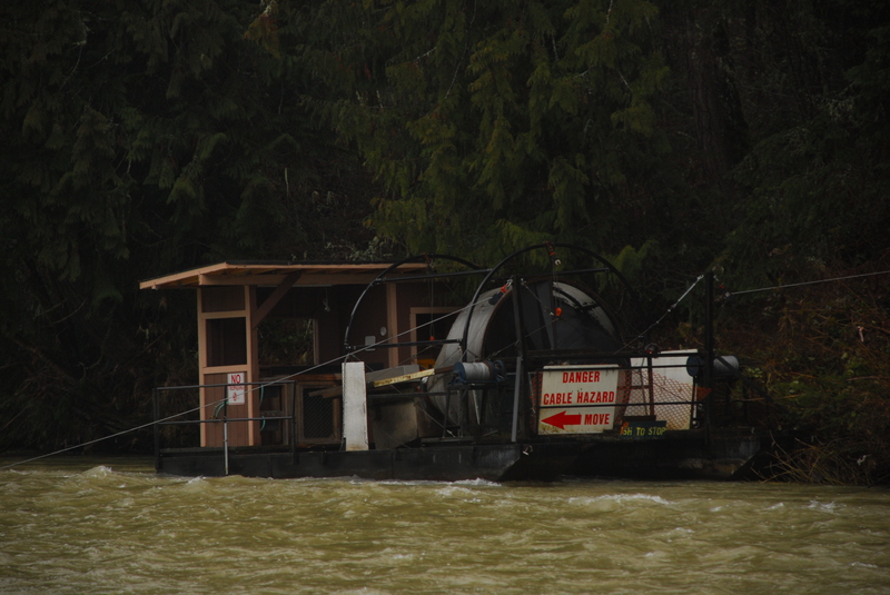
Hazards & Portages (1)
Caution: The following locations may require scouting or portaging. Always check current conditions.
Difficulty
Class II-III
Length
9.3 mi
Rapids
4
1 Hazard
Access Points
Shuttle Info
The put-in for this run is McKenna. The parking area that includes toilets and a boat ramp is just 1/2 block upstream of the Highway 507 Bridge on river right (Highway 507 mile 30.8). To reach the take-out head 2.5 miles west towards Yelm and then head straight onto Highway 510.
The takeout is 2.4 miles northwest of Yelm on Hwy 510 (Highway 510 mile 13.2). Look for the sign for the Centralia City Light Yelm Hydro Project on the northeast side of road which marks the turn onto Powerhouse Road. It will be on the right as you're coming from Yelm. The road wonders down 0.8 mile to a gated parking area with boat ramp and toilet. The gate and parking area closes at 3:30 pm. You can also takeout at the Tank Crossing. It's located another mile or so northwest on Hwy 510. Look for the TANK CROSSING sign and turn right in a northeast direction down to the river.
Difficulty Classes
I Easy
II Novice
III Intermediate
IV Advanced
V Expert/Extreme
VI Unrunnable
Current Conditions
5-Day Forecast
Whitewater data from
American Whitewater
American Whitewater