3. Sang Run Road to Friendsville
Linked via: Proximity 98% confidence Synced 6mo ago
Gauge Conditions
Runnable: 2.9 – 4.0 FT
Data from American Whitewater & USGS
Run Map
Run Time Estimate
Select put-in and take-out to estimate time.
Unlock Advanced Trip Planning
See wind-adjusted speed maps, forecast planning, and detailed time estimates.
Sign in to generate an AI timing estimate for this run.
Whitewater timing varies with scouting, portages, and group pace. Use as a planning baseline.
Description
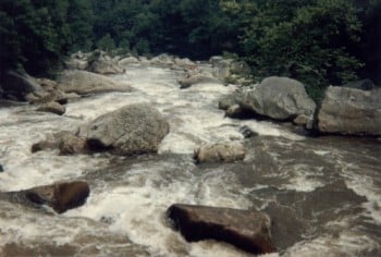
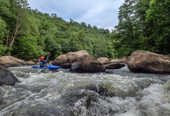
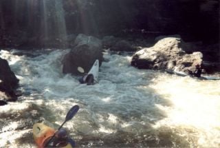
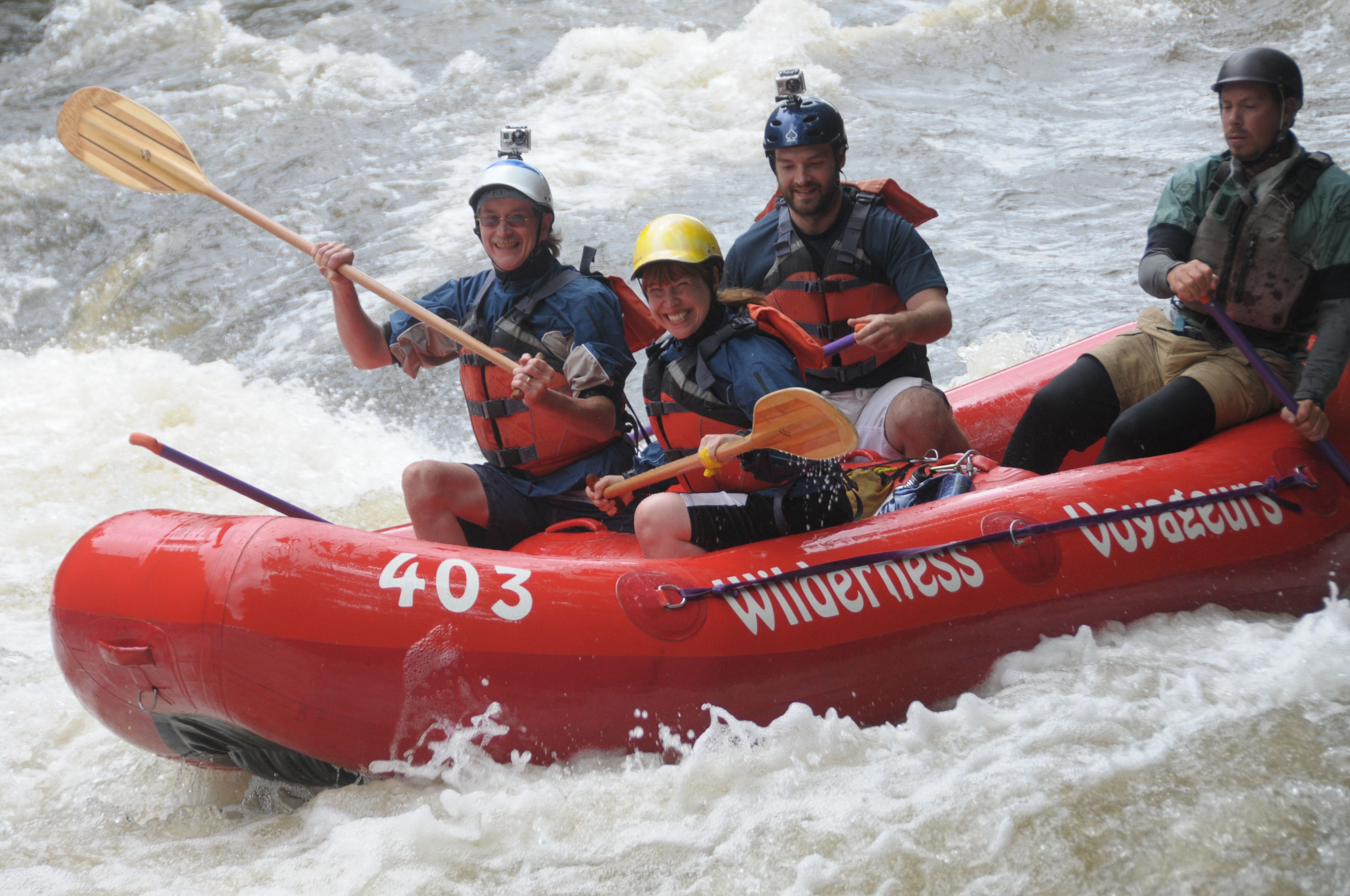
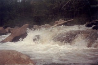
The Upper Yough is a truly exceptional class IV/V river that has attracted the paddlers from around the globe for decades. The river was and remains a hotbed for the development of paddling skills and equipment, and offers some of the most technical commercial rafting you'll find anywhere. Predictable summer releases make this one of the main playgrounds for Eastern Class-IV and Class-V boaters. The rapids are continuous, technical, beautiful, and intoxicating. Most rapids have numerous lines ranging from Class III/IV to solid Class V lines featuring narrow slots, tricky boofs and big holes. The intense crowding brought on by rafters and kayakers during a Saturday release only serves to increase the challenge, and add to the aura connected with this gem of a river.
The trip begins with about two miles of flattish water. If you begin at the start of the release, you're liable to 'outrun the bubble,' i.e., to get ahead of the water. It's fun to head down and wait at Wait Rock. When Wait Rock is getting covered by water, it's a good idea to put your uneaten cookies back into the drybag and get into your boat while you can. (If you would like detailed information about releases, click 'Show More' to read the hidden information!) After a short pool is Gap Falls, which marks the beginning of several miles of consistent named drop-pool rapids. (See the rapids descriptions, below, for more.)
The rapid descriptions given below are for the typical summer release level of 1.9-2.1' (on the Sang Run gauge; Sang Run = Friendsville - 1.25). Some lines will vary at other levels. The reader is of course cautioned that this description is no substitute for judgment, knowing who's leading you down, and etc. (Read the disclaimer!) After all the rapids, it's nothing but three miles of Class-I-II drudgery.
Take out on river left, just downstream of the Maple Street bridge in town, at Wilderness Voyageurs, or under the 68 overpass, and walk past the liquor store to the parking lot. Please don't park on Maple Street, and follow the rules and be quiet and discrete while changing. This great new takeout was created in 2015 by the Town of Friendsville after $25,000 in paddler-donated seed money was raised through an AW and friends fundraiser, and $160,000 in grants were raised by the Town under the leadership of Jess Whittemore.
*(Thanks to John Kobak for many helpful comments and suggestions re. the rapid descriptions.)*
The put-in is at Sang Run (see map), at a public MD State access field. AW continues to manage the Sang Run put-in for the MD-DNR based on a 2001 agreement, thanks to the AWESOME volunteer efforts to keep the site looking great . Your donations at the put-in are vital to our continued access successes on the Upper Yough. Put an amount that you think is fair for your level of use into the brown fee box at the parking lot. If we don't cover our expenses it goes back to the state, and they will be forced to use more coercive methods for getting payment.
Please observe the usual courtesies at both access areas! Don't drink alcohol in public, change clothes where others can see you, or park in residential areas in town. Please take time to patronize the businesses in Friendsville, and be great visitors and neighbors.
Directions: To takeout: from I-68, take the Friendsville Exit (the westernmost exit in MD). If you're coming from the West, bear Left at the fork on the off-ramp, and take a left at the stop sign. Cross under the bridge and take your first right. (If coming from the East, take a right at the end of the off-ramp.) This gets you onto Maple Street. The parking lot is just past the liquor store on the left.
To put-in: Head back out of town back toward I-68. Take a left onto Rte. 42. Continue on 42 about 4-5 miles and take a right onto Bishoff Rd. Head about 2 miles on Bishoff, and at the four-way intersection, head right onto Sang Run Rd. The put-in is a small grassy and gravelly lot on the left. (If you get to the bridge, you've gone too far.) Park and remember to put a couple bills into the till for your good friends at American Whitewater!
Another nice online guide to this section can be found at Gorp.
Upper Yough Release Rules & Flow Timing Guide
-----------------------------------------------------
#### 💧 Release Volume
- Two Tubes (620–700 CFS)\*: Released if natural flow is below 600 CFS at Friendsville gauge.
- One Tube (310–350 CFS)\*: Released if natural flow is between 600 and 1350 CFS.
- No Release:
- If natural flow exceeds 1350 CFS,
- If flow is rising and above 900 CFS, release may be canceled.
***\*Note**:* Tube flow varies slightly depending on lake level—higher lake = faster flow per tube.
#### How to Estimate Total Flow
- Check the current CFS at USGS Gauge #03076500
- Add the expected release volume to the gauge value.
- For more accurate trip planning, use the projected 3 PM flow (but be aware that USGS estimates can be unreliable).
Let's do a calculation on what the Sang Run Bridge Gauge should read once the release hits. We'll go through the calculation below. Remember, this is only a rough calculation.
Given:
- Friendsville Gauge = 150 CFS
- Expected Release (2 tubes) = 640 CFS (We are assuming the lake is within the bands on the Lake Operating Rule Band chart.)
- Estimated Total Flow = 150 + 640 = 790 CFS
Formula:
Estimated Sang Run Gauge Reading = (CFS ^ 0.332) × 0.2417
Step-by-Step Calculation:
1. 790 ^ 0.332 ≈ 9.162
2. 9.162 × 0.2417 ≈ 2.21
Estimated Sang Run Gauge Reading: ~2.21 ft
#### ⏱️ Release Timing: When Will the Water Arrive?
- Release Start Times:
- Spring/Fall: 10:00 AM EDT
- Summer: 11:00 AM EDT
Travel Time of Water from Dam:
- Sang Run Bridge: ~2 hours
- Wait Rock: ~3 hours
- Friendsville (Take-Out):
- 5:00 hours if natural flow ~100 CFS
- 4:15 hours if natural flow ~200 CFS
- 3:30 hours if natural flow ~300 CFS
- 3:00 hours if natural flow ~400 CFS
🚨 Latest Put-In Time at Sang Run (After Release Ends)
- Water starts dropping at the put-in: ~1:15 hours after dam shutoff
- Water leaves put-in: ~1:45 hours after dam shutoff
- If you're at the put-in 2 hours after the release ends, you'll be chasing the bubble the whole way
- 'Lost and Found' rapid: bubble leaves ~3 hours after release ends
- Friendsville take-out: bubble leaves ~4 hours after release ends
#### Lake Level & Release Policy
Check the Lake Level and Schedule page. Look for a graph labeled 'Lake Operating Rule Band'. Use that in reference to the guidelines below.
- Above Upper Rule Line: Guaranteed release
- Within Rule Band: Follow published release schedule
- Below Lower Rule Line: May still do a 2-hour fish flow release, especially if water temps are high
### Other related or nearby streams:
Lower Yough (Class III)
Bear Creek (Class IV)
Top Yough (Class IV-V)
Little Sandy (Class III-IV)
Upper Big Sandy (Class III-IV)
Lower Big Sandy (Class IV-V)
Middle Yough (Class II)
Lat/Longitude coords verified by GPS.
Rapids in this Run (11)
Waterfalls (1)
Hazards & Portages (3)
Caution: The following locations may require scouting or portaging. Always check current conditions.
Difficulty
Class IV-V
Length
9.6 mi
Gradient
52 ft/mi
max 140
Rapids
11
3 Hazards
Access Points
Shuttle Info
Shuttle from Put-in at Sang Run, east along Sang Run Rd to 4-way intersection, turn left on Bishoff Rd to its end at SR42, turn left. Proceed North to a right turn just before I-68, 1/2 mi to stop sign.
You can turn left to parking near Old Mt. Surf or turn right, then left and follow signs to city park.See [**Map**](http://www.keelhauler.org/khcc/upyok.html)
Difficulty Classes
I Easy
II Novice
III Intermediate
IV Advanced
V Expert/Extreme
VI Unrunnable
Current Conditions
5-Day Forecast
Whitewater data from
American Whitewater
American Whitewater