4. Gathright Dam to Covington
Linked via: Proximity 43% confidence Synced 6mo ago
Gauge Conditions
Runnable: 350.0 – 10,000.0 CFS
Data from American Whitewater & USGS
Run Map
Run Time Estimate
Select put-in and take-out to estimate time.
Unlock Advanced Trip Planning
See wind-adjusted speed maps, forecast planning, and detailed time estimates.
Sign in to generate an AI timing estimate for this run.
Whitewater timing varies with scouting, portages, and group pace. Use as a planning baseline.
Description
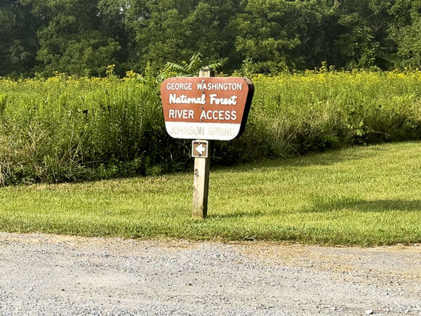
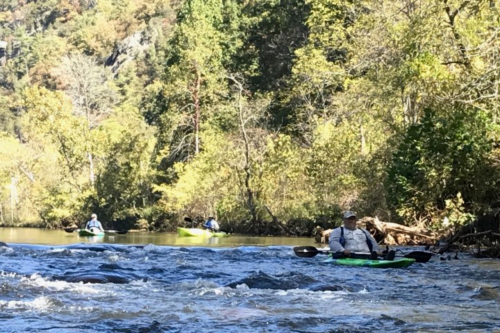
A class I-II run on clear, cold water, with optional II+ or III- rapids immediately below the dam (you can put on above or below them). This river, like some in the Commonwealth, has private property issues, although here related to fishing rather than access. According to the Blueway guide linked below, 'two stretches of river run through private property and are closed to fishing. Please respect private property and do not stop on shore or wade in the river.' However, that's not a problem for most boaters, and the public access points along the river are well developed and relatively frequent.
Typical releases from the dam, around 200-250 cfs, are unfortunately too low for an enjoyable paddle. Approximately once per month on a Wednesday, late spring through early fall, there is a pulse release peaking around 3,500 cfs. See Gathright Dam Releases.
See Also:
Alleghany Highlands Blueway for maps and info.
Alleghany Outdoors outfitters, Intervale Park.
*Classic Virginia Rivers,* Ed Grove (1992 ed), p. 222.
*Virginia Whitewater*, Roger Corbett (2000 ed.), p. 271.
*Exploring Virginia's Waterways*, Ed Gertler (2022 ed.), p. 195.
Difficulty
Class I-II
Length
17.0 mi
Gradient
9 ft/mi
Rapids
4
Access Points
Difficulty Classes
I Easy
II Novice
III Intermediate
IV Advanced
V Expert/Extreme
VI Unrunnable
Current Conditions
5-Day Forecast
Whitewater data from
American Whitewater
American Whitewater