4) Hwy 16 to Arkansas 59 Near Siloam Springs (5.1 miles)
Linked via: Proximity 97% confidence Synced 6mo ago
Gauge Conditions
Runnable: 2.5 – 6.0 FT
Data from American Whitewater & USGS
Run Map
Run Time Estimate
Select put-in and take-out to estimate time.
Unlock Advanced Trip Planning
See wind-adjusted speed maps, forecast planning, and detailed time estimates.
Sign in to generate an AI timing estimate for this run.
Whitewater timing varies with scouting, portages, and group pace. Use as a planning baseline.
Description
Nice slow class I float with an occasional Class II riffle. Many places to access although it flows through private land for much of the way.
Do not confuse the takeout with Oklahoma Hwy 59 as it will make the trip much much longer through the remnants of Lake Francis!
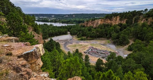
About halfway, the creek crosses under Fisher Ford Road and drops over a bedrock shoal known as 'Fisher Ford'. In 2014, enhancements are being completed to create the city ofSiloam Springs Whitewater Recreational Park. This is a nice class II playspot that offers something to surf at most flows, even in the summer.
Can be combined with upstream sections for longer trips.
Playspots (1)
Difficulty
Class I-II
Length
5.3 mi
Gradient
3 ft/mi
max 5
Rapids
0
Access Points
Difficulty Classes
I Easy
II Novice
III Intermediate
IV Advanced
V Expert/Extreme
VI Unrunnable
Current Conditions
5-Day Forecast
Whitewater data from
American Whitewater
American Whitewater