4. Llano to FM 3404 (below Llano) (19 miles)
Linked via: Proximity 96% confidence Synced 6mo ago
Gauge Conditions
Runnable: 2,000.0 – 50,000.0 CFS
Upper limit on best flows for this reach unknown. Please contribute a comment or report.
Data from American Whitewater & USGS
Run Map
Run Time Estimate
Select put-in and take-out to estimate time.
Unlock Advanced Trip Planning
See wind-adjusted speed maps, forecast planning, and detailed time estimates.
Sign in to generate an AI timing estimate for this run.
Whitewater timing varies with scouting, portages, and group pace. Use as a planning baseline.
Description
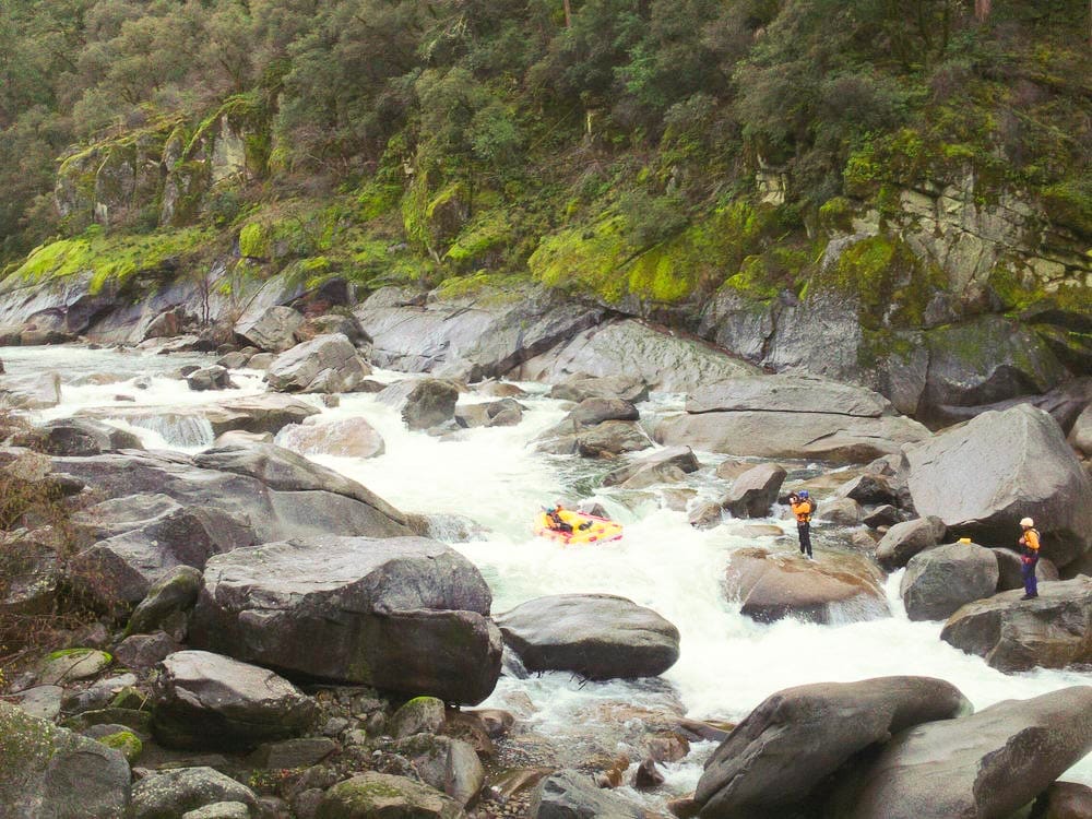
Pink granite is a sight not often seen in Texas, which is why the rivers and creeks that cut through the Llano Uplift, a granite vein running roughly from Fredericksburg to Burnet, are a rare prize. The Llano, in particular, is a very wide river, but because granite doesn't erode as quickly as limestone, some of the rapids on it are surprisingly technical. Above 10,000 cfs, the river starts to behave like a big water run, generating some Grand Canyon-sized features.
Since whitewater paddlers most often put in at Long's Fish Camp to run the falls, beta is needed on the stretch above this. Difficulty rating for that stretch is taken from Texas Whitewater. Distances and gradient measured using GIS tools in 2015. Maximum gradient is 30 fpm, measured from Don's Fish Camp to the base of Long Falls (0.5 miles.)
This drone footage shows The Slab, Eagle Rock, and Long Falls at thousands of cfs (exact level unknown, but probably between 3000-7000 cfs, based on the gauge readings on the day it was shot.)
For scale, the river is well over 100 yards wide at Eagle Rock.
Rapids in this Run (2)
Playspots (1)
Difficulty
Class II-III(IV)
Length
19.6 mi
Gradient
7 ft/mi
max 30
Rapids
2
Access Points
Difficulty Classes
I Easy
II Novice
III Intermediate
IV Advanced
V Expert/Extreme
VI Unrunnable
Current Conditions
5-Day Forecast
Whitewater data from
American Whitewater
American Whitewater