4. Obed Junction to Nemo Wild
Linked via: Proximity 95% confidence Synced 6mo ago
Gauge Conditions
Runnable: 1,000.0 – 8,000.0 CFS
Data from American Whitewater & USGS
Run Map
Put-in
Take-out
Rapids/Hazards
Wild
Scenic
Run Time Estimate
Select put-in and take-out to estimate time.
Unlock Advanced Trip Planning
See wind-adjusted speed maps, forecast planning, and detailed time estimates.
Sign in to generate an AI timing estimate for this run.
Whitewater timing varies with scouting, portages, and group pace. Use as a planning baseline.
Description
Read carefully-- what follows is a varied mix of three options to run approximately 10 miles of the Obed River canyon. Option 'A' is the one that correlates with the actual AWA description of this section: Obed Junction to Nemo. The other two options are probably listed here because most east Tennessee paddlers do not fancy the half mile hike from parking area to the Obed River and more often choose option 'B' or 'C' as a rule. It bears repeating that you cannot drive to Obed Junction; you can only hike/portage. The half mile trail is an old jeep road that is relatively well-maintained, is wide enough for a party of 4 to carry an inflated 6-person raft using its chicken lines and the hike includes a bridge over a small creek.
In March 2022 the park service improved the parking area for the Obed Junction Trail off of Potters Chapel Road. The trail is still a half mile in length; they did not shorten it.
CHOICES:
You have options for put-ins depending on how long a trip and what type of run you're looking for:
A) Hike half mile down to Obed Junction listed put-in for this run and you will get 10 miles of the incredible Obed River Canyon down to Nemo Bridge takeout.
B) Run Daddy's Creek from Devils Breakfast Table access area (NOTE: the road to reach DBT is sometimes closed with a locked gate depending on the posture of the Catoosa Wildlife Management Area). This makes for a 12 mile run as you get 2 miles or so on Daddy's Creek. Your takeout is still at Nemo Bridge.
C) Run Clear Creek to its confluence with the Obed and then down to Nemo takeout. You entirely skip the rapids listed below because via Clear Creek you enter the main Obed below each of them. A good argument could be made to remove option 'C' entirely from this description to keep it simple.
Logistics: To reach the take-out from the town of Wartburg (where there is a National Park visitor center), follow the signs to the Nemo Access from Old Highway 27. Head out the southwest corner of town and continue 6.0 miles to the river. A day-use area with ample parking, changing area, and picnic tables can be found upstream river left of the old Nemo Bridge. This makes a great meeting point, has above average pit toilets, and in any event Nemo Bridge is the center of gravity for many creek runs in the area.
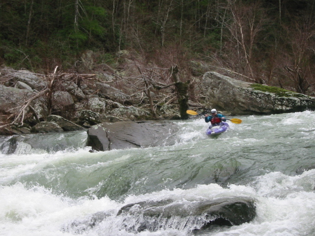
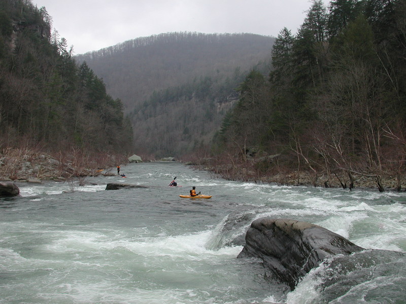
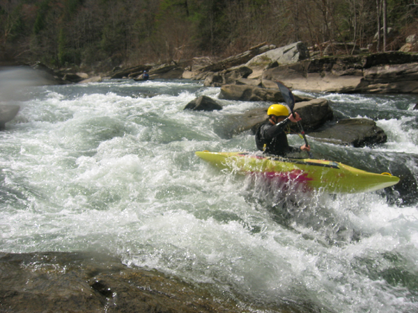
From Obed Junction (which is at the confluence with Daddy's Creek), the river contains class II/III rock gardens until you reach a one mile class III/IV section containing Ninety Right-Ninety Left, OhMyGod!, Rockgarden (be aware of the dangerous spot that exists on the right in this rapid), and Submarine Falls.
Soon after these drops, Clear Creek enters from the left. You will encounter four more class III rapids (separated by calm stretches of river), the last two of which are known as Keep Right and Widowmaker.
After the confluence with the Emory River it is just a mile downstream to the take-out at Nemo Bridge.
A check of the National Park Service website for Obed Wild & Scenic River will be time well spent. A phone call to the ranger Visitor Center, in Wartburg, is an even better use of your time if you want to clarify any concerns about shuttle drives, parking areas, locked gates and so forth.
https://www.nps.gov/obed/index.htm
Rapids in this Run (10)
Hazards & Portages (1)
Caution: The following locations may require scouting or portaging. Always check current conditions.
Difficulty
Class II-IV
Length
9.8 mi
Gradient
30 ft/mi
Rapids
10
1 Hazard
Access Points
Shuttle Info
Here's the official [Obed Wild & Scenic River Map](http://www.nps.gov/obed/planyourvisit/upload/OBEDmap1.pdf) with all the putins and takeouts.
Difficulty Classes
I Easy
II Novice
III Intermediate
IV Advanced
V Expert/Extreme
VI Unrunnable
Current Conditions
5-Day Forecast
Whitewater data from
American Whitewater
American Whitewater