4) Poe Dam to Poe Powerhouse
Linked via: Proximity 97% confidence Synced 6mo ago
Gauge Conditions
Runnable: ? – ? CFS
Approximate reading: This gauge is 20.3 miles away on Feather. Use as a general reference only.
Data from American Whitewater & USGS
CDEC Flow Data California
Data from California Data Exchange Center (CDEC)
Run Map
Run Time Estimate
Select put-in and take-out to estimate time.
Unlock Advanced Trip Planning
See wind-adjusted speed maps, forecast planning, and detailed time estimates.
Sign in to generate an AI timing estimate for this run.
Whitewater timing varies with scouting, portages, and group pace. Use as a planning baseline.
Description
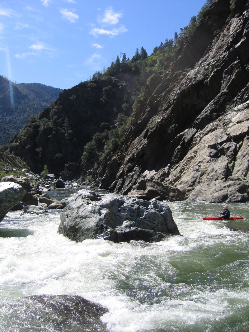
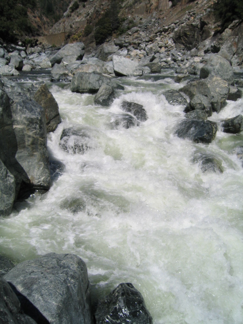
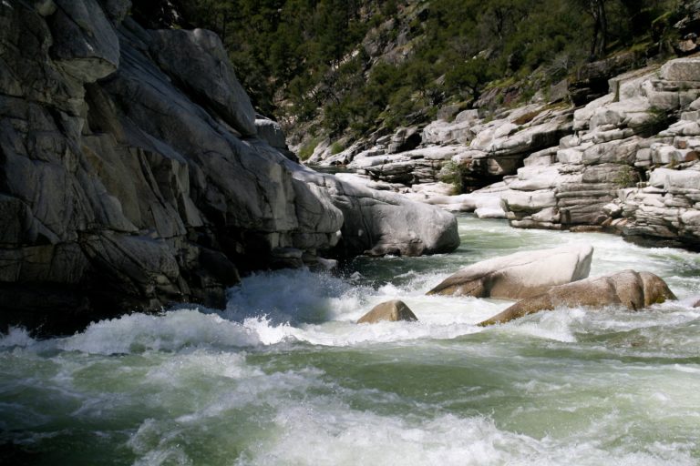
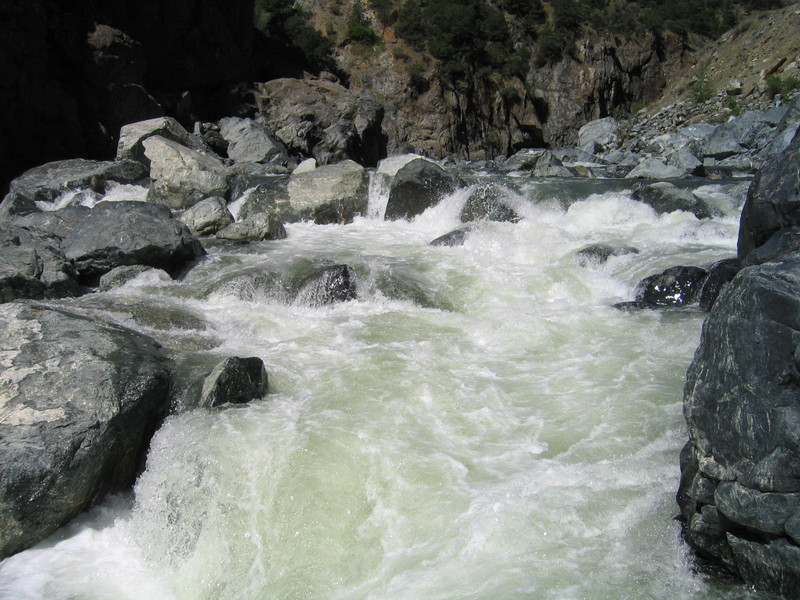
The Poe Run is the lowermost run on the North Fork Feather above the high water mark of Lake Oroville. This seven-mile-long reach comnprises two distinctly different reaches: Poe Canyon and Bardees Bar. The first four miles (the Poe Canyon) are continuous class IV/V and the second four miles (Bardees Bar) are class III/IV. Fortunately there is an access road at the mid-point at Bardees Bar where the character of the run changes. This enables padders to do the just the class V reach or the lower class III/IV reach, or both.
Put-in: On Highway 70, look for a location called Sandy Beach. It is about a half-mile downstream of the Poe Dam and just downstream from a Caltrans station.
Bardees Bar access: There are two ways to get to Bardees Bar. Take the turn out off Highway 70 where the power lines cross the highway for the quickest route. Take the dirt road to the right. This road is quite steep in places, so high clearance 4-wheel drive vehicle is recommended. Driving time is about 15 minutes. This road should not be used if there has been much rain. Regular autos should take the Big Bend Road to Bardees Bar Road. Figure about 40 minutes driving time on this route.
Take-out: From Highway 70, take the Big Bend turn off. Follow Big Bend Road until you see Bardees Bar Road on the right. This gravel road will lead to the Poe Powerhouse in about 4.3 miles. At 1.3 miles, there is a hairpin turn in the road, here Bardees Bar Road leaves to the left to go to Bardees Bar. Stay right to go to the powerhouse. After you leave your shuttle vehicle at the Poe Powerhouse, you can stay on Bardees Bar Road all the way to the Bardees Bar put-in.
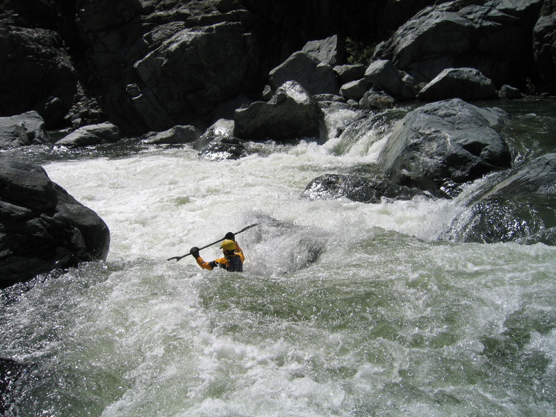
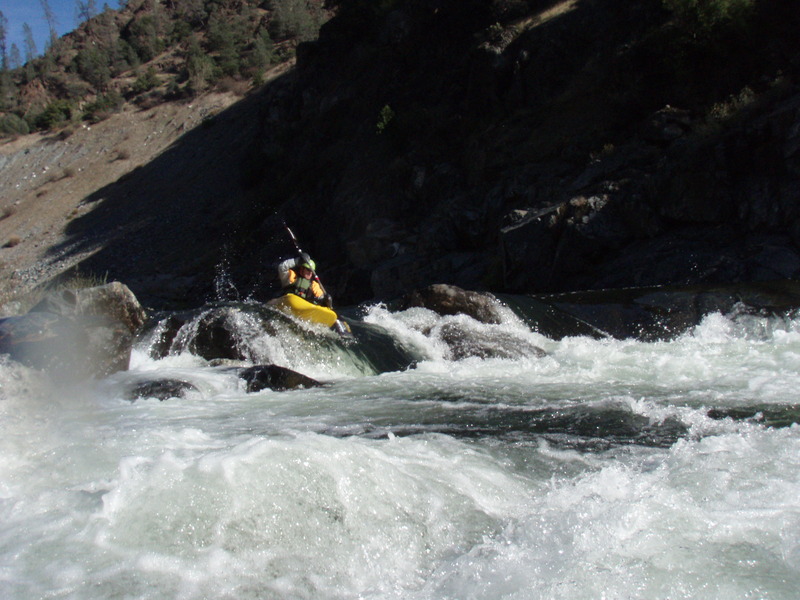
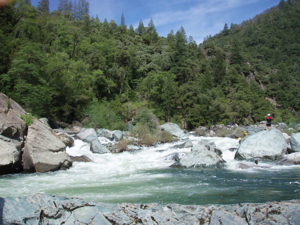
Poe Canyon Run
The run starts out with a few easy warm-up rapids before the Highway 70 bridge. After the bridge things pick up quickly. After several class IV rapids a class V+ rapid that was dubbed Four Doors during the flow study. While this rapid is potentially runnable, no one during the flow study ran this rapid in its entirety. Most used the portage route on the left side, which requires some technical rock climbing. Immediately below the Four Doors is a short rapid with a sticky hole at the bottom. Named Sticky Wicket, this was the site of several extended surfs during the flow study. Next up is a long rapid named Toboggan. This rapid became substantially harder at flow levels above 500 cfs. A number of fun class IV rapids occur over the next mile. Patchin's Passion, the only named rapid in the classic Holbeck/Stanley guidebook, is an impressive 12-15 foot drop that is difficult to come out of right side up. There is one more long class IV+ rapid before you reach Bardees Bar.
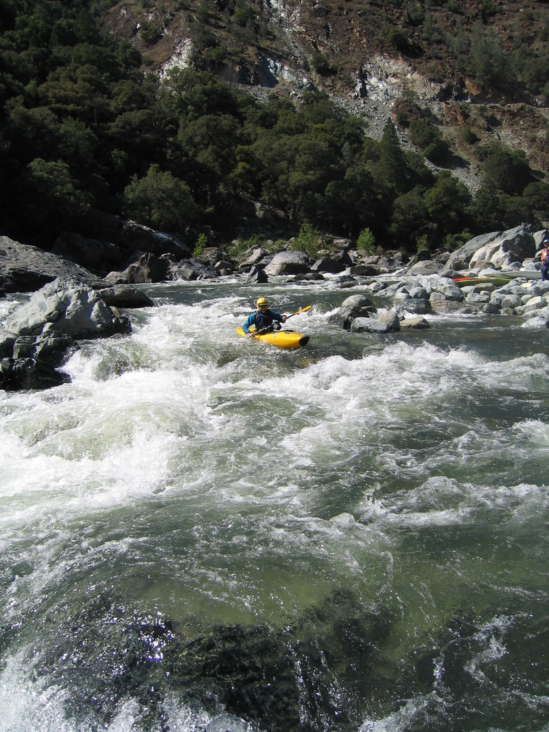
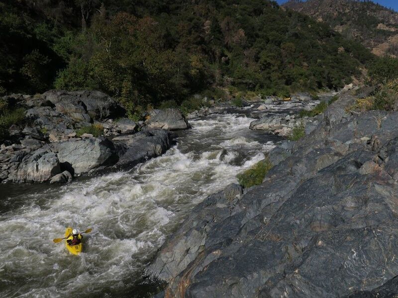
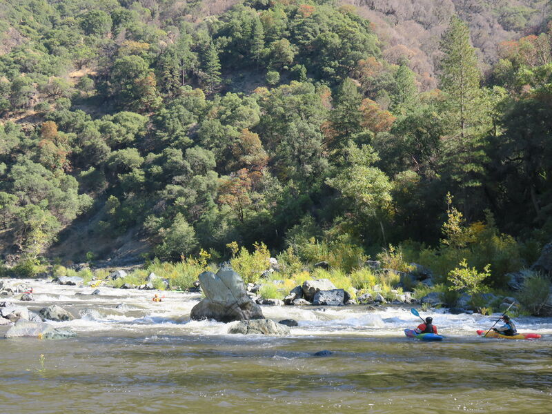
Bardees Bar Run
Below Bardees Bar, the river mellows considerably and flows through a delightful part of the North Fork Feather Canyon that is away from Highway 70. This section contains several class III+ rapids. The class IV rapid that begins immediately below the put-in can be a little junky at low flows. Several long class III + rapids follow with one IV- that is just above the bridge leading to the Poe Powerhouse. Bald eagles are regulars to this reach, so be sure to look up while padding this section of river. American Whitewater has been leading an effort to develop a hiking trail along the river right in this section, and PG&E is required by their Poe Hydroelectric Project federal license to construct the trail.
Cresta is the next run upstream.
Big Bend is the next run downstream. Big Bend is in the Oroville Lake bottoms and is only available when the reservoir is very low.
Other Information Sources:
A GUIDE TO THE BEST WHITEWATER IN THE STATE OF CALIFORNIA, HOLBEK & STANLEY, 1988
Rapids in this Run (8)
Waterfalls (1)
Hazards & Portages (1)
Caution: The following locations may require scouting or portaging. Always check current conditions.
Difficulty
Class IV-V
Length
7.2 mi
Gradient
70 ft/mi
max 120
Rapids
8
1 Hazard
Access Points
Difficulty Classes
I Easy
II Novice
III Intermediate
IV Advanced
V Expert/Extreme
VI Unrunnable
Current Conditions
5-Day Forecast
Whitewater data from
American Whitewater
American Whitewater