6. Lower
Linked via: Proximity 70% confidence Synced 6mo ago
Gauge Conditions
Runnable: 1.1 – 7.0 FT
Arguably most difficult at 4-5'. Above 5', things begin to wash out, though there are some BIG holes and waves.
Data from American Whitewater & USGS
Run Map
Run Time Estimate
Select put-in and take-out to estimate time.
Unlock Advanced Trip Planning
See wind-adjusted speed maps, forecast planning, and detailed time estimates.
Sign in to generate an AI timing estimate for this run.
Whitewater timing varies with scouting, portages, and group pace. Use as a planning baseline.
Description
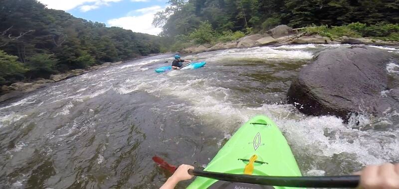
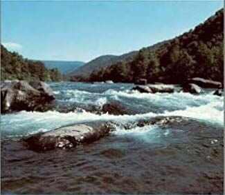
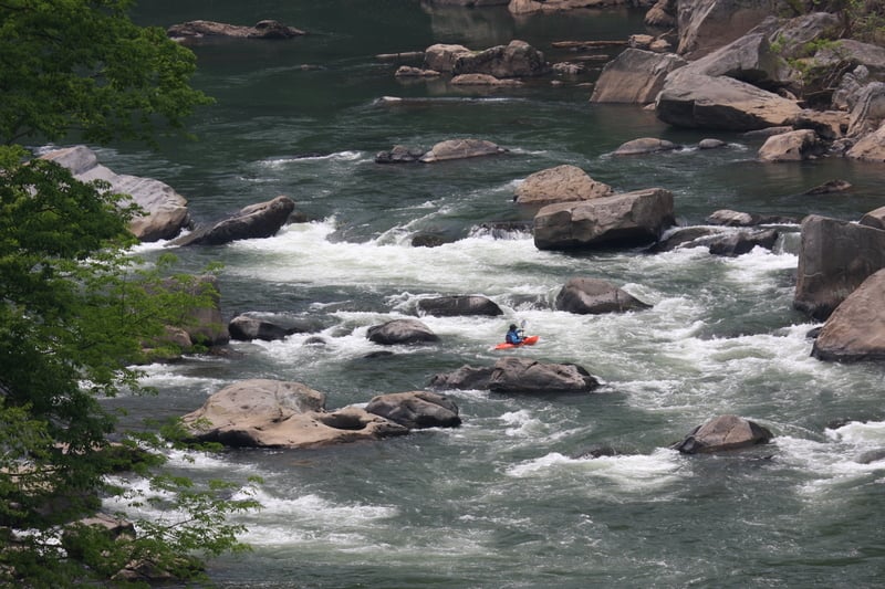
The Lower Youghiogheny River, or simply the *Lower Yough*, is one of the most popular and dependable whitewater runs in the eastern United States. Flowing through the steep sandstone gorge of Ohiopyle State Park in southwestern Pennsylvania, this seven-and-a-half-mile reach begins just below Ohiopyle Falls and winds downstream to the take-out at Bruner Run. The river’s consistent dam-regulated flows, moderate gradient, and beautiful scenery make it a year-round favorite. With several class III rapids punctuated by deep pools and technical boulder gardens, the Lower Yough offers an ideal blend of excitement, accessibility, and natural beauty.
From the moment paddlers launch below the thundering drop of Ohiopyle Falls, the river sets a lively tone. The water is clear and cold, coursing between forested cliffs and massive sandstone boulders that give this gorge its rugged character. Just below the put-in Entrance Rapid offers excellent warm-up opportunities, with friendly waves and plenty of eddies to practice ferrying and maneuvering. As the river sweeps around the famous horseshoe bend known locally as *the Loop*, the whitewater becomes more continuous with Cucumber and a sequence of half a dozen fun rapids down to the High Bridge. This upper mile of the run provides a compact and thrilling experience where paddlers can put in and take out almost at the same point—a perfect option for first-timers wanting to sample the Lower Yough without committing to the full run or anyone looking for a short whitewater fix with easy logistics.
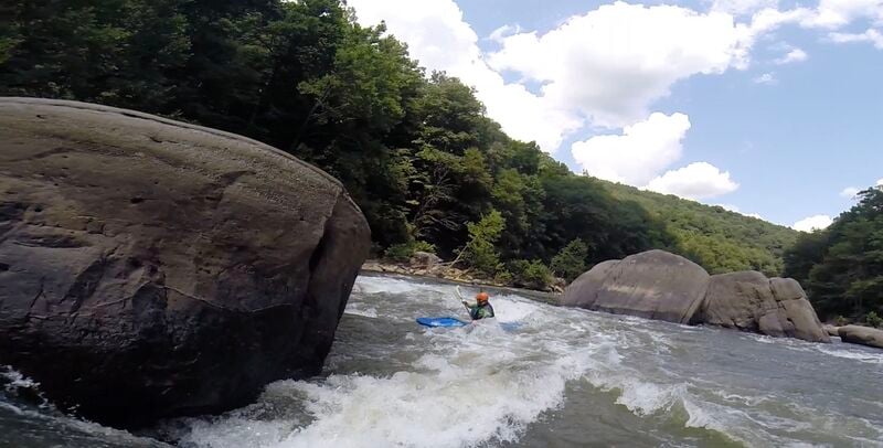
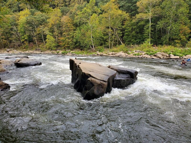
Below the Loop, the river continues through a scenic stretch and the sense of wilderness deepens as the river leaves the bustle of Ohiopyle behind. The corridor is steep and wooded, with rocky cliffs rising from both banks and the sound of whitewater echoing through the gorge. The pace is relatively mild until you reach Dimple Rock where the pace quickens and paddlers need to exercise precise boat control to avoid the hazard of Dimple Rock that has a dangerous sieve. While the Lower Yough is considered manageable for intermediate paddlers, the river’s bouldery character and occasional undercut rocks, particularly Dimple Rock, demand attention. Even experienced boaters respect its power and ever-changing lines, especially at higher flows when the difficulty edges toward Class IV.
For most paddlers, the trip concludes at Bruner Run, the standard take-out where the gorge opens slightly and the current begins to relax. By this point, the river has dropped roughly 25 feet per mile through the gorge, delivering a satisfying day of technical whitewater framed by laurel thickets, hemlock groves, and views of the Laurel Highlands. The experience is both social and scenic—on summer weekends, the river fills with colorful rafts and kayaks, yet the grandeur of the gorge still dominates.
While the Lower Yough’s character is defined by its steady gradient and bouldery rapids, its accessibility owes much to the careful management of Ohiopyle State Park. Boaters are required to sign in and obtain a launch permit at the put-in, and all paddlers must wear helmets and Coast Guard–approved life jackets. The put-in is located just below Ohiopyle Falls in town on the downstream lower level of the park office, and the park maintains clear procedures for launch tokens, shuttle logistics, and required safety gear. Many first-time visitors choose to go with a local outfitter, which provides boats, gear, guides, and shuttle service. Water levels are regulated by dam releases upstream, but conditions vary with rainfall, so checking current gauge data before launching is essential which is easy to do at the staff gage located at the put-in.
For newcomers, the best introduction is often a half-day trip on the Loop—a one-mile section that captures the essence of the Lower Yough’s rapids while keeping logistics simple. It’s also a great choice for those looking for a quick run. Those continuing downstream to Bruner Run should plan ahead for shuttle arrangements and anticipate a full day on the river. Running parallel to much of the gorge is the Great Allegheny Passage, a 150-mile rail trail that forms part of the longer route connecting Pittsburgh and Washington, D.C. The six-mile stretch between Ohiopyle and Bruner Run provides a convenient bike-shuttle option, allowing paddlers to return to town under their own power while taking in another perspective of the river. Weekends can be busy, but with good timing, proper equipment, and a healthy respect for the gorge, the Lower Yough delivers one of the finest Class III whitewater experiences in the country—an engaging mix of continuous rapids, technical maneuvering, and Appalachian mountain scenery that continues to inspire paddlers season after season.
Rapids in this Run (18)
Rapid
III
Entrance Rapid
Rapid
III
Cucumber
Rapid
I
Piddly
 Rapid
II+
Rapid
II+
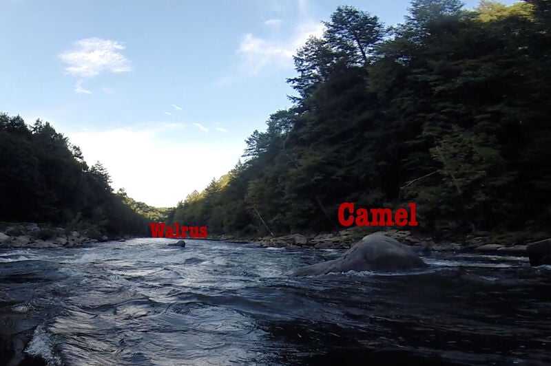
Camel and Walrus
Rapid
II+
Eddy Turn
Rapid
II+
Dartmouth
Rapid
Loop Takeout Trail
Rapid
II
Lower Railroad
 Rapid
II
Rapid
II
Three Sisters
Rapid
III
Swimmers
Rapid
II+
Bottle of Wine
Rapid
III
Double Hydraulic
 Rapid
III+
Rapid
III+
River's End
Rapid
II+
Schoolhouse Rock
 Rapid
II+
Rapid
II+
Stairstep
Rapid
Stewarton
Rapid
II+
Maze
Rapid
II+
Bruner Run
Playspots (1)
Hazards & Portages (1)
Caution: The following locations may require scouting or portaging. Always check current conditions.
Difficulty
Class III
Length
7.2 mi
Gradient
25 ft/mi
max 45
Rapids
18
1 Hazard
Access Points
Shuttle Info
**Directions to Ohiopyle:**
From the PA Turnpike (I-76):
Take Exit 9 (Donegal). Go left at the end of the off-ramp.
A couple of miles down the road, turn Right onto Rt. 381. Continue for several miles until you reach the T intersection.
Go left at the T intersection, staying on Rt. 381. Continue for several miles.
After crossing the railroad and the river, you're in Ohiopyle. Turn left up the hill and park.
From Washington, DC:
Take I-270 to I-70 West.
In Hancock, take I-68 West toward WV.
In Keysers Ridge (near the Savage River), take US 219 North, and after about a mile, take US 40 West.
After about 20 miles, in Farmington, bang a Right onto PA 381. After about 4 miles, you're in Ohiopyle, ready to change and shuttle!
(Shortcut: on Rte. 40, turn right on DinnerBell-Ohiopyle Road shortly after Glissan's Restaurant, at the Priestly Ridge School sign. Dinner Bell Road will take you right into 381 North.)
Difficulty Classes
I Easy
II Novice
III Intermediate
IV Advanced
V Expert/Extreme
VI Unrunnable
Current Conditions
5-Day Forecast
Whitewater data from
American Whitewater
American Whitewater