7. Ausable Chasm to US Route 9
Linked via: Proximity 94% confidence Synced 6mo ago
Gauge Conditions
Runnable: 240.0 – 1,400.0 CFS
Based on 2005 Flow Study.
Data from American Whitewater & USGS
Run Map
Run Time Estimate
Select put-in and take-out to estimate time.
Unlock Advanced Trip Planning
See wind-adjusted speed maps, forecast planning, and detailed time estimates.
Sign in to generate an AI timing estimate for this run.
Whitewater timing varies with scouting, portages, and group pace. Use as a planning baseline.
Description
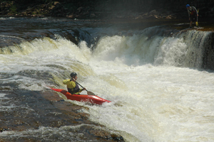
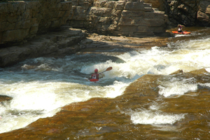
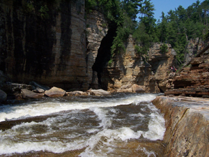
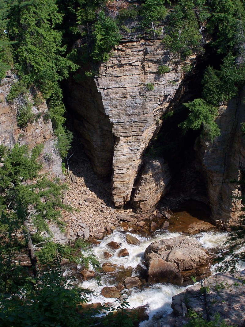
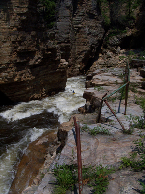
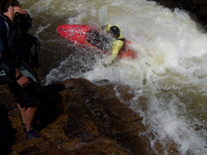
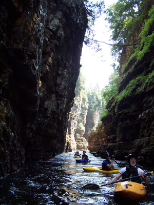
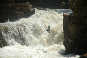
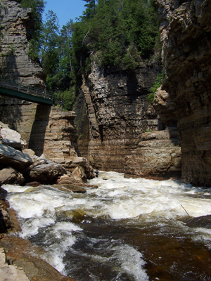
The Ausable Chasm is a committing Class IV/IV+ river in a vertical walled canyon. Paddling high quality rapids through an east coast slot canyon provides an extraordinary and unique experience for advanced whitewater paddlers. The river offers 6 to 8 high quality class IV rapids ranging from vertical ledges to long slides, to rapids laced with waves and holes. After paddling the Chasm, paddlers must paddle out over a couple miles of swiftly moving but shallow flatwater. Suitable natural flows are common throughout the year, including summer and fall, which is a regional rarity. The river can be run quite low. 3
Wood and metal debris are present in the Chasm, and metal debris has specifically been noted above and immediately below Mike's Hole. The debris pose the largest threat to paddlers in the Chasm, and shifts regularly between seasons from ice action.
NOTE: In 2017 a house-sized rock fell from the wall into the water upstream of Mikes Hole. It has had little effect on the run at regular flows but at 1000+ cfs Mikes hole has become a river wide keeper hole where before it flushed on the left.
Federal regulators allow the power company to close their access area to prevent river access between halloween and memorial day weeked, so the Chasm is open June-October. The Ausable Chasm Company provides hiking, viewing, and scouting opportunities on numerous decks and walkways in the gorge (for a fee). Once on the river, scout and portage only below the high water mark to avoid trespassing on Ausable Chasm Company lands. Do not park in the bar's parking lot at the put in - stick to the provided spaces or park legally elsewhere. There is a public lot near the bridge that you can park in after dropping off your gear. Please recognize that we are new visitors to the area, so respectful behavior is critical.
Historically the power company blocked all public access. American Whitewater negotiated a whitewater flow study and led advocacy for public access After several years and letter-writing campaigns, paddlers gained legal access to Ausable Chasm in 2010!
See also
Ausable River to Open June 18, 2010!, June 14, 2010
New York Area Boaters Get an Early Christmas Gift!, December 23, 2004
Yankee Ingenuity Alive and Well in Upper New York State, November 12, 2001;
Paddlers' Alert--Ausable River, February 14, 2002;
2002 Top 10 Conservation and Access Issues, November 14, 2002;
AW in the NorthEast, 2004;
River Stewardship Issues for 2004, October 7, 2004;
Comments on the Ausable, April 28, 2004; and
Ausable Chasm Open Flow Study Planned, May 31, 2005.
Lat/longitude coords are approximate, from TopoZone.
Plattsburgh Area Reaches
Ausable (Ausable Chasm) Ausable, E. Branch
Ausable, W. Branch (4. High Falls Gorge) Ausable, W. Branch (5. The Flume)
Ausable, W. Branch (Section 6) Black Brook
Boquet, S. BranchBoquet, N. Branch
Chateaugay Great Chazy (Chazy Lake to Miner Lake)
Great Chazy (Miner Lake to Mooers) Great Chazy, North Branch
Little Black Brook Little Trout
MarbleSalmon
Salmon (Lake Champlain) Saranac (Permanent Rapids)
Saranac (1. Union Falls to Silver Lake Road) Saranac (2. Silver Lake Road to Redford)
Saranac (3. High Falls Gorge) Saranac (Sec. 4)
Styles Brook
Google Map of New York Whitewater
New York Whitewater Paddlers Facebook Group
Rapids in this Run (8)
Hazards & Portages (2)
Caution: The following locations may require scouting or portaging. Always check current conditions.
Difficulty
Class IV+
Length
3.3 mi
Rapids
8
2 Hazards
Access Points
Difficulty Classes
I Easy
II Novice
III Intermediate
IV Advanced
V Expert/Extreme
VI Unrunnable
Current Conditions
5-Day Forecast
Whitewater data from
American Whitewater
American Whitewater