A) Carney Rapids/Old County A to Four Foot Falls (0.4 miles)
Linked via: Nhdplus discovery 90% confidence Synced 6mo ago
Gauge Conditions
Runnable: ? – ? CFS
Approximate reading: This gauge is 11.7 miles away on Pike. Use as a general reference only.
Data from American Whitewater & USGS
Run Map
Run Time Estimate
Select put-in and take-out to estimate time.
Unlock Advanced Trip Planning
See wind-adjusted speed maps, forecast planning, and detailed time estimates.
Sign in to generate an AI timing estimate for this run.
Whitewater timing varies with scouting, portages, and group pace. Use as a planning baseline.
Description
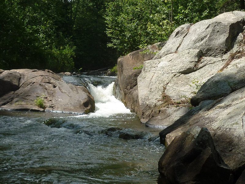
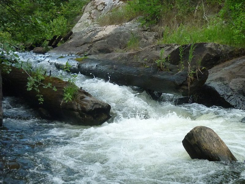
At Old County A, Carney Rapids drops into a mini-gorge (right under the road bridge) which would be a sweet, straight-forward drop, except ...
There are huge timbers (embedded in the rock flanking the drop) which have huge spikes sticking out of them. Additionally, there is a large log in the pool at the base of the drop, angled diagonally up toward the drop, ready to hammer anyone / anything coming down the drop. Unless you have done a recent low-water scout, or otherwise have confirmation that these things have changed, this makes this a highly recommended portage (I.E., have a look, but plan to put in below it).
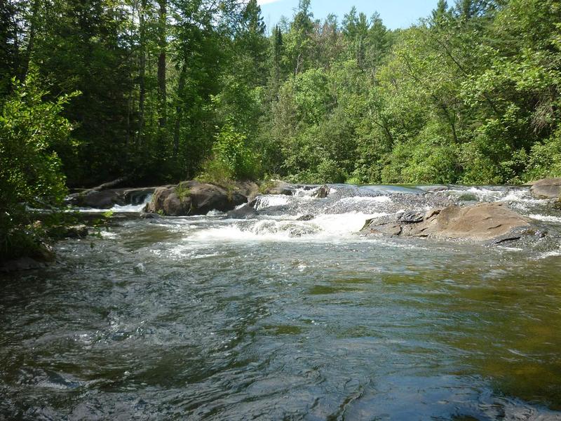
About one-third of a mile (of flat/flowing water with intermixed easy rapids) leads a to another interesting drop, Four-Foot Falls. A 1.5-2.0' ledge is a straight-forward run right or center, or a twisting run river left toward center. Almost immediately beyond this ledge is a weird slot against the left wall. At low water, all the flow drops about 2.5' into this slightly more than boat-width slot. At higher flows, another path down a somewhat more inviting ledge/falls would be available on river right.
For what it's worth . . . upstream of here, I have paddled (approximately 2 miles) from CCC Camp Road down to Old County A. It is a fine northwoods float, but holds no real whitewater. I have also paddled (the ~4.3 miles) from 4' Falls down to the "Four Falls" put-in, and the river consists of easy shoals, flat water, and snags, with little gradient and extraordinarily little interest for whitewater paddlers (Incidently, same is true for all unlisted 'intervening' stretches of the Pike and both it's branches. I have not paddled upstream of the uppermost listed reaches, but have paddled all 'intervening' stretches, and cannot recommend as a whitewater trip anything other than what has been listed.)
Waterfalls (1)
Playspots (1)
Hazards & Portages (1)
Caution: The following locations may require scouting or portaging. Always check current conditions.
Difficulty
Class III
Length
0.3 mi
Rapids
0
1 Hazard
Access Points
Shuttle Info
This short stretch (if/when anyone bothers to do it) will most likely be a 'park and play' or 'park and huck', with the 'shuttle' being carrying up on foot. Therefore, ignore the shuttle directions below, but use the text-entry box to input your home (or other starting location) address or lat/lng coordinates to get drive time, distance, and directions to this location.
Difficulty Classes
I Easy
II Novice
III Intermediate
IV Advanced
V Expert/Extreme
VI Unrunnable
Current Conditions
5-Day Forecast
Whitewater data from
American Whitewater
American Whitewater