A) Mineral Lake to Mineral Lake Rd (0.5 mile)
Linked via: Proximity 88% confidence Synced 6mo ago
Gauge Conditions
Runnable: ? – ? CFS
Approximate reading: This gauge is 0.6 miles away on Brunsweiler. Use as a general reference only.
Data from American Whitewater & USGS
Run Map
Run Time Estimate
Select put-in and take-out to estimate time.
Unlock Advanced Trip Planning
See wind-adjusted speed maps, forecast planning, and detailed time estimates.
Sign in to generate an AI timing estimate for this run.
Whitewater timing varies with scouting, portages, and group pace. Use as a planning baseline.
Description
This is a short section of nice water that is almost never run (Heck, even the upper and lower section are tough to catch 'up'.) It can be used as an alternate put in for the Upper Brunsweiler (Beaver Dam lake to Spring Brook Road). The down side is that there is 2 miles of flat water between the two sections.
Put in on FR 1412, an access road to Mineral Lake. Be sure to park well off to the side of the road at the put in so large vehicles can get by very easily. Alternately (if there is not sufficient room for parking and passage), you could drop your boats off then head back toMineral Lake Road to park and walk back to your boats to put in. This is a courtesy to the homeowner at the end of FR 1412 since it is a dead end road.
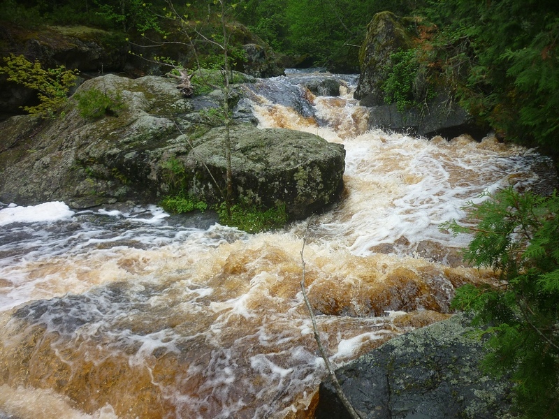
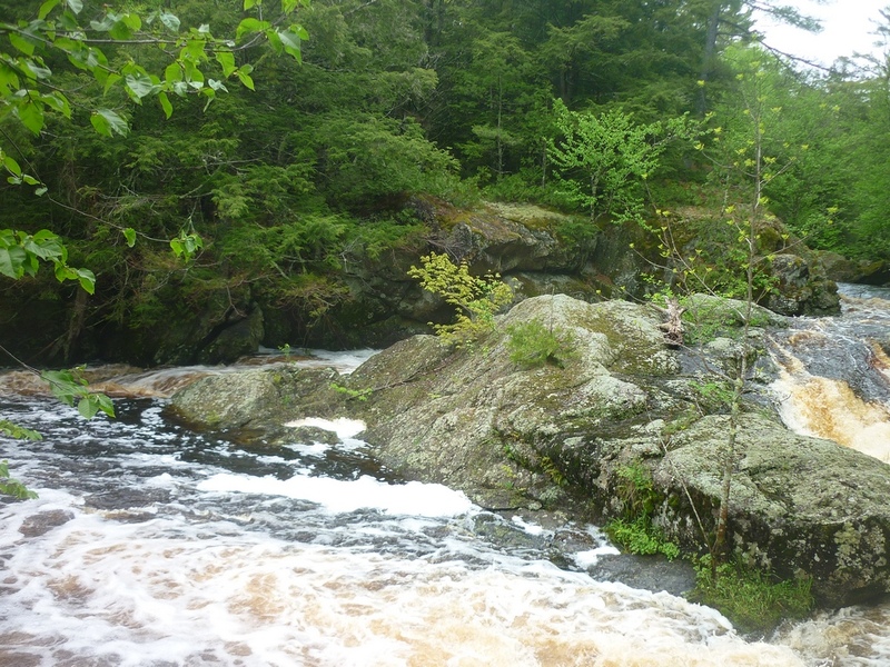
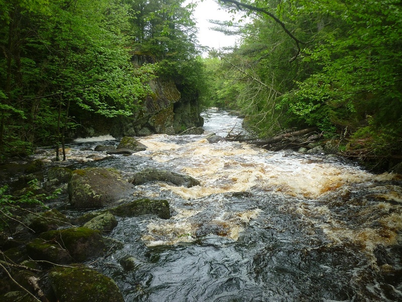
Paddle across to the Northwest end of the lake and begin your ride. The river begins with a bang right out of the lake with a nice drop that can be run on either side of the island. Get out on the left to look at the drop and if you choose to portage, the right is better. This is a class IV- drop with a couple of hazards to watch for. The right channel has some vertical pinning potential and the left side often has wood in the channel. There is a few pretty nice Class II and III rapids beyond this and then comes the flat water. If you want to hit the Upper Brunsweiler, keep going under the bridge and it's fun begins 2 miles beyond.
Rapids in this Run (4)
Difficulty
Class III-IV
Length
0.6 mi
Gradient
41 ft/mi
Rapids
4
Access Points
Shuttle Info
It is highly unlikely that anyone will do this short reach all by itself. Rather, they are likely to also plan on doing the 'Upper Brunsweiler' and likely also the 'Lower Brunsweiler'. The 'coin toss' will be whether to set shuttle for this short piece, then set shuttle again for the Upper and/or Lower, or (alternately) to do the whole thing ('Upper Upper', 'Upper', and 'Lower') with just one shuttle, biting the bullet on the two-full-miles of flatwater (including paddling across Beaver Dam Lake) between the 'Upper Upper' and the 'Upper'.
Use the input fields and options below to get driving directions from your home (or other starting location) to the river.
Difficulty Classes
I Easy
II Novice
III Intermediate
IV Advanced
V Expert/Extreme
VI Unrunnable
Current Conditions
5-Day Forecast
Whitewater data from
American Whitewater
American Whitewater