A) 'Upper Dog': Mulligan Truck Trail to CR510 (8.3 miles) Wild
Linked via: Nhdplus discovery 90% confidence Synced 6mo ago
Gauge Conditions
Primary
Runnable: 90.0 – 400.0 CFS
Possible ELF (Extreme Low Flow) scrape run.
Data from American Whitewater & USGS
Run Map
Put-in
Take-out
Rapids/Hazards
Wild
Description
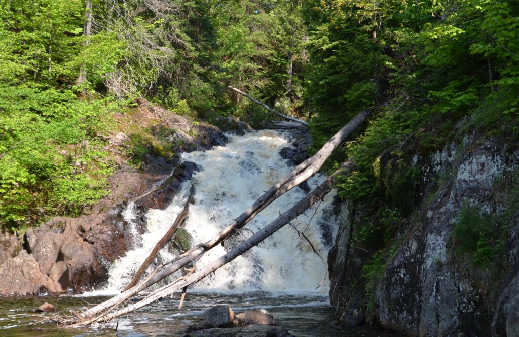
From the listed put-in, boaters will likely encounter areas of swiftwater often flowing through overhanging alder. (While there are no major (or barely even significant) rapids here, high water may make passage through overhanging brush that much more problematic!) Pinnacle Falls, a big drop and portage for most sane individuals, is 2 miles into this section. While there are plenty of areas of minor rapids, there are relatively few memorable rapids, making this is a reach which is seldom boated.
It might also be noted that, while maps may show a 'Wylie Falls' about a mile upstream of our recommended put-in, all reports are that it is little more than a beaver dam and minor rapids, not worth the bother to find or boat.
Rapids in this Run (1)
Waterfalls (1)
Difficulty
Class II-III(V+)
Length
8.4 mi
Gradient
55 ft/mi
max 73
Rapids
1
Access Points
Shuttle Info
The put-in is pretty remote, in what is known as the "Yellow Dog Plains". Early season runs are likely to find the roads up here impassible, either due to snow or ruts, on dirt/sand/gravel roads. (On my first/only trip up here, we reached an impassible point on AAA Road, and had to hike in the rest of the way.) If the roads are clear and in good shape (or your vehicle has 4WD and good clearance) you may be able to drive to the river, either at the listed put-in or upstream nearer Wylie Falls.
Difficulty Classes
I Easy
II Novice
III Intermediate
IV Advanced
V Expert/Extreme
VI Unrunnable
Current Conditions
5-Day Forecast
Whitewater data from
American Whitewater
American Whitewater