A) Upson Falls to Foster Falls (Sullivan Rd) (2.5 or 7.2 miles)
Linked via: Proximity 99% confidence Synced 6mo ago
Gauge Conditions
Runnable: ? – ? CFS
Approximate reading: This gauge is 0.0 miles away on Potato. Use as a general reference only.
Data from American Whitewater & USGS
Run Map
Run Time Estimate
Select put-in and take-out to estimate time.
Unlock Advanced Trip Planning
See wind-adjusted speed maps, forecast planning, and detailed time estimates.
Sign in to generate an AI timing estimate for this run.
Whitewater timing varies with scouting, portages, and group pace. Use as a planning baseline.
Description
Boaters may wish to split this run into a short run of the upper 2.5 miles, then shuttle down to 'park-and-huck' the final listed sequence (about 0.5-0.7 mile).
Bryan Foster provides (2014-04-29):
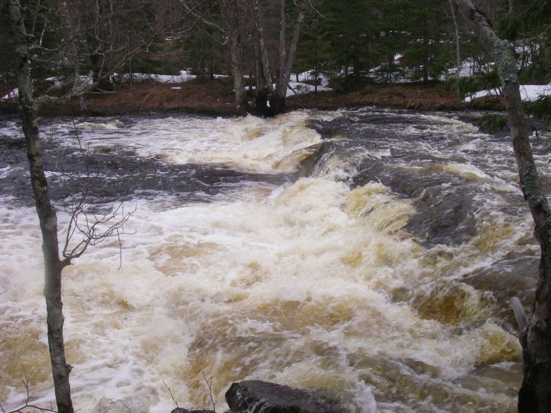
Ran this on 4/27/2014. Level was 742cfs and falling on the Hwy.169 virtual gauge. The level was measured at 76.5' on the put in culvert at Hwy.77. Levels in the range of 742cfs to 830 cfs were perfect for running Hwy.77 to Upson Lake Road. I would guess that below 400 or 500cfs would make this run too low.
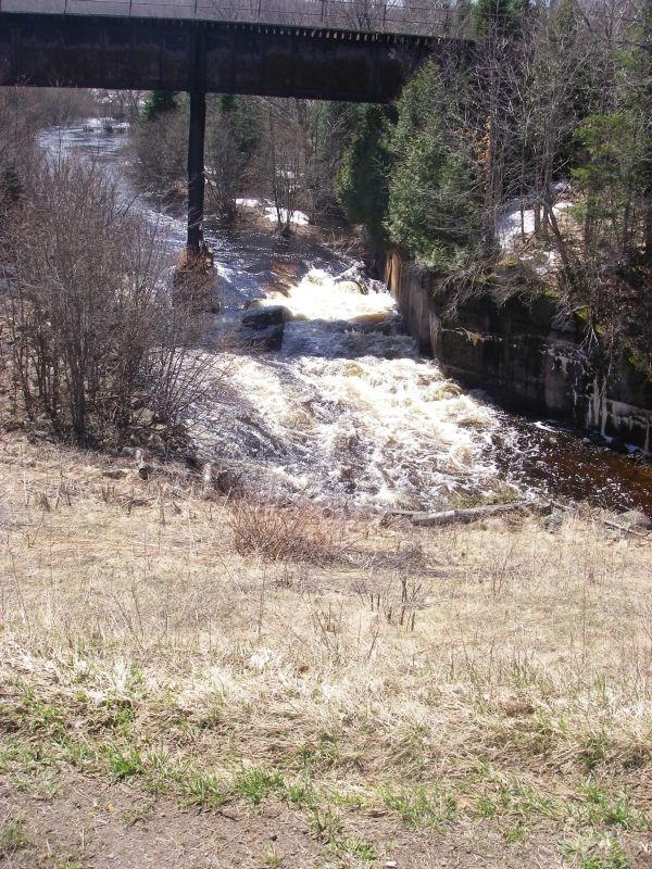
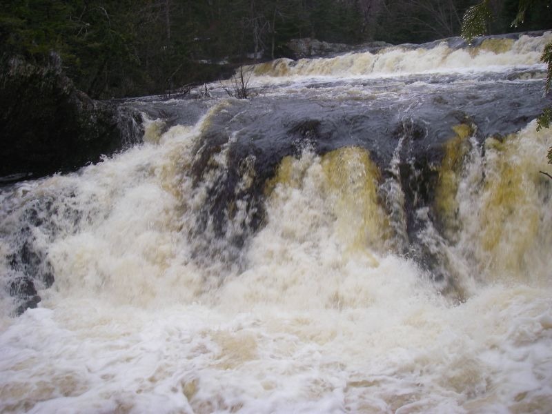
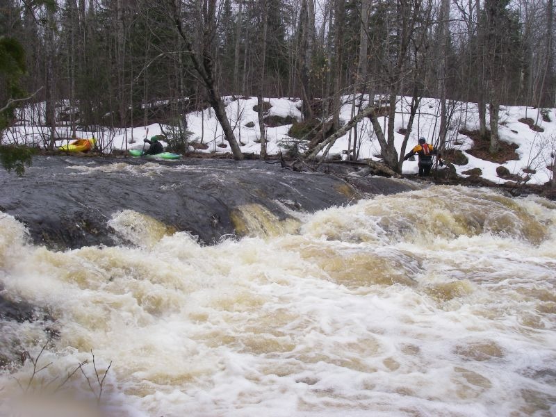
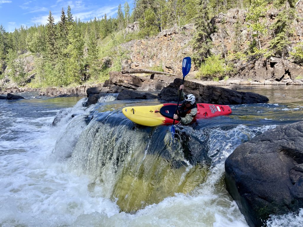
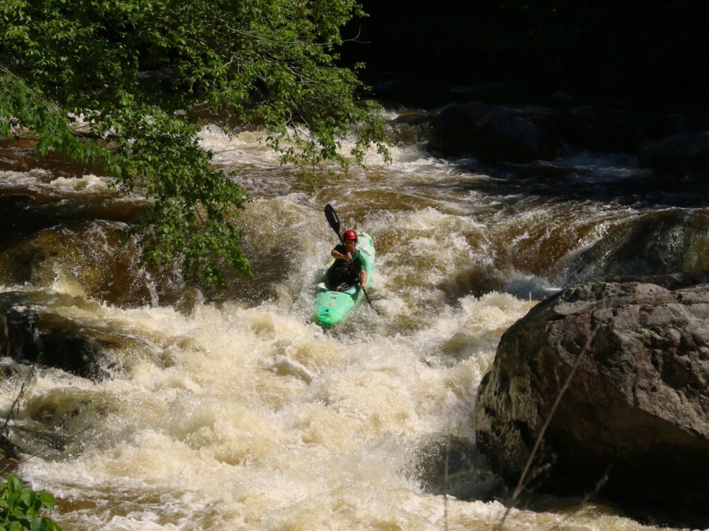
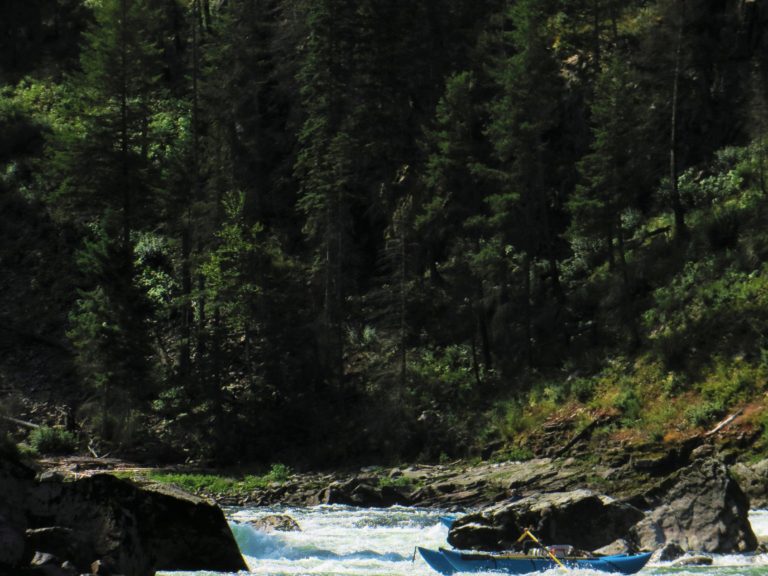
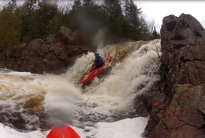
The first main rapid is Upson Falls. You can scout this from the Park along trails in the woods. If you decided to run the falls, put in at Hwy.77, otherwise you can put in at the park. The falls consists of three drops. The first drop is about 5 to 6 feet and has a stair step in it. The river right side formed a decent hole at our level, so we ran a seam in the center. Scott pitoned on a line that went down one of the stair steps. The 2nd drop is larger, at about 10ft. We ran this on river right (you can see the line in the photo). The 3rd drop is only a few feet and has a few lines.
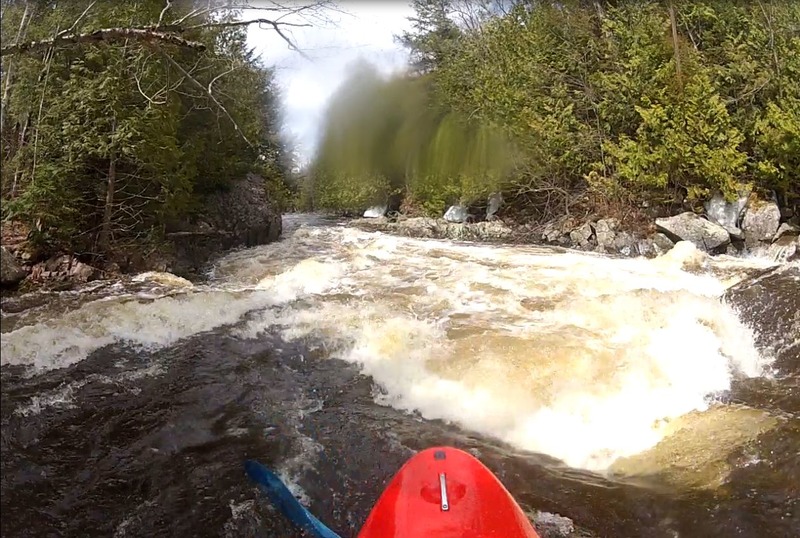
After Upson Park Road, the river has a nice class II Brunsweiler feel until a first ledge of about 4ft. There is a large rock in the middle and either side was runnable. Shortly after is the second ledge of about 4ft. We were able to run this anywhere, but some holes will most likely form at higher levels. River right is a safe slide.
At about 1.1 miles there's a rapid with a curving wave train down the left side of the river. This and the rest of the rapids down to the ATV bridge at Upson Lake Road were 'read-and-run'. We took out at the ATV bridge on Upson Lake Road, where there is a parking for about 2 cars. Sullivan Road was still snowed in (being a fire lane, it is not plowed in the winter).
Bryan Foster further provided (2014-05-09):
Ran again on 5-3-2014. Level was 830cfs and falling on the Hwy.169 virtual gauge. The level was measured at 74' at Hwy.77 put-in.
Upson Falls was not as scrapy with the extra water. General character of the river did not change from 742cfs to 830cfs (76.5' down to 74' down). Casey Sag Road was open, but Sullivan Rd was still snowed in. We able to park where the road crosses river. Roads to falls below Foster Falls were in pretty rough shape.
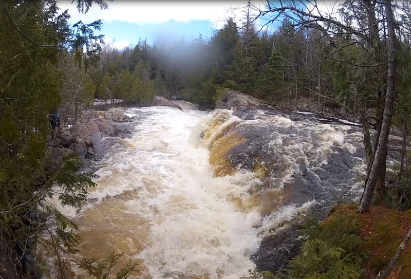
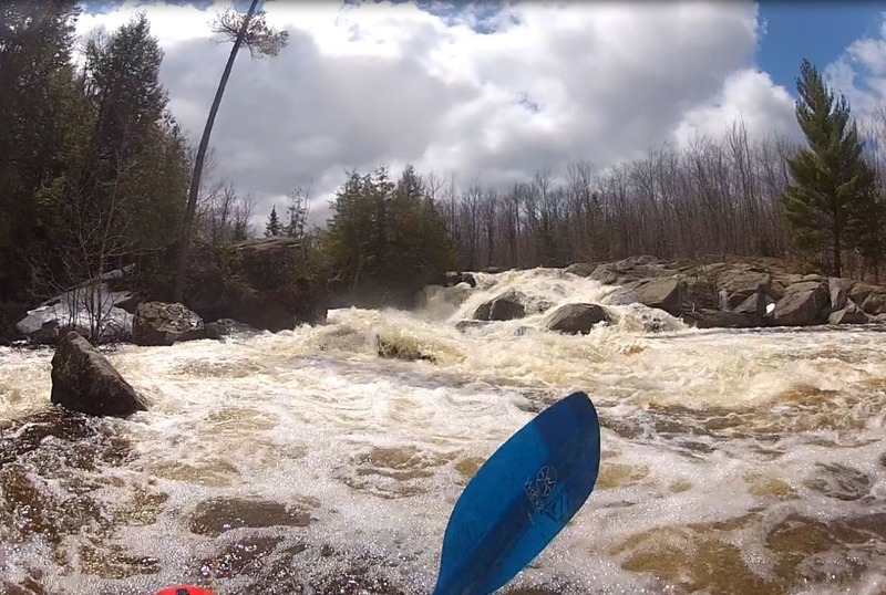
There is only 2 consecutive class II boulder beds from Upson Lake Road to Foster Falls. We portaged Foster Falls on the left along a 'road'/ATV trail. River split below Foster falls, with the left channel choked with wood, but a nice curving dells section down the right side was clear. The 'dells' as marked on the description is more of a falls. Soon after the river bends left, we got out on left and right and scouted. The upper was better scouted from river left along with the lower drop. The hole on the lower right channel would require a scout from the island splitting the lower section of the falls or from down stream looking up. The right bank is a cliff with cedar trees making visual of the hole sketchy. We only ran the lower left steep slide/drop and short dells below.
Hike back out was along a ATV/4x4 trail to Casey Sag Road.
Thanks, Bryan, for the wonderful updates!!
Click this link (from YouTube, courtesy of 'edo0776') for a great accounting of what you'll find on this run: _https://youtu.be/CJZBFdHAkoE_
Rapids in this Run (20)
 Rapid
II
Rapid
II
Railroad Drop
Rapid
USGS sampling site
 Rapid
Rapid
Island
 Rapid
IV
Rapid
IV
Upson Falls
 Rapid
Rapid
Upson Park Road
 Rapid
III
Rapid
III
Second Ledge Sequence
 Rapid
III
Rapid
III
Third Ledge
 Rapid
Rapid
*Possible* mild gradient/rockgarden sequence
 Rapid
Rapid
Rock outcrop sequence
 Rapid
Rapid
Tree covered ledge?
 Rapid
Rapid
(Chute?)
 Rapid
Rapid
Confluence Alder Creek
 Rapid
Rapid
(Low gradient rapids bouldergarden)
 Rapid
Rapid
Upson Lake Road
 Rapid
Rapid
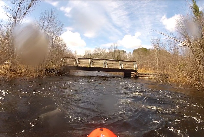
ATV/Snowmobile Bridge
 Rapid
Rapid
Rocky Sequence
 Rapid
Rapid
Confluence: Sullivan Creek
 Rapid
Rapid
Casey Sag Road / Sullivan Road
 Rapid
Rapid
Dells
 Rapid
Rapid
Transverse Falls
Waterfalls (2)
Hazards & Portages (1)
Caution: The following locations may require scouting or portaging. Always check current conditions.
Difficulty
Class II-III(IV)
Length
6.9 mi
Gradient
27 ft/mi
max 77
Rapids
20
1 Hazard
Access Points
Difficulty Classes
I Easy
II Novice
III Intermediate
IV Advanced
V Expert/Extreme
VI Unrunnable
Current Conditions
5-Day Forecast
Whitewater data from
American Whitewater
American Whitewater