Alpine Road to Bull Road Scenic
Beaver Creek (Conewago Creek trib.)
Linked via: Proximity 97% confidence Synced 6mo ago
Gauge Conditions
Runnable: ? – ? CFS
Approximate reading: This gauge is 61.4 miles away on Beaver Creek (Conewago Creek trib.). Use as a general reference only.
Data from American Whitewater & USGS
Run Map
Put-in
Take-out
Rapids/Hazards
Scenic
Run Time Estimate
Select put-in and take-out to estimate time.
Unlock Advanced Trip Planning
See wind-adjusted speed maps, forecast planning, and detailed time estimates.
Sign in to generate an AI timing estimate for this run.
Whitewater timing varies with scouting, portages, and group pace. Use as a planning baseline.
Description
River Description:
This creek flows out of Gifford Pinchot Park Lake (Northeast corner of the lake). Beaver Creek's upper reaches lie underneath the manmade Gifford Pinchot Park lake.
Beaver Creek begins at the bridge on Alpine Road. Parking is available on the upstream river-right side of the bridge. The takeout is located on Bull Road at the bridge crossing. Parking is available on river right, downstream of the bridge.
The run can only be made in the late fall, winter or spring after heavy rains or continuous rain for several days. This dam has a spillway and a drain valve; when the lake is full, water will naturally flow over the 100-ft spillway to provide natural flow. Sometimes, water is released from the dam through a drain valve. Every three years, the lake is drained to a certain level to allow algae to be killed. This release typically lasts one week. The release is typically enough (valve 1/2 way open) to provide minmum runnable levels.
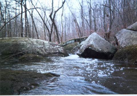
This creek is very tight (15 feet at its narrowest). The entire run is approximately 1.5 miles long. The first 0.5 miles is relatively flatwater (Class II).
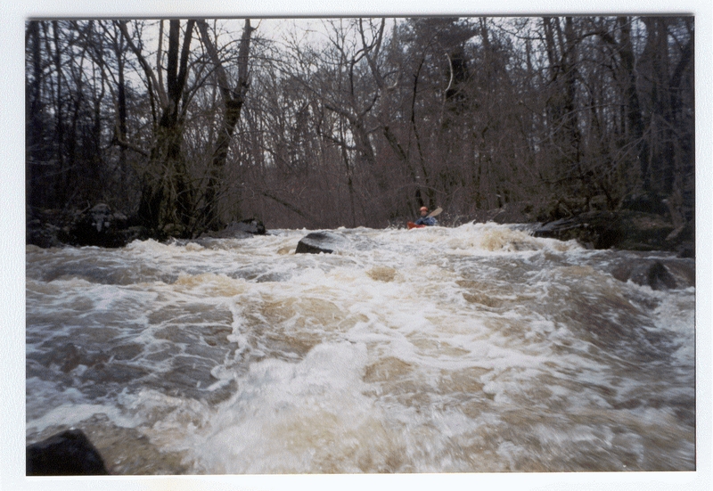
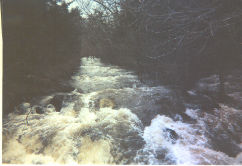
The next and final mile is continuous Class III-IV.
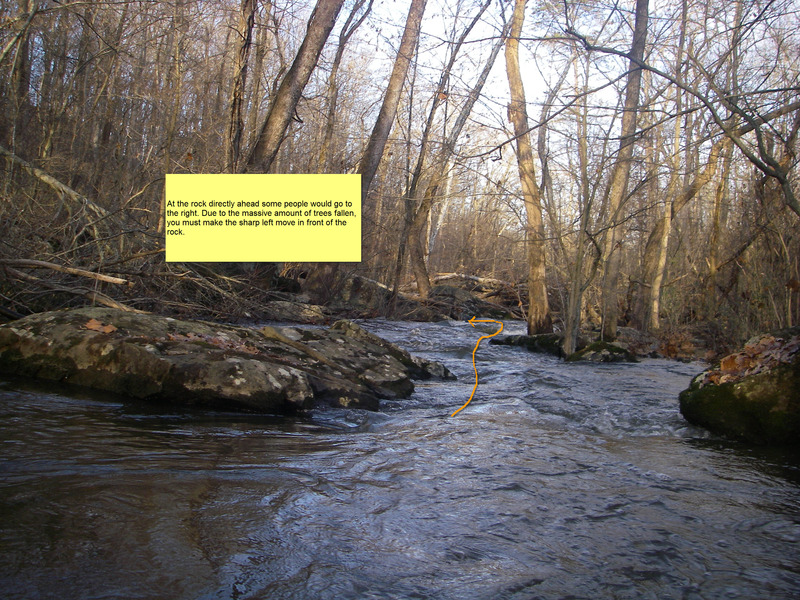
Wood is definitely a problem on this creek, including fallen trees and overhanging trees.
Main rapids described in rapids section. All other rapids are class III-III+.
PLEASE NOTE: RUNNING THE SPILLWAY IS ILLEGAL AND COULD PUT OUR ACCESS TO THIS BEAUTIFUL LITTLE CREEK IN JEOPARDY!
Difficulty
Class III-IV
Length
1.7 mi
Gradient
80 ft/mi
Rapids
4
Access Points
Shuttle Info
**Shuttle Directions:**
Put In
Take Route 74 North from York through Dover. 4 miles north of Dover Town Square, turn right onto Alpine Road (first road after crossing the Conewago Creek). Travel approximately 4-5 miles on Alpine Road (NE direction). After you pass Bob's Weld Shop on your right, keep your eyes peeled for a gravel parking lot on the left, before you cross Beaver Creek.
Take Out
From the Put In, turn left out of the parking lot onto Alpine Road. Travel approximately 0.25 miles. Turn right onto Conley Road. Travel approximately 2 miles to Bull Road. Turn right at the stop sign, onto Bull Road. Travel approximately 200 yards to the Take Out bridge which crosses Beaver Creek.
\*\*alternate directions to the take out: From the Put In, turn right onto Alpine Road. Travel 0.6 mile (just past Bob's Weld Shop). Turn left on Kunkles Mill Road (which becomes New Bethel Road). Travel 0.16 and turn left onto Kunkle's Mill Road (at a white church). Immediately past the church go left again on Boring Bridge Road. Stay on this road to the stop sign. Turn right on BU Rd/Bull Rd. The take out will be ahead on your right.
Difficulty Classes
I Easy
II Novice
III Intermediate
IV Advanced
V Expert/Extreme
VI Unrunnable
Current Conditions
5-Day Forecast
Whitewater data from
American Whitewater
American Whitewater