B) Gile Falls to Hwy.2 (6.3 miles)
Linked via: Nhdplus discovery 90% confidence Synced 6mo ago
Gauge Conditions
Runnable: ? – ? CFS
Approximate reading: This gauge is 5.7 miles away on Montreal. Use as a general reference only.
Data from American Whitewater & USGS
Run Map
Run Time Estimate
Select put-in and take-out to estimate time.
Unlock Advanced Trip Planning
See wind-adjusted speed maps, forecast planning, and detailed time estimates.
Sign in to generate an AI timing estimate for this run.
Whitewater timing varies with scouting, portages, and group pace. Use as a planning baseline.
Description
Flow can be obtained by calling dam operator at 715-893-2213 for both the WF Monetreal and the mainstem Montreal.
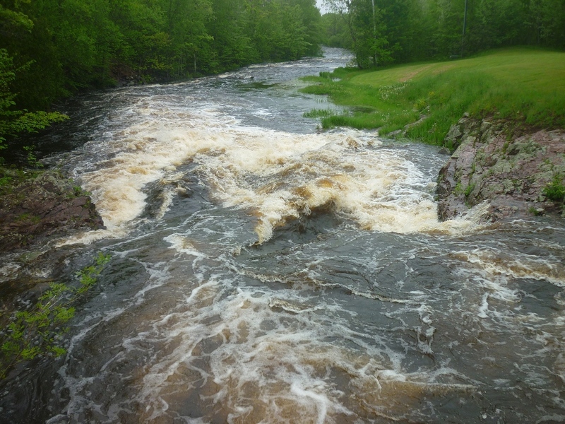
Tough to catch with water, but contains one of the longest IV- rapids in the state.
Some river guide descriptions break the run into two sections, using Kimball Town Park as the intermediate take-out/put-in. This shortens the upper trip to 5.0 miles, and yields a 'section 2' run with 1.5 miles of II-III rapids (down to just below Hwy.2) followed by about a mile of much lesser gradient before the confluence with the main Montreal River (midway through a described reach of that river). Breaking this reach as described here, you get virtually all of the whitewater on the West Fork in one reach.
Alternatively, put-in may be possible from backroads north of the town of Montreal, skipping Gile Falls and thus also skipping 1.6 miles of flatwater.
Gile Falls (at/near the put in) is a scenic area where the river is squeezed between rock walls to plunge over a short falls. At most boatable flows you will be best advised to avoid the reversal that forms here by skirting as far left as possible. Just downstream, the river is diverted 90degrees left through a vertical walls of rock.
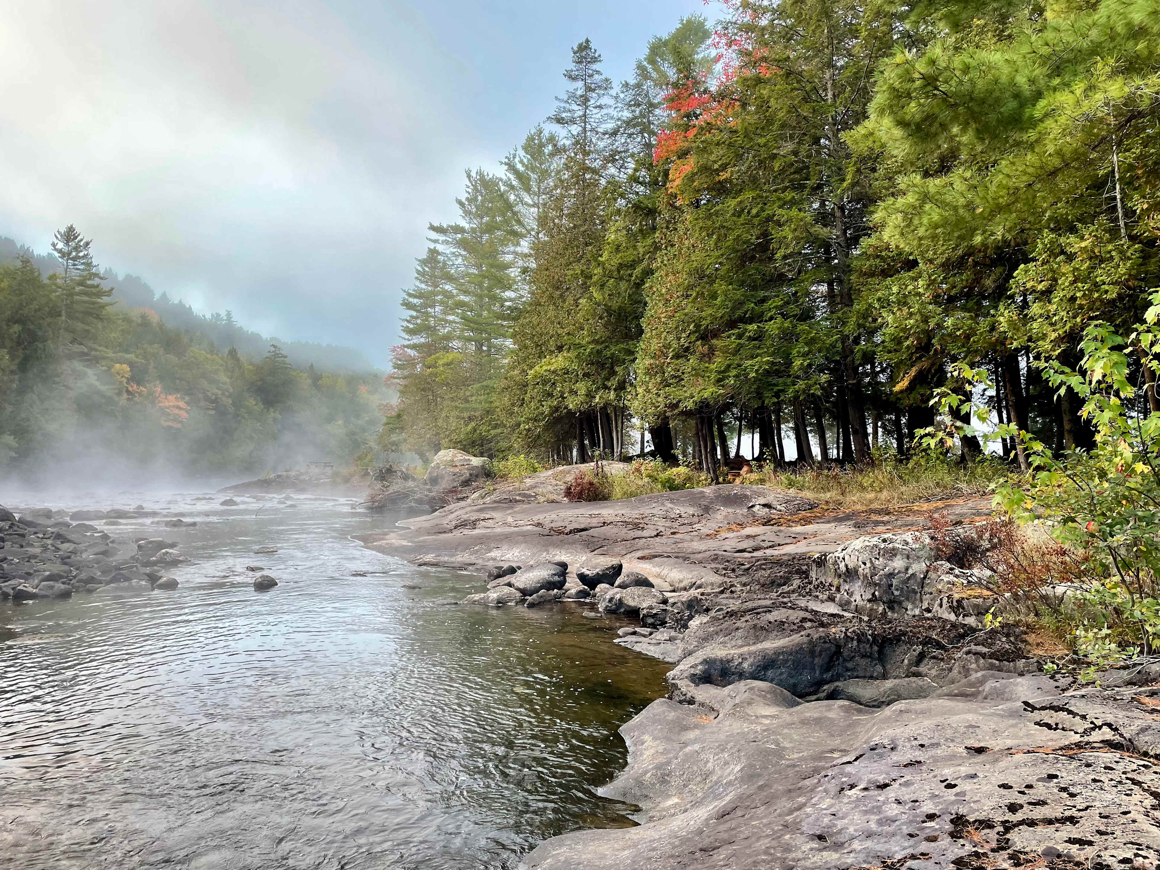
Much flatwater intervenes until *Rock Cut Falls (a.k.a. Railroad Rapids)* is encountered. Scouting is highly advised, as this area has been known to collect snags. There are virtually no eddies to the bridge, and only a few small ones below. A great series of (almost unavoidable) offset holes in a relatively narrow boulder-lined channel lead to a bit of slack water under the (defunct) railroad bridge. The action resumes (only *slightly* diminished) leading to a river-right ledge and rock jumble creating a final slide into a pool.
A short distance downstream, another river-wide irregular ledge creates a fairly nasty reversal at most runnable levels. The best route is a 'sneak' well to the right, with a short boof ledge, then enjoying the rapids which lead toward and past a fine rock outcropping on the right. Fairly continuous I-II action and flat but swift water will bring you to Kimball Falls, easily recognized by the clearing and park buildings on the left. Again, take out well in advance to scout. A fun series of small ledges lead down to a bridge, immediately after which the river is twisted and contorted into wrapping diagonal waves funneling into a final, wicked-looking hole.
Use the park at Kimball Falls (above or below the drop) as a short-run take-out, or proceed the next 1.5 miles through fairly continuous I-II action (with a couple boat-scoutable larger drops bordering on III) to the Hwy.2 bridge. A sweet, surfable wave forms in the downstream end of the culvert to finish off your trip.
The following video (via YouTube, courtesy of 'Duck Wild Producktions') does a great job of providing a boater's-eye view of the run from Rock Cut Falls to Kimball Falls:
Click here for Part 1 of an article from the AW Journal, way back in 1981!
Click here for Part 2 of the article.
The article describes the following: Michigan's, Upper Presque Isle, Lower Presque Isle, Middle Black, Lower Black, Upper Silver, Lower Silver, Falls, and Rock; and Wisconsin's Lower Brunsweiler, Montreal Canyon, and West Branch Montreal.
FROM NORTHWOODS WHITEWATER BY JIM RADA:
The West Fork of the Montreal originates, for all intents and purposes, at the Gile Flowage a half mile south of Wisconsin Highway 77 in the town of Montreal. It’s mostly a curse and rarely a blessing, as most dams are, that the power company (Xcel Energy) regulates the flow. Once this river ran in accord with the seasons, but now it’s screwed up. Yet, the run is so fine that it was used as a Pan Am Cup wildwater course in 1984, is so fine that it holds the record for my earliest river put-in (about 5:30 a.m. in predawn fog as we knew the river would be dry by 8:30), is so fine that I jerk my head whenever I cross it on U.S. 2 or Wisconsin 77 to see if it’s boatable, but usually all I see is the steady flow of about 100 CFS that trucks water down to the Saxon Falls powerplant.
There are two times when you stand a better than average chance of seeing it running: peak snowmelt and October. If the snowmelt is really heavy, the Gile Flowage may rise to use that threaten to flood U.S. 51 on its east flank and they’ll spill water, also a little water will come in from the banks. In October there’s sometimes a drawdown of the Gile Flowage to prepare for the next spring’s runoff—this can mean a chance to boat it, as it did one Columbus Day with Tom Schelberg, under a canopy of yellow and red sugar maples blazing against a blue sky. In fact, my cruise during the August 1984 Pan Am release was also highly memorable, bathtub warm, shaded by those same trees, and full of life. If boaters succeed in getting water releases for the Montreal Canyon, the West Fork will run, too, so let’s work on getting scheduled releases.
As for the run, if you start at the Gile Flowage, you’ll be treated to a short, narrow mini-canyon holding one drop with a powerful, recirculating reversal. There’s a ski trail that goes up from Wisconsin 77 to look at it—park at the Montreal Town building near the Highway 77 bridge. However, from Highway 77 the next two miles is simply flatwater, so I prefer to carry in just where the West Fork runs into the Penokee Range hills, about one and a half to two miles north of Montreal. Walk in to an old farm clearing or along a powerline cut from the small dirt road that runs about a quarter-mile west of the West Fork. This will bring you to the crux rapid of the run, a steep, constricted flume as the West Fork pinches up against a rock wall on its left and goes under an old railroad bridge, now a four wheel drive trail (the Iron Horse Trail).
Some paddlers refer to this wonderful two hundred yard long class IV as “Railroad Rapids” because of the bridge, but I prefer the locals’ name for it, Rock Cut Falls. Whatever the name, several sharp narrow drops in quick succession make the paddler churn his way through some hefty holes—wildwater indeed! A hundred yards of confined “holy water” ends slightly at the railroad bridge, then takes off for a few more shots—I love it!
Following Rock Cut, the river broadens a bit and hurries down some pretty steep bouldered—don’t broach. Okay, now be lively because about a half mile from the railroad bridge you’ll encounter a nifty double ledge, class III-IV, scout left. This ledge snared an open boat from Missouri once, which we left stranded, coming back to retrieve it an hour or two later when the river was dry again.
The next couple miles are easier, picking up with some nice little ledges after you pass under a small bridge where Center Drive crosses the river. About a mile after this bridge, you’ll see another bridge, this one leading to the Kimball Town Park on the river left. I recommend scouting here as the drop just below this bridge, Maple Sap Falls, changes from class III to IV+ as the water level goes up.
At low flows Maple Sap Falls is just a scrapy sloping double ledge; at moderate flow there’s a good hole right and a narrow tongue left. At flood, which I’ve seen, there’s an awesome hole at the bottom and I was glad to portage. You have only about a half-mile of river left after Maple Sap Falls, so relax as you approach U.S. 2. Look forward to surfing in the culverts under U.S. 2 and then take out, feeling quite lucky to have found water in the West Fork!
Rapids in this Run (6)
Waterfalls (1)
Difficulty
Class II-IV
Length
6.1 mi
Gradient
51 ft/mi
max 101
Rapids
6
Access Points
Difficulty Classes
I Easy
II Novice
III Intermediate
IV Advanced
V Expert/Extreme
VI Unrunnable
Current Conditions
5-Day Forecast
Whitewater data from
American Whitewater
American Whitewater