B) Hwy.140 to Shopiere (PnP, 1.3, or 4.7 miles)
Linked via: Nhdplus discovery 90% confidence Synced 6mo ago
Gauge Conditions
Runnable: 150.0 – 500.0 CFS
Flat-water float, but gradient areas will be scrapey.
Data from American Whitewater & USGS
Run Map
Run Time Estimate
Select put-in and take-out to estimate time.
Unlock Advanced Trip Planning
See wind-adjusted speed maps, forecast planning, and detailed time estimates.
Sign in to generate an AI timing estimate for this run.
Whitewater timing varies with scouting, portages, and group pace. Use as a planning baseline.
Description
Quick Facts:
Location: Hwy.140 to Shopiere (Approximately 6 miles NW from Beloit, WI).
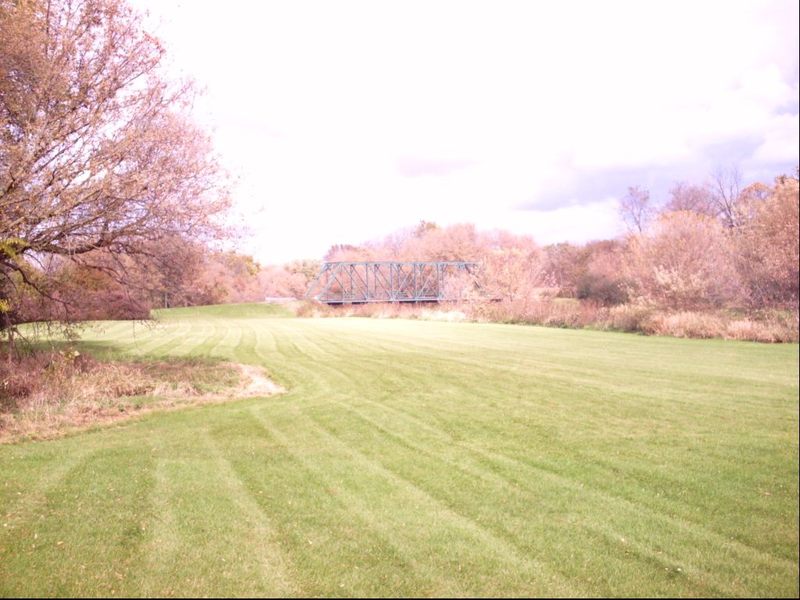
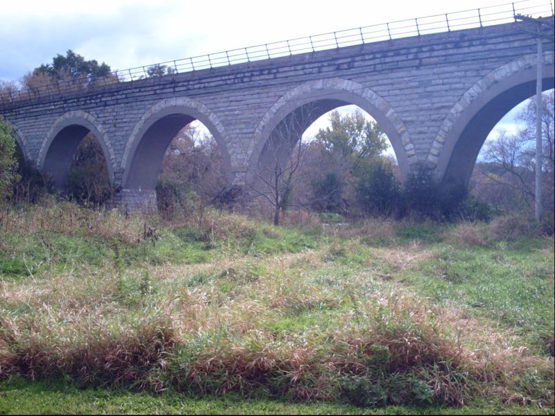
Character: Rural scenery (fields, trees), an impressive scenic railroad trestle, mudflat and gravel shoals.
Shuttle Length: 1.3 miles or 4.9 miles. For whitewater enthusiasts, mostly recommended as (possible) park-and-play at railroad ledge near Smith Road.
General Overview
Removal of the Shopiere Dam (summer, 2000) had revealed a short bedrock ledge. Well, *bedrock* is probably the wrong term -- the bottom here is mud and clay. Unfortunately, the 'mud ledge' has now completely eroded away. However, additional scouting has found other potential playspots in this watershed. (See 'River Features' below.)
A very enjoyable, moderately scenic 4.7 mile float trip (flatwater paddle) starts from parking at a wayside at Hwy.140, 2.6 miles north of the town of Clinton, WI, and ends in a pretty little park (Sweet-Allyn County Park at Belding/Butterfly Road just north of Shopiere) where gravel shoals create a few minor riffs and rips leading downstream to the mown grassy area of the park for your take-out. I have not floated this reach, but I have heard that there may be at least one area where a rocky ledge and/or rock rubble forms a bit of pourover/wave (at some flows) which may allow for minor surfs. This is right at the very scenic (multiple high-arching stonework) railroad bridge which is about a mile upstream of Sweet-Allyn County Park, and may be accessed from nearby Smith Road for a park-and-play, or a run of just 1.3 miles with the best of the gradient (such as it is . . . just riffles and rips).
Difficulty
Class I
Length
5.0 mi
Gradient
3 ft/mi
Rapids
3
Access Points
Shuttle Info
While the default mapping below shows a route to the south of the creek, I generally find E.Creek Road (to the north of the creek) a more convenient route (fewer turns).
Difficulty Classes
I Easy
II Novice
III Intermediate
IV Advanced
V Expert/Extreme
VI Unrunnable
Current Conditions
5-Day Forecast
Whitewater data from
American Whitewater
American Whitewater