B) LSB Pike: Mathias Lake Road to Dave's Falls
Linked via: Proximity 95% confidence Synced 6mo ago
Gauge Conditions
Runnable: ? – ? CFS
Approximate reading: This gauge is 2.7 miles away on Pike. Use as a general reference only.
Data from American Whitewater & USGS
Run Map
Run Time Estimate
Select put-in and take-out to estimate time.
Unlock Advanced Trip Planning
See wind-adjusted speed maps, forecast planning, and detailed time estimates.
Sign in to generate an AI timing estimate for this run.
Whitewater timing varies with scouting, portages, and group pace. Use as a planning baseline.
Description
_NOTE: From the recommended take-out for the 'Upper South Branch' run to the put-in for this stretch, there is about 6.5 miles of largely uninteresting water (from a whitewater perspective) which we do not list._
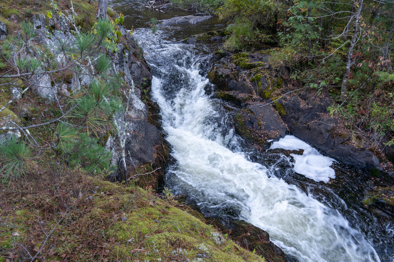
LSB (Lower South Branch) Pike ... main attractions on this reach are Big South Falls, Surprise Ledge, and Dave's Falls. You may also wish to take a 'side trip' to view a falls on the Little South Branch. (Look for it entering on your right, just downstream of Big South Falls.) At some levels, some boaters may run Dave's Falls, though it is likely most will take out between "Upper Dave's Falls" and Dave's Falls. Keep in mind that flow here will be double the 'virtual gauge' reading shown on this section (I.E., it will be equal to the regular USGS gauge, as listed on the two main-stem reaches of the Pike downstream).
The take-out at Dave's Falls is accessible via Dave's Falls County Park. In appreciation for the facilities provided here (parking, bathrooms, improved trails, etc), please be honest and pay the requested fee. (If I understand things correctly, paying one fee gets you legal access to as many different parks in Marinette County as you can visit in one day. Thus, if you might plan to look at and/or run the nearby "Four Falls" section of the North Branch Pike, either before or after this run, one fee would cover both parks.)
Regarding Dave's Falls, Brock Royer reports (2005-11-17): _Mark Hattendorf and I have run this falls multiple times and found that even at higher flows the left line toward the wall at the end is much more benign (flushy) than it looks...even at higher flows. I still however would suggest remaining upright regardless of the line you take b/c there are a few rocks not far below the surface. It is a fun drop and much easier than it looks. Enjoy!_
_~Peace~_
_Brock_
That said, many runs we're aware of go rather less-successfully than was hoped for:
However, here is a look at a successful run of the falls: https://youtu.be/fXa6HDqVeSc
Rapids in this Run (5)
Waterfalls (4)


Hazards & Portages (1)
Caution: The following locations may require scouting or portaging. Always check current conditions.
Difficulty
Class II-IV
Length
4.9 mi
Gradient
19 ft/mi
max 34
Rapids
5
1 Hazard
Access Points
Difficulty Classes
I Easy
II Novice
III Intermediate
IV Advanced
V Expert/Extreme
VI Unrunnable
Current Conditions
5-Day Forecast
Whitewater data from
American Whitewater
American Whitewater