B) Redwood Falls (PnP, 1.4 or 4.6 miles)
Linked via: Proximity 99% confidence Synced 6mo ago
Gauge Conditions
Runnable: 500.0 – 3,000.0 CFS
Likely too low for any real whitewater experience. (We need your input! Add a comment or report.)
Data from American Whitewater & USGS
Run Map
Run Time Estimate
Select put-in and take-out to estimate time.
Unlock Advanced Trip Planning
See wind-adjusted speed maps, forecast planning, and detailed time estimates.
Sign in to generate an AI timing estimate for this run.
Whitewater timing varies with scouting, portages, and group pace. Use as a planning baseline.
Description
An anonymous user provides (2010-06-12):
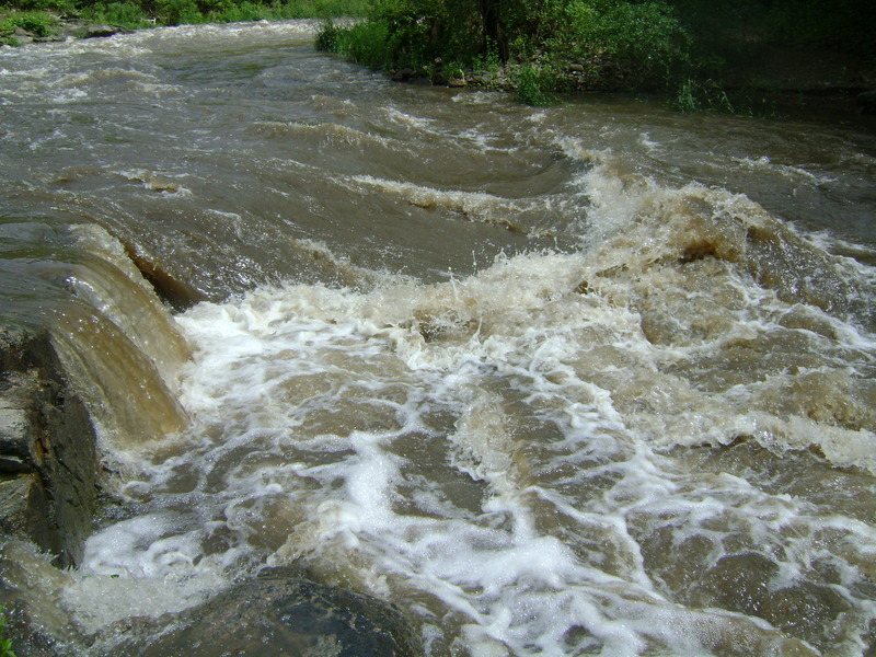
_I explored this river earlier today and took some pictures which are the first 6 photos uploaded. These pictures show the upper portion of the river, including the falls that are just south of where most people put in. I would consider 700cfs low runnable, which is about what the pictures are showing. Anything 500 cfs and less is too low to run for sure._
Another report (reprinted, with minor edits, from Rapids Riders message board, with the writer's permission):
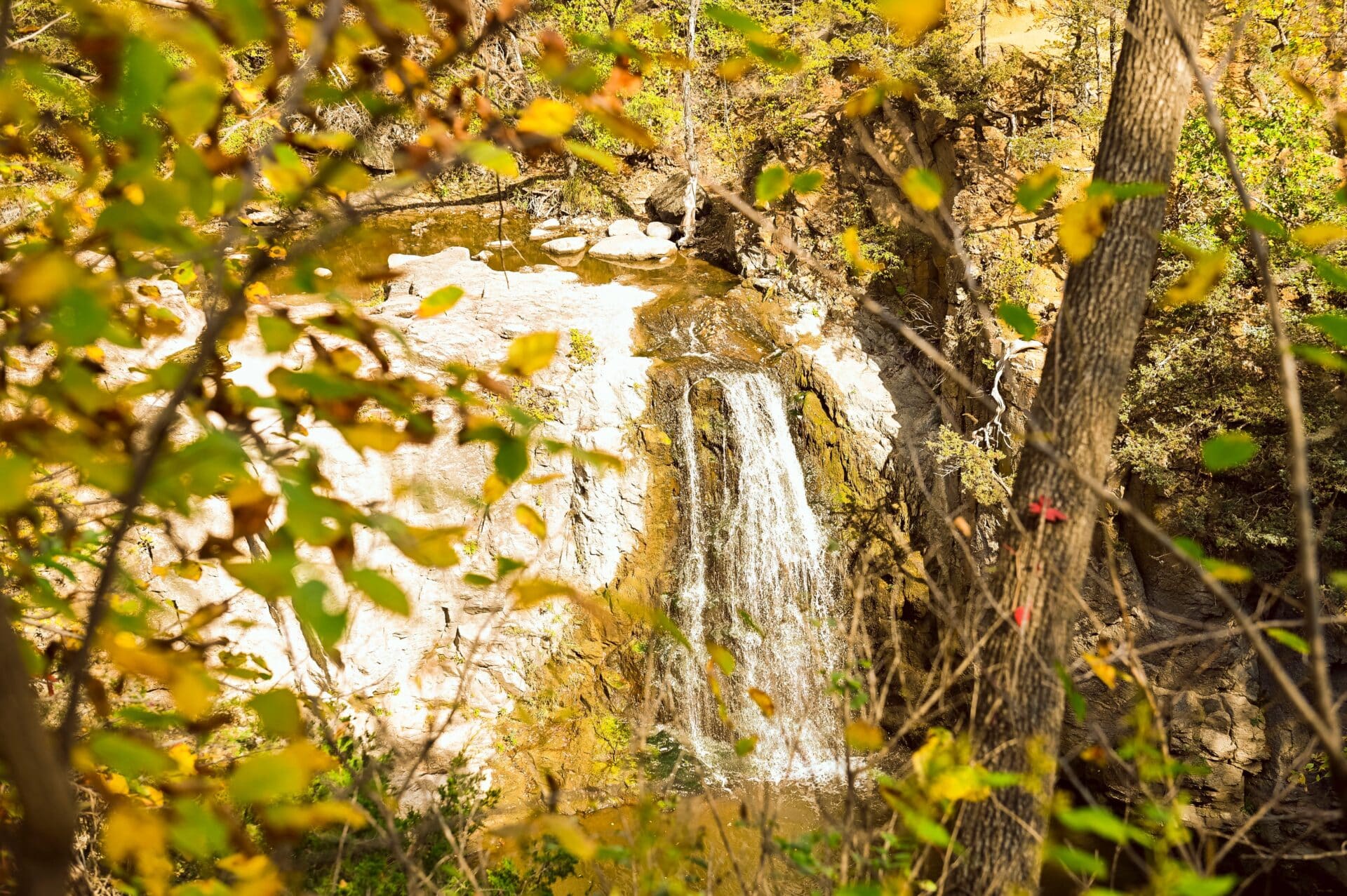
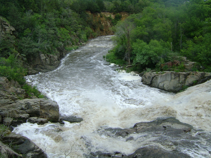
_In the middle of town is Ramsey Park, a large municipal park, and the Redwood River flows through it. You can see only glimpses of the river because it flows through a steep gorge, some walls easily over 100 feet tall. Also in the park is Ramsey Creek. There is a trail that goes to an overlook of Ramsey Creek Falls, a 35 to 40 foot falls. The pool looks deep and there looks like a line left of center with a bit more water than was flowing over last Tuesday. (It looks cleaner than falls such as 'Almost Always' on the Lester, which does get run often when there are medium or higher flows.) Ramsey Creek flows another few hundred yards from the falls into the Redwood River._
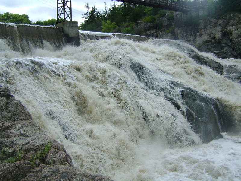
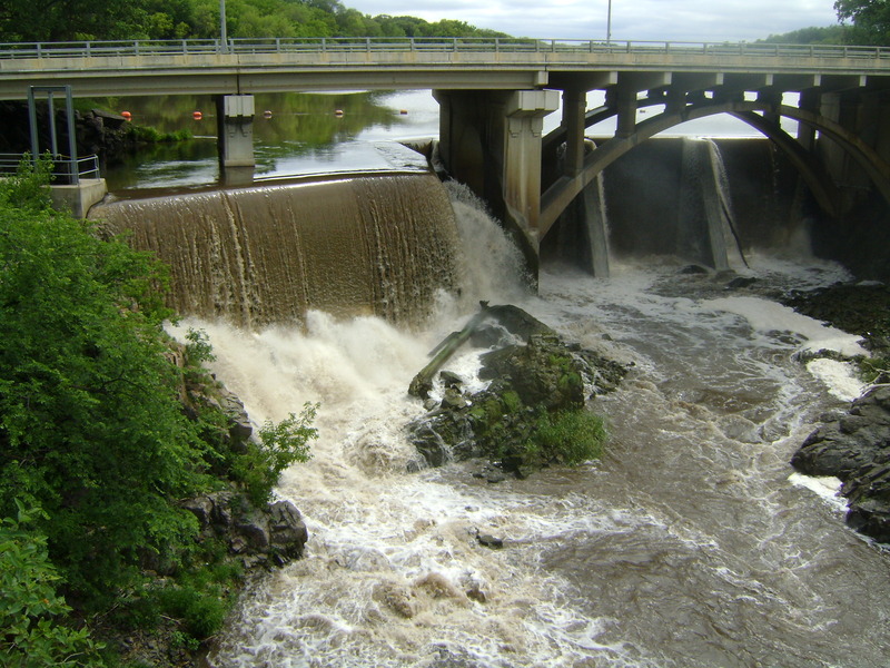
_After some exploring I found the put in: A small pedestrian bridge crosses the river over the second dam, immediately at the base of the dam. The dam is the top of this big sliding falls with some fast flumes of water and big bursting holes. There is a theoretical line where the green lip flows over the center of the dam then a flume into a exploding hole that looks like it might flush you. (I didn't run it.)_
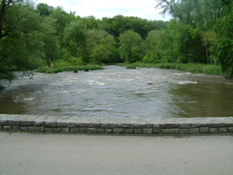
_I put in below, into grayish water class II+ and class III wave trains. After a 1/2 mile or so (the whole run is a mile and a half , seems shorter then that) the river makes a 90 degree turn left, there is a hole I skirted it to the right. (This must be the classIV listed on AW) immediately after the hole (10 feet or so) was a really sweet fast play wave. It built and surged, about 4 feet pile, with excellent eddy service. Spins, blunts, and went for a couple loops (not real good in my EZ but I am sure they are possible there). I wish I would have sessioned it longer because the rest of the run was all class II with one wavehole that could be good with more water. The level was 1200 and was a fun playrun. As I type this it is 2600, so it could be really pumping in that gorge. I am not sure if that washes out things or enhances. 1200 was a good flow I guess that 1000ish and up is good times. That play wave is sweet, fast and deep._
Thanks, Cliff, for the excellent report!
And, finally, we have this:
_I paddled the Redwood at 2000 cfs and many of the play features Cliff described were washed out and the rapids more continuous and the classing of rapids remained the same II/III. A feature that I found that wasn't mention is dynamic play hole is located on the Redwood River 200 yards upstream from the large blown out dam (the foot bridge) in Ramsey Park. It's a river wide hole with many exit seams and excellent eddy access._
_Regarding Ramsey Falls on Ramsey Creek: I spoke with a few locals and the depth of the pool on far river left is 10feet deep at low water and gets deeper as the water level rises. However, there is a rock shelf that is at the base of the falls that runs three quarters the width of the falls. So most of the falls is dangerous to run. Only on far river left down the green tongue is where to run safely. Of course, scout it yourself and determine to run it or not._
Rapids in this Run (1)
Waterfalls (2)
Playspots (2)
Hazards & Portages (2)
Caution: The following locations may require scouting or portaging. Always check current conditions.
Difficulty
Class II-III+
Length
4.5 mi
Gradient
21 ft/mi
max 35
Rapids
1
2 Hazards
Access Points
Shuttle Info
We are uncertain about access and parking at indicated put-in/take-out.
Boaters may wish to just 'park-and-play' or 'park-and-huck' the best of the gradient, and hike back to their vehicle.
As a result, the shuttle directions may not be useful.
However, you can use the text-entry box to input your home or other starting location to get time, distance, and directions to this location.
Difficulty Classes
I Easy
II Novice
III Intermediate
IV Advanced
V Expert/Extreme
VI Unrunnable
Current Conditions
5-Day Forecast
Whitewater data from
American Whitewater
American Whitewater