Bair Road Bridge to Orick
Linked via: Nhdplus discovery 90% confidence Synced 6mo ago
Gauge Conditions
Runnable: 250.0 – 3,000.0 CFS
Flow range for best boatability uncertain. Please help your fellow boaters with a comment or report.
Data from American Whitewater & USGS
CDEC Flow Data California
Data from California Data Exchange Center (CDEC)
Run Map
Run Time Estimate
Select put-in and take-out to estimate time.
Unlock Advanced Trip Planning
See wind-adjusted speed maps, forecast planning, and detailed time estimates.
Sign in to generate an AI timing estimate for this run.
Whitewater timing varies with scouting, portages, and group pace. Use as a planning baseline.
Description
Redwood Creek offers a long river trip that includes a section through some of the tallest trees on Earth in Redwood National Park. Most of the whitewater on this run is upstream of the park where the creek flows through ranch and industrial timberlands, and all of the big trees are within the park. In other words, you get the whitewater excitement first, then you get the amazing experience of paddling beneath 350-foot-tall trees next. This is usually boated as an overnighter or multi-day trip with excellent camping along the creek in the national park (camping permit required).
Historically, boaters have put in for this run in Redwood Valley or Lacks Creek, but the increasing challenge of gaining permission to access these private land put-ins have led most boaters to now put in about seven miles upstream at the Bair Road bridge. Unless you have a connection to a willing landowner in Redwood Valley, using Bair Road bridge is your best bet.
There are a number of rapids in the class III range, but one rapid of note is class V+ Rocky Gap, which nearly all boaters choose to portage. There is a small eddy at the top from which the strenuous portage begins so, if you're boating in a group, it's important to stage boats upstream so each one can individually access this eddy. Don't be fooled by False Rocky Gap which is a short distance upstream.
Redwood Creek downstream of Redwood Valley is proposed for additional to the National Wild and Scenic Rivers System and the adjacent land within the national park is a proposed Wilderness Area. Should this legislation become law, the creek will have three of the nation's most significant protections: national park, wild and scenic, and wilderness. Very, very few rivers have this status.
Intrepid boaters with ocean paddling skills and thr right craft type can complete the trip by paddling into the Pacific Ocean, turning south, and taking out on the beach by the Redwood National Park visitor center or picnic area. This is only recommended for skilled ocean boaters when the ocean conditions and tides are favorable. There is a potentially dangerous rip tide at the the mouth of Redwood Creek and everyone on the North Coast knows about the sharks. No wipeouts allowed.
Redwood National Park Camping Permit
No permit is required to boat the creek through the national park but a free dispersed backcountry camping permit is required for any overnight stay. Permit information and a link the online permit application is at the Park Service's Redwood Creek Dispersed Camping Permits for Whitewater River Users page. American Whitewater has worked with the Park Service to ensure that boaters will be able to apply for these permits easily via a mobile-friendly web page that will automatically email your permit when you complete the application.
If you enounter problems, email Redw\_Permits@nps.gov or call the park's general information line at (707) 464-6101. Note that although the Park Service stops issuing dispersed camping permits to hikers when the Redwood Creek is too high for hiking in the stream channel, it does continue to issue permits to whitewater boaters.
Also check out the Park Service's general information on Redwood Creek dispersed camping.
Flows
Gage for upper Redwood Creek, most accurate for flows at the put-in: Redwood C NR Blue Lake CA
Flow forecast for Redwood Creek at Orick: Redwood Creek river forecast
Season
Redwood Creek drains just under 300 square miles in a long, narrow watershed located one major ridgeline inland from the ocean. It is primarily rain-fed and its flows go up and down with the weather. This can make it a challenge to catch at good levels. In dry years, the creek runs at boatable flows unpredicatably and for short periods. In wet years, it is much more reliable and sometimes even has a component of snowmelt to help even it out. No matter the water year type, the creek may rise rapidly during rain storms.
Logistics
Ideally, you have a shuttle driver assist with this run both to make logistics easier and to help ensure that your vehicle is secure. Break-ins are common near the take-out and private property challenges make it difficult to leave a vehicle at the top too.
_Put-in_
Put in at the Bair Road bridge over Redwood Creek. As a county road, the right-of-way at the bridge allows for public access to the creek. Just stay close to the bridge to avoid trespass on adjacent private property.
_Take-out_
The easiest take-out is on river right upstream of Highway 101 where a short dirt road off Bald Hills Road goes down to the river bar. This is generally about one mile north of Orick. Don't park overnight here unless you're willing to risk a break-in.
Additional Information
The best guidebook for this run is Dan Menten's 2016 classic, _The New School Guide to Northern California Whitewater_ (p. 81).
Dick Schwind's 1974 guidebook _West Coast Whitewater Touring_ (p. 120) gives a detailed description of this run that rings true after all these years.
This run is also in the Cassady & Calhoun and Holbek & Stanley (p. 31) guidebooks.
Bill Tuthill's CA Creeks site has detailed information.
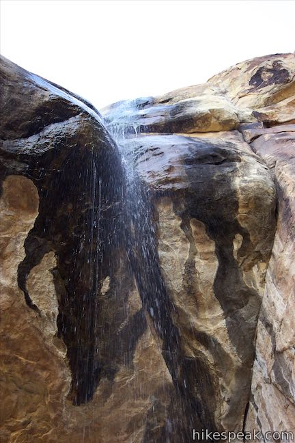
Waterfalls (1)
Hazards & Portages (1)
Caution: The following locations may require scouting or portaging. Always check current conditions.
Difficulty
Class III
Length
36.0 mi
Rapids
0
1 Hazard
Access Points
Difficulty Classes
I Easy
II Novice
III Intermediate
IV Advanced
V Expert/Extreme
VI Unrunnable
Current Conditions
5-Day Forecast
Whitewater data from
American Whitewater
American Whitewater