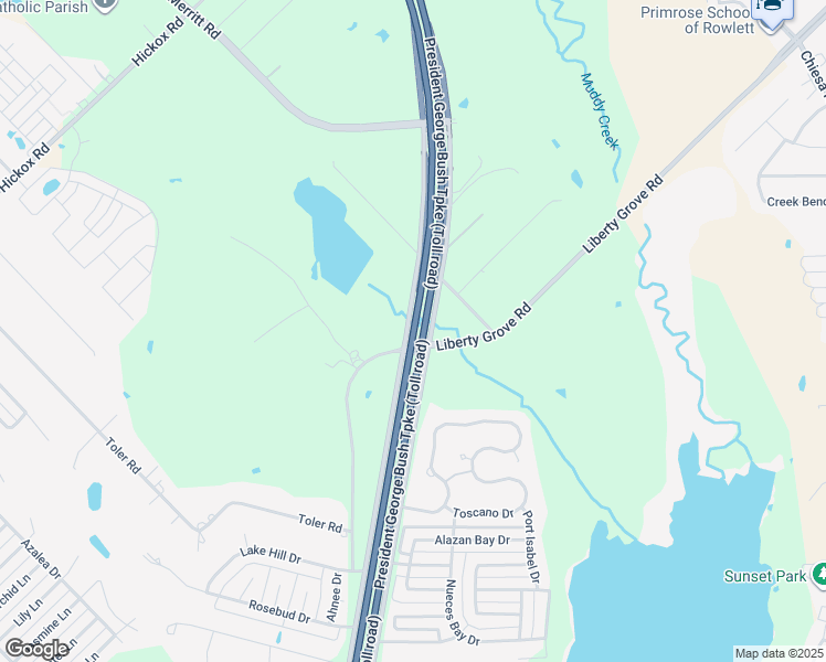
Ben Davis Rd to Pleasant Valley Rd (1.6 miles)
Linked via: Proximity 99% confidence Synced 6mo ago
Gauge Conditions
Runnable: 200.0 – 2,500.0 CFS
Data from American Whitewater & USGS
Run Map
Run Time Estimate
Select put-in and take-out to estimate time.
Unlock Advanced Trip Planning
See wind-adjusted speed maps, forecast planning, and detailed time estimates.
Sign in to generate an AI timing estimate for this run.
Whitewater timing varies with scouting, portages, and group pace. Use as a planning baseline.
Description
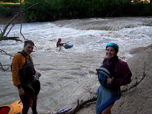
First Ledge:
Level
Description
500-1000 cfs
Shallow and scrapey, but there is good surf on river left after the main drop.
1000-1500 cfs
Much better level. Deep enough for squirts. Lots of play. Above the drop, a 30-foot-wide wave starts to form.
1500-2000 cfs
1st ledge gets big-- run it center or right of center. Above the drop, there is a great 30-foot-wide wave/hole.
2000-3000 cfs and above
Things start to get big at this level. Watch out for strainers along both banks.
Second Ledge:
Level
Description
500-1000 cfs
2nd ledge has lots of play, but it's very shallow at the last hole.
1000-1500 cfs
Surf everywhere at this level.
1500-2000 cfs
At these levels, the ledge is best run right of center. The hole in the middle starts to become a bit of a keeper.
2000-3000 cfs and above
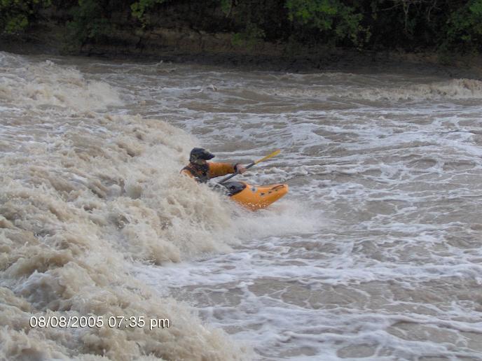
The middle hole of the second ledge is best left alone. Boaters have watched this hole surf logs for 20 minutes. Run both ledges right of center.
General Description:
There are two natural ledges on this section of Rowlett Creek, with at least three play holes at each one. The First Ledge will be marked by about 70-100 meters of insignificant standing waves/fast water (and at levels above 2k, a small surf hole or two.) The meat of the drop is a two-tier affair: the first tier is a hole extending halfway across the river (more than halfway at higher levels.) This in itself is an excellent surfing hole. The one concern here is the next drop, a mere 20-30 meters downstream, which is probably the steepest drop of the run.
At levels above 2100-3000+ cfs, the last drop before the takeout (Second Ledges) should only be attempted by someone with solid Class IV paddling skills. There are numerous holes, essentially river-wide at higher levels. These holes produce large hydraulics with significant back flow, capable of churning and tumbling truck-size trees as if they were matchsticks. An unskilled boater flushed into this maelstrom will get severely thrashed and likely extracted from their boat, placing them in the dangerous position of swimming on a flooded creek. The drop can be run with a sneak route on river right. However, care must be taken in the execution; there is a hole at river right, under a large overhanging tree, that might create a strainer hazard.
Distances and gradient measured using GIS tools in 2015.
Rapids in this Run (1)
Playspots (2)
Hazards & Portages (1)
Caution: The following locations may require scouting or portaging. Always check current conditions.
Difficulty
Class II-III
Length
1.6 mi
Gradient
7 ft/mi
max 10
Rapids
1
1 Hazard
Access Points
Shuttle Info
TAKE OUT: From downtown Dallas, go north on 75 and exit Spring Valley go right. Spring Valley turns into Buckingham. Keep going east until you get to Pleasant Valley Rd and go left (north). Keep going until you see the shooting range on your right. Just past here you go over a bridge and park. This is the take out.
PUT IN: From the take out, go north on Pleasant Valley Rd and take your first left on Old Miles Road. At Bunker Hill Road turn left. Take the next left on Ben Davis Rd. (This is a NO OUTLET road.) Follow this to the end. Park and put-in next to the bridge.
Difficulty Classes
I Easy
II Novice
III Intermediate
IV Advanced
V Expert/Extreme
VI Unrunnable
Current Conditions
5-Day Forecast
Whitewater data from
American Whitewater
American Whitewater