C) 'Lower Slate': Silver Road to Skanee Road (3.1 miles)
Linked via: Proximity 98% confidence Synced 6mo ago
Gauge Conditions
Runnable: 8.6 – 9.4 FT
Data from American Whitewater & USGS
Run Map
Run Time Estimate
Select put-in and take-out to estimate time.
Unlock Advanced Trip Planning
See wind-adjusted speed maps, forecast planning, and detailed time estimates.
Sign in to generate an AI timing estimate for this run.
Whitewater timing varies with scouting, portages, and group pace. Use as a planning baseline.
Description
This run, coupled with the upper Slate, is considered by some boaters to be some of the U.P.'s finest spring boating. It has excellent back-woods scenery, a real small creek feel, and a bunch of great drops.
This section can be combined with the upper, but be advised that two miles of river between our listed take-out for upper and the gravel road (put-in for this lower reach) has no real rapids, and is likely to contain many snags which may require limbos, log-boofs, and portages to get under, over, or around. It's a tough call whether its more hassle to 'double-shuttle' or suffer the flatwater and snags to combine the sections. It should be noted that the lower reach also contains a significant flat stretch with an even worse problem of deadfall than the upper reach. On some occasions, we've had to walk as much as a quarter-mile before finding the river passable again. In spite of this, most who have boated the reach will put up with this, for the incredible experience which this run has to offer for an experienced team of boaters.
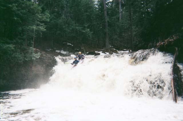
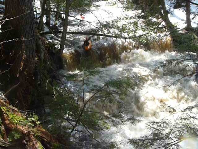
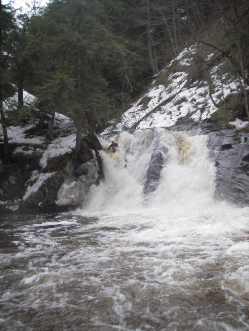
This lower run is completely different in character, and a serious notch up in difficulty and potential consequence, compared to the upper. The majority of the drops are ledges and slides. Many verticals land in shallow pools, making a good 'boof' mandatory. Transverse splines of rock often divert water (and boaters) diagonally across the river. The river twists and turns in an ever deeper canyon, often making scouting or portaging difficult to impossible. In particular, the walls around the final drop (Slate River Falls) are quite steep, and as water levels rise, there will be precious few eddies before the falls.
It is strongly advised that all boaters (before putting on the river) hike a trail up the river-right ridge (from the parking area at Skanee Road) to have a look at Slate Falls and its approach to:
(a) make sure it is clear of logs and snags (logs which had crossed the whole face of the falls for years 'disappeared' during 2003 -- how long it will remain clear is anyone's guess!),
(b) make a decision about if and how they plan on running it, and
(c) firmly implant an image in their brain of the approach to the falls, that they will recognize it when they approach it on the river.
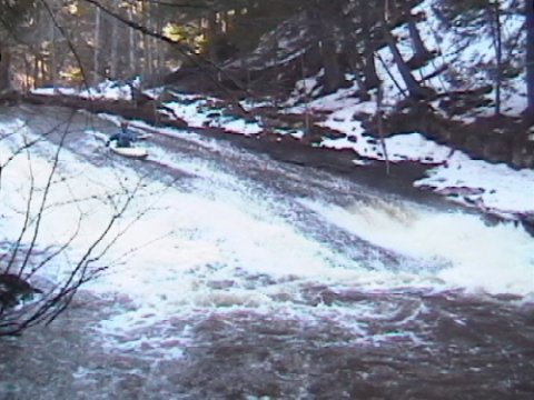
If you choose not to run the canyon section, the easiest option is to take out (river right) directly after Smooth Creamy Thigh, a delightful 40' slide dropping about 15' (See 'slide' photo). As the river twists to the right, it drops deeper and deeper into the canyon, and the walls get increasingly steep. The further downriver (toward Slate Falls) you go, the higher and steeper your climb out will be if you are not running the falls. There is a path around the entire canyon section, high on the top of the ridge.
Driving Directions: From downtown L'Anse, MI, head northeast on Skanee Road 11 miles to Arvon Road. Turn right (south) and proceed 2 miles to a crossroad. Turn left (east), and proceed to the river. (Note: when DeLorme's and other maps show this road going through the river, take that quite literally. There is a 'ford' in the stream, which obviously will be impassible in times of high water. Not a problem, since you are only going TO the river.)
Shuttle Information: Length (each way): 3 miles, Estimated Time (each Way): 7 minutes
Check out this helmet-cam video of the run: _Lower Slate_
The following (long) video shows a good number of the falls at low water (which gives you a great view of the geology which you'll be dealing with). It's cued to start at the base of Slate River Falls. You may wish to click the timeline to skip forward a bit here and there, or click the YouTube gear icon to select 'Playback Speed' and bump it up to 1.5 or 2.0 times normal. _Hiking up Slate River_
Rapids in this Run (3)
Waterfalls (2)
Difficulty
Class III-IV(V)
Length
2.4 mi
Gradient
117 ft/mi
max 166
Rapids
3
Access Points
Difficulty Classes
I Easy
II Novice
III Intermediate
IV Advanced
V Expert/Extreme
VI Unrunnable
Current Conditions
5-Day Forecast
Whitewater data from
American Whitewater
American Whitewater