Camp Nine to Parrot's Ferry
Linked via: Proximity 94% confidence Synced 6mo ago
Gauge Conditions
Runnable: ? – ? CFS
Approximate reading: This gauge is 0.1 miles away on Stanislaus. Use as a general reference only.
Data from American Whitewater & USGS
CDEC Flow Data California
Data from California Data Exchange Center (CDEC)
Run Map
Run Time Estimate
Select put-in and take-out to estimate time.
Unlock Advanced Trip Planning
See wind-adjusted speed maps, forecast planning, and detailed time estimates.
Sign in to generate an AI timing estimate for this run.
Whitewater timing varies with scouting, portages, and group pace. Use as a planning baseline.
Description
The fight to stop the construction of New Melones Dam and to save this section of the Stanislaus failed, but it did lead to the founding of Friends of the River and a strong river conservation movement in California.
When the reservoir drops low enough to reveal parts of this river, it is worth paddling again to experience the beauty that is still there and to contemplate what it was once like. Monitor the reservoir levels at New Melones on the CDEC website. Compare the reservoir elevation with the elevation markers on the map tab, to get an idea of how much river you can paddle at that level.
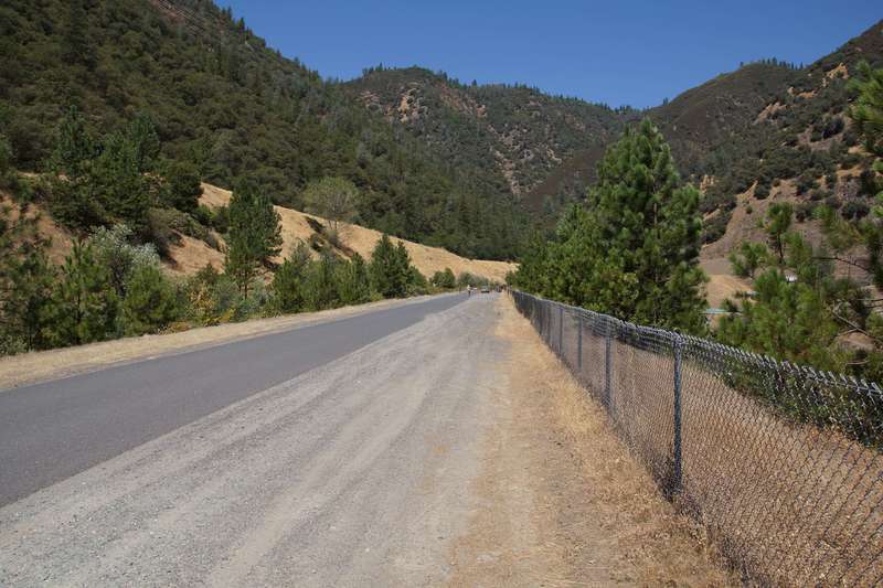
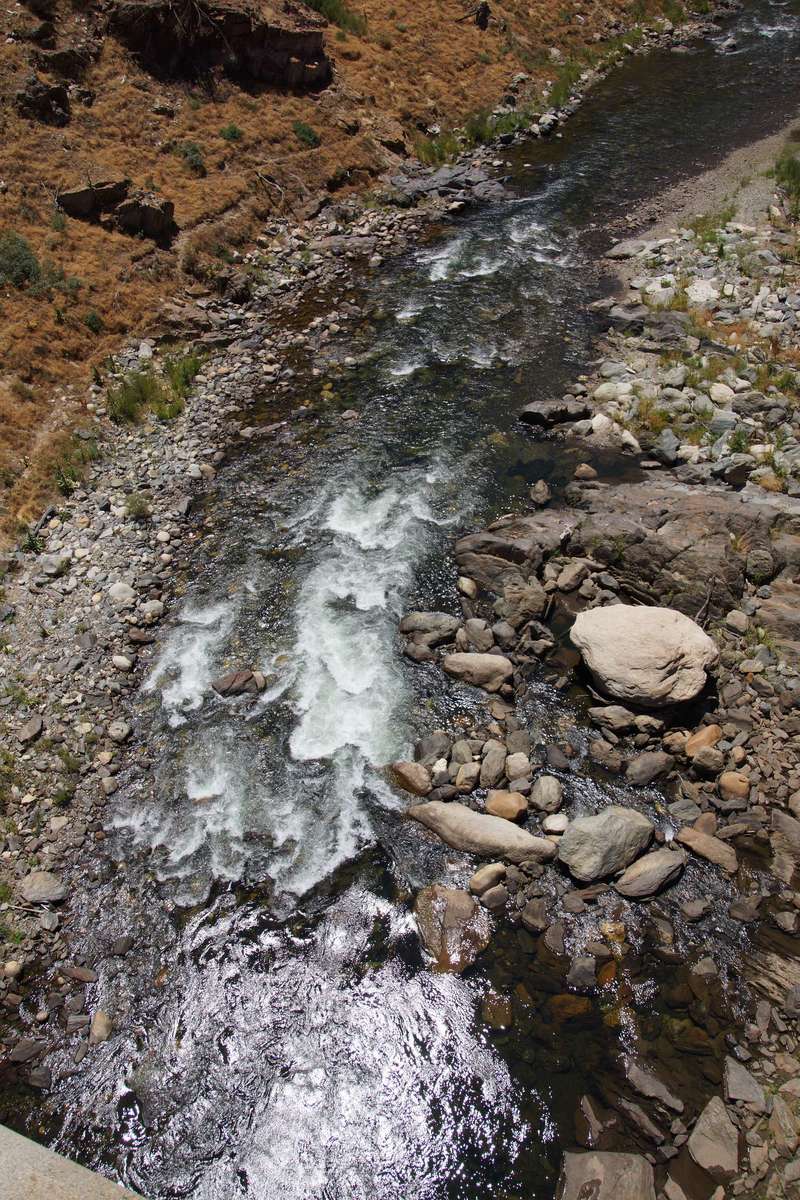
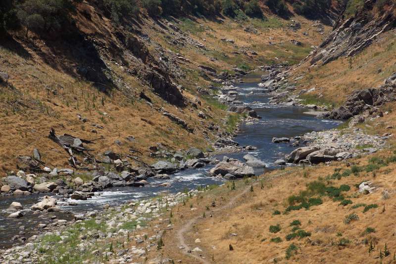
Put in: Elevation at the powerhouse is about 1080 feet. There is plenty of parking at the end of the road near the new powerhouse, however access to the river in this area could be difficult for rafters. There are use trails that provide reasonable access for kayakers. There is an old railing system for sliding rafts down to the water next to the remains of the old Camp Nine bridge. This is about 1 mile downstream of the end of the road and there are several rapids in between.
The Camp Nine road is a one lane, paved, heavily patched, twisty road that is not county maintained. Allow extra time for this drive. The junction with Parrot's Ferry road is not well marked.
Take out: The old Parrot's Ferry Bridge is just above 800 feet elevation. However, this road is gated at the top, so it is about 3/4 of a mile to hike up from the reservoir to the highway. There is space for quite a few cars near the gate at the junction of the old road with the new road. The old road down to the old bridge is reported to be in very poor condition due to lake wave action. The chief park ranger at New Melones wrote, "Paddlers may hand carry boats and equipment from Parrotts Ferry up to the road, but the access gate will not be open to vehicular traffic this season due to safety concerns surrounding the current state of deteriorated road conditions. We are currently exploring the options associated with improving the road condition if the drought will be long term. It may be suitable for kayaks to carry out, but rafts would be quite the chore as the distance is considerable. I recommend that rafts be towed out by motorboat to either the Glory Hole Boat Ramp or the Mark Twain Day Use Area. New Melones Lake Marina may have rental motorboats available in order to help facilitate rafting party tow outs."
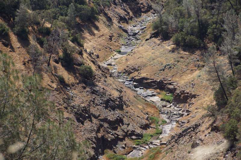
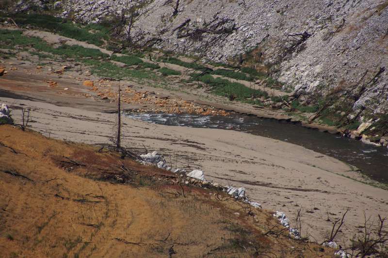
Silt: Each year that the river is underneath the reservoir it fills in with sand and silt. Each day that the river flows and is exposed above the reservoir it steadily erodes the sand and silt. With time, the streambed is cleaned out, though terraces of sand will remain on the each side. However, all the sand and silt that are erroded from the streambed are deposited where the river meets the reservoir. So, as the reservoir drops, the last mile or two or more of river will have a shallow sandy bottom rather than a deep rocky bottom. Generally, the closer to the reservoir you get, the more spread out and shallow the river will be. The last few hundred yards will be the worst. As the current slows down, the sand and silt drop out forming a watery mud. If your boat gets stuck, you can't really stand in the muck to push as much as anchor yourself. Then you have to kind of swim/crawl to move along. If you pick the right currents to follow and stay in deep enough water, you might get through with out getting stuck. But odds are you will get stuck a few times before reaching the lake water.
FERC Information: The Stanislaus powerhouse, is part of FERC No. 2130, Spring Gap-Stanislaus Hydroelectric Project. The FERC license issued April 24, 2009 requires that PG&E publicly post flow information for the river below the Stanislaus Powerhouse.
Other Information Sources:
See Bill Tuthill's CA Creeks page: http://cacreeks.com/stan-c9.htm
Don Briggs video from before the flooding: https://www.youtube.com/watch?v=nQ-UM6Gzz7c
Stanislaus River Digital Archive
Stanislaus River Basin pdf schematic of reservoirs, diversions, powerhouses and gauges. USGS 11299000 NEW MELONES RES NR SONORA CA
CDEC New Melones
Bureau of Reclamation: New Melones
Map of New Melones area and facilities.pdf
New Melones Lake Marina at 209-785-3300 or http://houseboats.com/new-melones-lake/.
Water in New Melones is used by Oakdale Irrigation District, South San Joaquin Irrigation District, and also for other downstream uses.
Rapids in this Run (12)
 Rapid
Rapid
Parking area near Stanislaus Powerhouse
 Rapid
Rapid
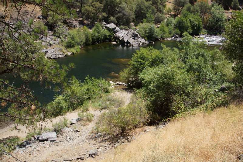
Beach Access
 Rapid
II
Rapid
II
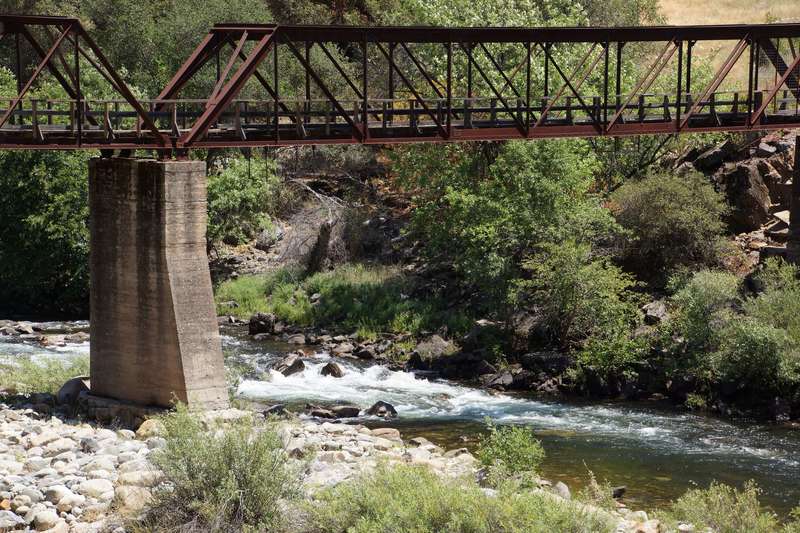
Old Pedestrian Bridge
Rapid
1040 feet elevation
 Rapid
II
Rapid
II
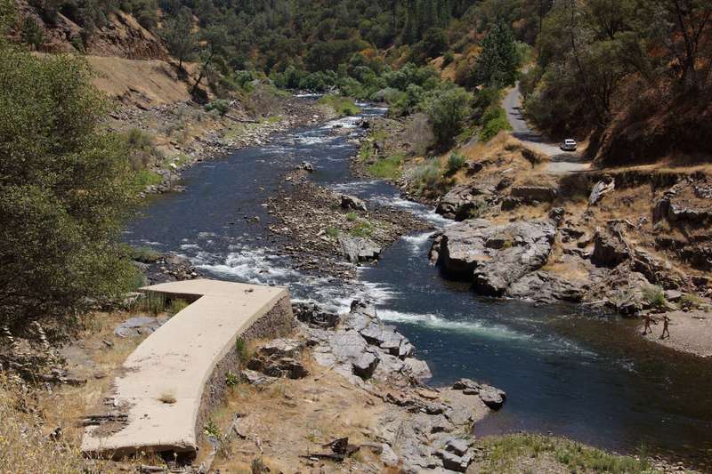
Old Camp Nine Bridge Remains
 Rapid
Rapid
New Camp Nine Bridge
 Rapid
II+
Rapid
II+
1000 feet elevation
 Rapid
Rapid
Rose Creek - 960' elev.
 Rapid
I
Rapid
I
Rapid
 Rapid
Rapid
920 feet elevation
Rapid
880 feet elevation
 Rapid
Rapid
840 feet elevation
Difficulty
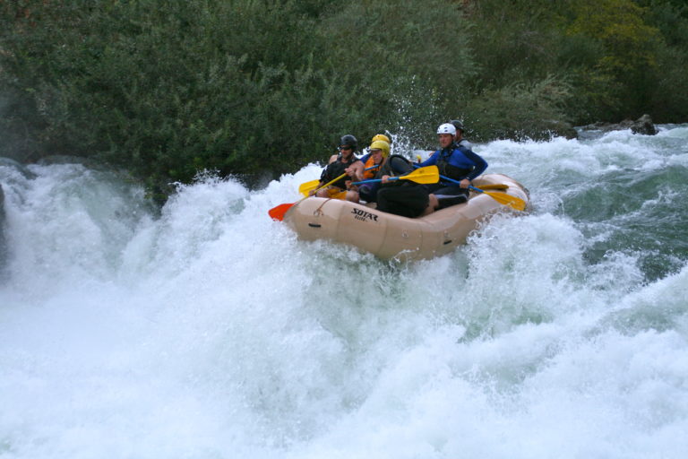
Class III
Length
9.3 mi
Gradient
31 ft/mi
Rapids
12
Access Points
Difficulty Classes
I Easy
II Novice
III Intermediate
IV Advanced
V Expert/Extreme
VI Unrunnable
Permit Required
No permits are needed for this section.
Current Conditions
5-Day Forecast
Whitewater data from
American Whitewater
American Whitewater