Canada Mills to Wachusett Reservoir
Linked via: Proximity 99% confidence Synced 6mo ago
Gauge Conditions
Runnable: 8.1 – 10.5 FT
Data from American Whitewater & USGS
Run Map
Description
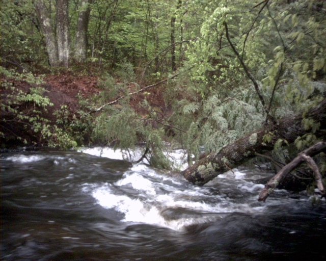
The Quinapoxet is a delightful II/III stream located in Central Massachusetts approximately seven miles north of Worcester, getting its start in the hills northwest of Worcester and draining into Wachusett Reservoir.
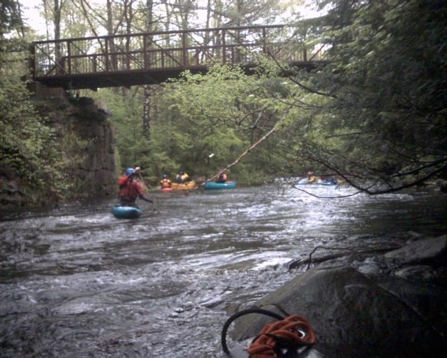
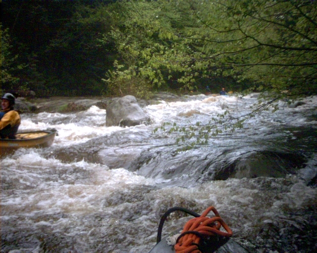
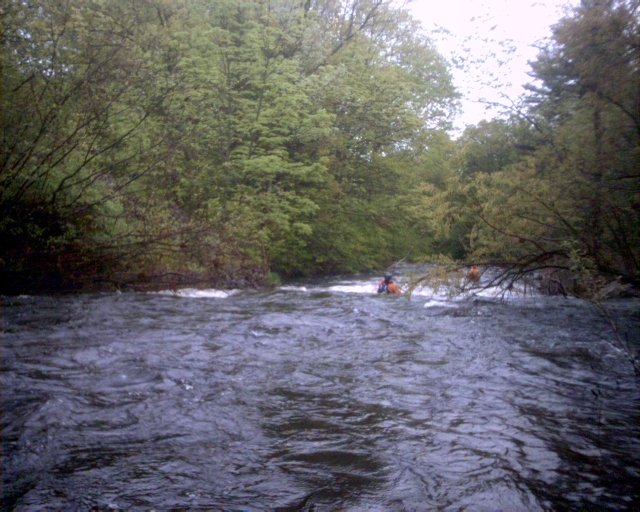
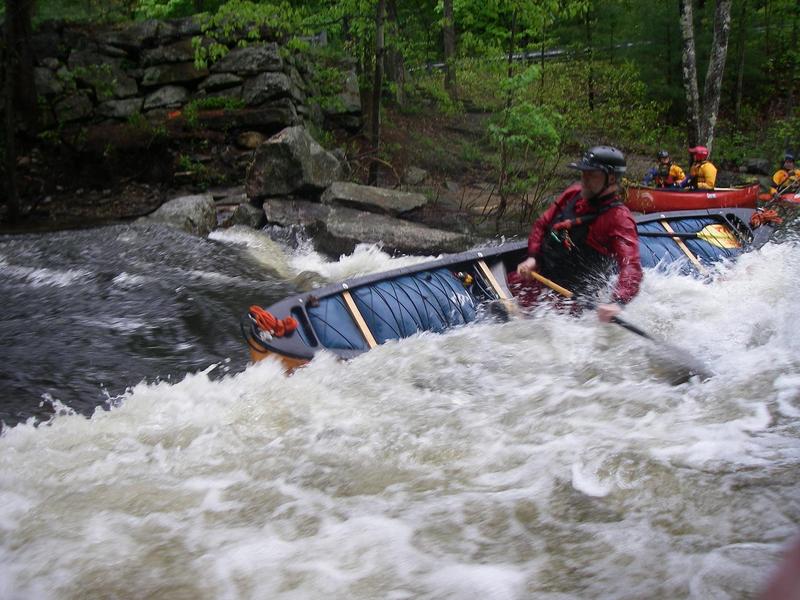
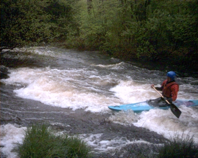
The run is class II for the most part except for an longish class III stretch past the remains of the 19th century Springdale Mill; plus an abrupt three foot drop just downstream of the I-190 crossing.
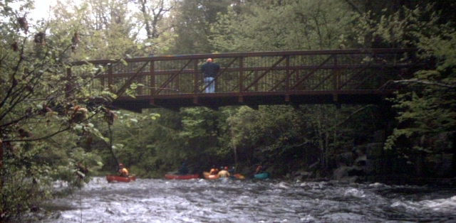
The Wachusett Greenways Section of the Mass Central Rail Trail runs along the river for the majority of the run.
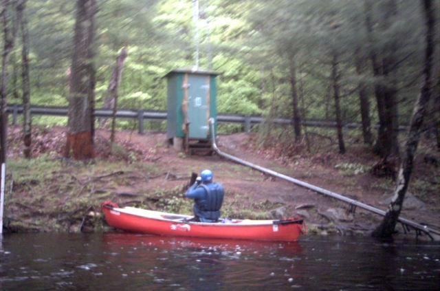
Put-on a few feet downstream of the gage. There is a wonderful surfing wave located at the put-in. From then on it is a combination of quickwater to class II down to the mill. After that the pace picks up a bit for the second half of the run.
### Technical info
```
Put in elevation........553'
Take out elevation......447'
Total drop..............96'
Average drop/mile.......38.5'
Distance................2.75 miles
River width average.....20' ???
River geology...........???
River water quality.....Good, clarity neutral to good.
Scenery.................Woods, some old mill and dam ruins being
covered up and overgrown.
Wildlife................???
```
### Amenities
```
Nearest Gas.............Intersection of Routes 31 and 122A in Holden.
Convenience Store.......Route 31 by the Manning Street Intersection
north of Holden.
Nearest Restrooms.......None near by.
Camping.................??
Restaurants/Pizza/etc...??
```
### Regional Weather
Go here for a NOAA weather forecast.
Local Map - Quinapoxet River and surrounding area of Holden and West Boylston
_Map of Holden, West Boylston, and area surrounding the river.__Map courtesy of Mapquest_
Rapids in this Run (6)
Playspots (2)
Hazards & Portages (1)
Caution: The following locations may require scouting or portaging. Always check current conditions.
Difficulty
Class II-III
Length
2.9 mi
Gradient
38 ft/mi
max 100
Rapids
6
1 Hazard
Access Points
Shuttle Info
### Take-out - From the North or South
Take Route 2 (from north) or the Mass Pike/I-290 (from south) to Interstate 190 exit 5 north of Worcester (Route 140 exit). Take Route 140 south approximately 1 mile. Continue **_straight_** onto Thomas Street when Route 140 turns left. Approximately 1/3 mile down Thomas Street turn right on River Road. There is a flatwater take-out on the right near the intersection of Thomas and River; the whitewater take-out is one-half mile up where the river runs next to the road.
### Take-out - From the East
Take Interstate 495 to Interstate 290 in the Hudson/Marlborough area. Follow I-290 west to Exit 23B in Boylston (Route 140). Take Route 140 north 4.8 miles to the Routes 140/12 Intersection (Route 140 turns right here). Continue **_straight_** onto Central Street (ie, get off Route 140). Follow Central Street, which becomes Crescent Street (after crossing Goodale Street), for 0.85 miles. Then continue straight onto Thomas Street when Crescent Street bears left. Turn left 0.9 miles up Thomas Street onto River Road. There is a flatwater take-out on the right near the intersection of Thomas and River; the whitewater take-out is one-half mile up where the river runs next to the road.
### Put-In
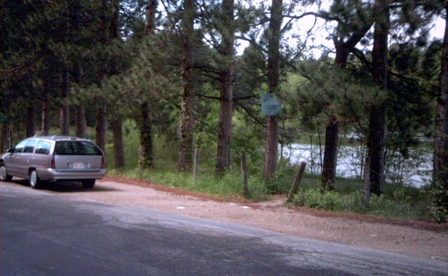
From the take out, follow River Road along the river which becomes River Street after passing under Interstate 190. River Street turns right about 1.5 miles from the put-in where it meets Harris Street. The Put-in is about 200 feet beyond this intersection just past the River Street Bridge and a few feet below the gage. There is a small roadside parking area for the rail-trail and for river access.
Difficulty Classes
I Easy
II Novice
III Intermediate
IV Advanced
V Expert/Extreme
VI Unrunnable
Current Conditions
5-Day Forecast
Whitewater data from
American Whitewater
American Whitewater