Canoga Rd to Turnpike Rd
Linked via: Proximity 99% confidence Synced 6mo ago
Gauge Conditions
Runnable: 400.0 – 1,800.0 CFS
Data from American Whitewater & USGS
Run Map
Description
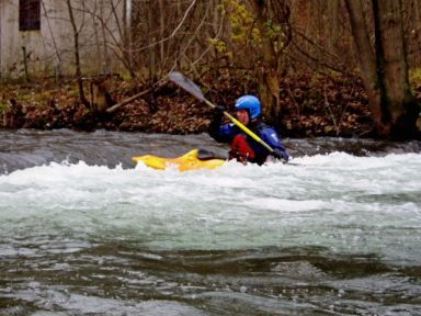
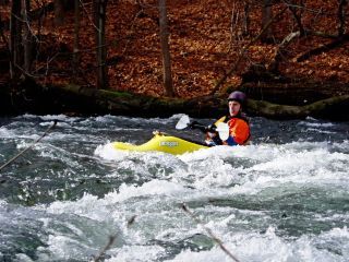
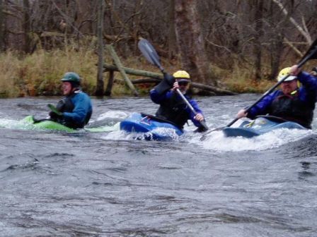
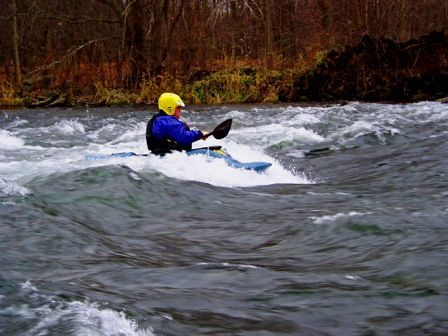
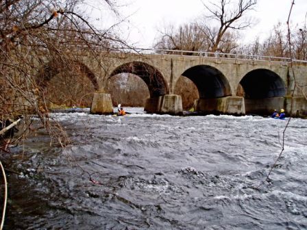
The Owasco River originates at the North end of Owasco Lake. The river is initially navigable to the first dam but then flows through an industrialized section of Auburn where downstream flows are used and regulated by Auburn Hydro. The river becomes navigable again at Wadsworth Street, upstream of the suggested put-in at Canoga Road. The Turnpike Road takeout, 3 miles downstream, is also the beginning of a pleasant, 4.5 mile class 2 section through remote woodlands and valleys to the Village of Port Byron, from here, continuing downstream at class 1, the Owasco meanders to the Seneca River and a State Boat Launch site at Mosquito Point.
ACCESS:
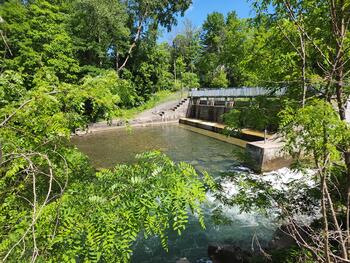
Put in: Canoga Road bridge. Auburn does not currently provide public access to the Northern Navigable portion of the river that AW paddlers use, although they (?) support it in the Auburn Greenway Trail & Auburn Comp Plan . The property owner at the Canoga Road put-in ( all 4 corners) has been known to assert his authority by physically moving paddlers vehicles or challenging paddlers who do not contact him before accessing. Please park on the public right-of-way being sure not to block his driveways or just call his number (on little sign in front of old factory) and say you're paddling. Also there have been several citations issued to paddlers using this section because clarification of the Auburn City Code may be needed. Auburn Code 234-11-C
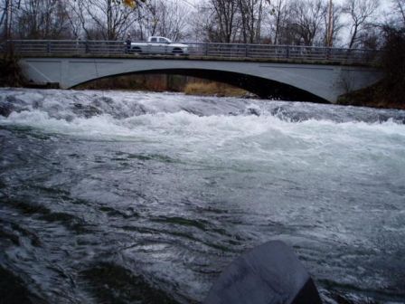
Take out: Turnpike Road bridge-current access is a herd path with parking on the shoulder suitable for 3-4 cars. Cayuga County possesses all 4 corners inclusive in a 400+ acre parcel acquired from NYSEG with a requirement that it remains "open land". Discussions about better parking/access here have progressed to the County Planning Level with support from local Town Boards and County Legislator Dave Axton commenting, "..Let me speak to some people but i guarantee you it would need to be built to spec.."
HAYDEN ROAD-current access is also a herd path with limited roadside parking however, excellent public access potential exists on lands with ownership disputed between the deeded landowner and NYSDOT. Parcel Id# 87.00-2-76 at Cayuga GIS Maps This is near the northern terminus of the 400+ acre County Land and the beginning of the class 1 section flowing into Port Byron.
ENVIRONMENTAL ISSUES:
TRASH
Currently there is trash all over the entire stretch ranging from shopping carts and TV's, to tires, old boats, and more. Although local assistance has been requested for disposal there has been no help. A small volunteer group is forming for removing the debris from the river.
STRAINERS
This river is a floodway and maintenance as established by DEC, falls on the local towns. A small volunteer paddling contingent has been actively removing hazardous strainers from Auburn-Port Byron following published AW guidelines; there has been favorable contact with local officials and DEC Officers.
STEWARDSHIP
The River downstream from Turnpike Road flows through a unique, undeveloped and primitive section where many species including Mink, Fox, Beaver, Fish, Waterfowl, Eagles, and more are routinely seen. It wanders through a wooded valley along exposed gypsum formations. Fortunately, it is mostly included in the 400 acre County Parcel Id# 101.00-1-7.1 at http://71.176.110.94/par\_cayuga/
Auburn City Code chapter 234- 11 reads as follows:
#### § 234-11. Indecent exposure; restrictions on use of Owasco River.
A. Immodest exhibitions. No person shall publicly make any indecent, immodest or immoral exhibition or exposure of his or her person, or of any animal or thing, or cause or procure any other person so to do.
B. Swimming in public places. No person shall swim or bathe in the Owasco River. No person shall swim or bathe in any other raceway or canal or public place, unless his or her person is covered by a proper and sufficient garment or bathing suit, so as not to expose his or her private parts, including the breasts of a woman, or remove his or her clothes for the purpose of putting on such garment or bathing suit preparatory to bathing during the daylight hours, unless within a tent, building, or other concealed location.
C. Rafting and boating on Owasco River. No person shall engage in tubing, rafting, boating or similar activities north of the Mill Street Dam on Owasco River in the City of Auburn.
AW information about New York navigation laws
http://www.americanwhitewater.org/resources/repository/New.York.Navigation.pdf
http://www.protectadks.org/data/content/view/137/1/
Boaters who had trouble on the river and required rescue have been cited.
Forum Discussion about Owasco River: http://www.americanwhitewater.org//content/Forum/read/send/25,26877/
Conservation Club
Syracuse Area Runs:
Butternut Creek Chittenango Creek (Cazenovia)
Chittenango Creek (Chittenango) Fish Creek E. Branch (Taberg)
Limestone Creek (Edwards Falls) Oriskany Creek (Oriskany Falls)
Oriskany Creek (Clinton) Owasco River (Outlet)
Salmon River (Section 1) Salmon River (Section 2)
Finger Lakes Area Runs
Bowman CreekCascadilla Creek Canandaigua Outlet
Canaseraga Creek Canisteo Cayuga Lake Hole
Cayuta Creek Conesus Creek Fall Creek (1.)
Fall Creek (2.)Fall Creek (3.) Great Gully Creek
Honeoye CreekIrondequoit Creek Keshequa Creek
Keuka Outlet Lock 32 Whitewater Course Owasco River (Outlet)
Salmon Creek Sixmile Creek Sugar Creek
Taughannock Creek (1.) Taughannock Creek (2.) Trumansburg Creek
Vanbuskirk Gulf
Google Map of New York Whitewater
New York Whitewater Paddlers Facebook Group
Rapids in this Run (1)
Waterfalls (1)
Playspots (6)
Hazards & Portages (2)
Caution: The following locations may require scouting or portaging. Always check current conditions.
Difficulty
Class II(III)
Length
3.1 mi
Rapids
1
2 Hazards
Access Points
Difficulty Classes
I Easy
II Novice
III Intermediate
IV Advanced
V Expert/Extreme
VI Unrunnable
Current Conditions
5-Day Forecast
Whitewater data from
American Whitewater
American Whitewater