Cedar Creek Rd near Johnson School Rd to Bells Mill Rd (12.2 miles)
Cedar Creek (Floyds Fork trib.)
Linked via: Nhdplus discovery 90% confidence Synced 6mo ago
Gauge Conditions
Runnable: 1.3 – 2.0 FT
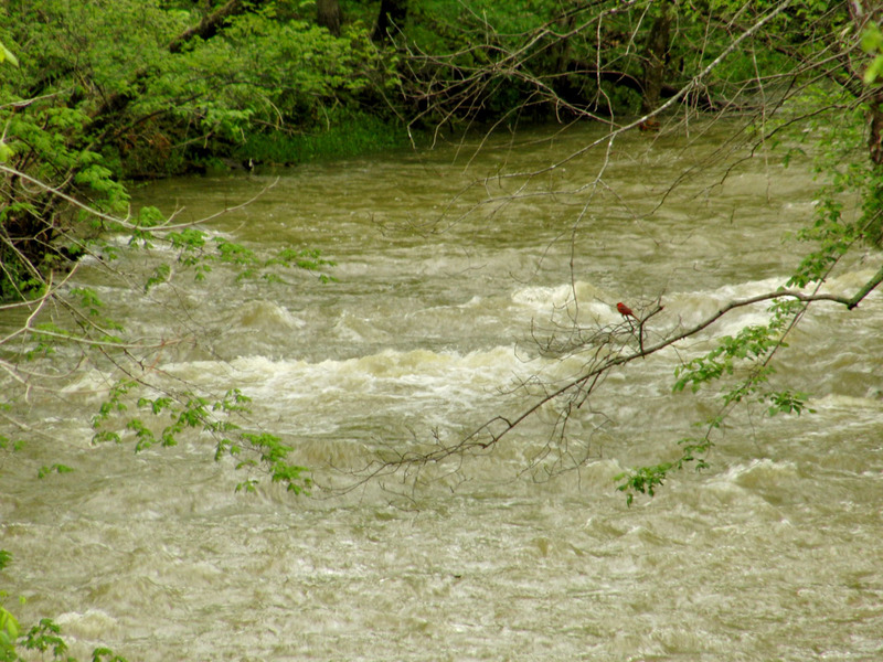
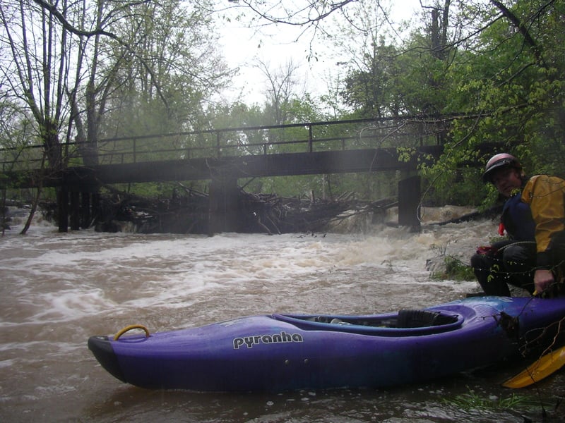
So shallow you might have to get out a few times, but at 30 CFS we had a fun scenic time and even found some whitewater.
Data from American Whitewater & USGS
Run Map
Description
NOTE: Cedar Creek Road goes over Cedar Creek twice. To clear up any confusion I will either call the road Cedar Creek Road (near Zoneton Road)-the put in for the main WW stretch, or Cedar Creek Road (near Johnson School Road)-the put in for upper Cedar Creek.
ALSO NOTE: I noticed the gauge doesn't seam to update perfectly on AW, and so always check the level here: http://waterdata.usgs.gov/ky/nwis/uv/?site\_no=03298250&PARAmeter\_cd=00065,00060,00062 before heading out to the creek.
Main WW stretch:
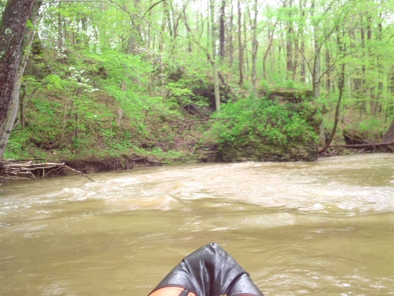
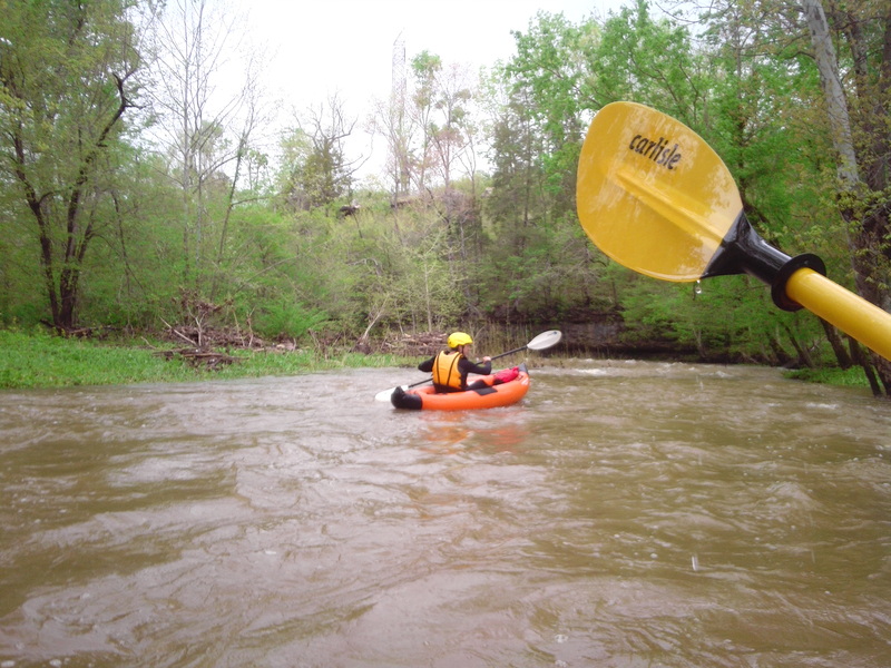
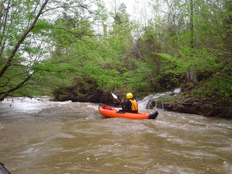
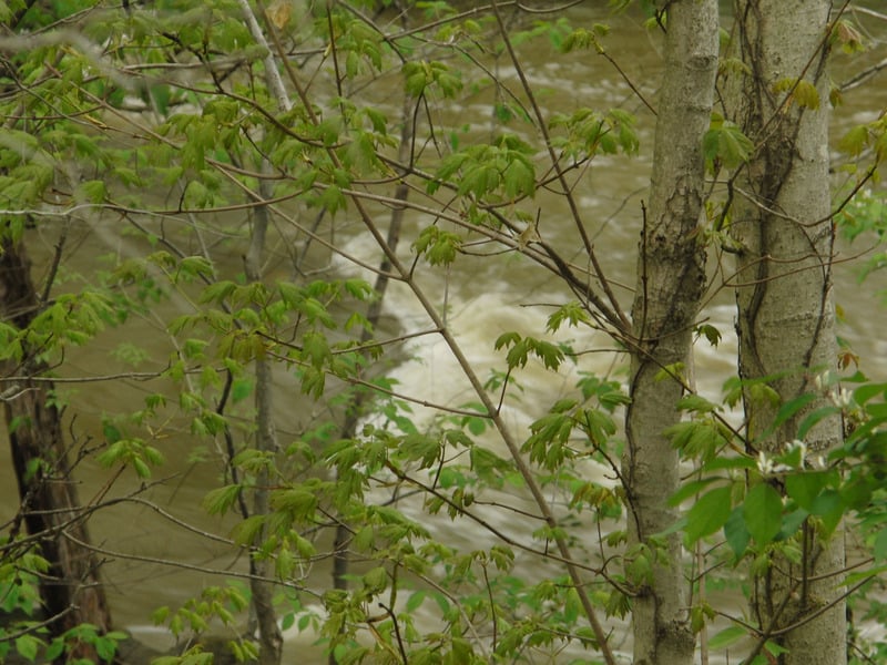
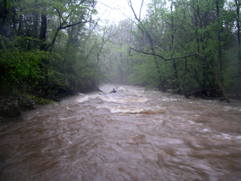
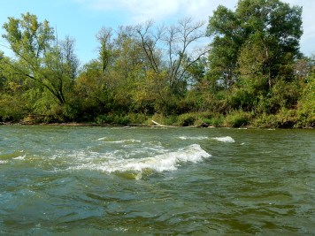
The heart of this creek lies between Cedar Creek Road (near Zoneton Road) and Zoneton Road and I will refer to this section as the "main WW stretch". In this 2 mile stretch there are 3 class II rapids, a few surf waves, and a few 1+ rapids. The parking at Cedar Creek Road (near Zoneton Road) and Zoneton Road is great, just pull off to the side of the road and park. I have run this stretch 7 times. It can be run as low as .78 feet/30 CFS, but it will be so low you'll have to get out in a few palces. I have found 1.3 feet to be a good minimum, 1.5 is great, and 1.7 is even better. Just recently (Feb 2018) I ran it at 2 feet and it was amazing. There were two surf waves before the entrance rapid, and all the 1+ rapids turned in to II's. Eddys were still available for all the scouting.
Scenic Section:
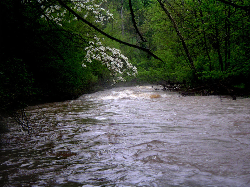
A great way to add some miles to the main WW stretch is to put in a Thixton Road. From Thixton Road to Cedar Creek Road (near Zoneton Road) there is some great scenery, and so I refer this section to as "the scenic section". There are rock walls for most of that stretch and there are very large boulders in the middle of the creek that you have to maneuver around. There are also lots of small waterfalls on this run, none of which are over 15 feet tall, but they still add to the scenery. At one spot right before Cedar Creek Road (near Zoneton Road) you can see three waterfalls at the same time. This run is 20 FPM but doesn’t really seem like it except for the fact that it has a good flow to it.
Stave Mill:
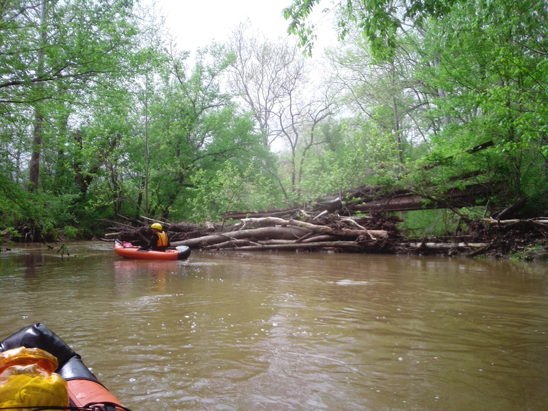
Another way to add a tiny bit more mileage to the main WW stretch is to park at Stave Mill Road. Between Zoneton Road and Stave Mill Road you will find a nice rock wall on river left that creates some nice wave trains, but CAUTION: it's undercut and it sucks you towards it, keep a safe distance away from it!!!! The creek is narrow in this section and I've seen a big creek-wide strainer here before, but the last time I ran it(8-26-2017), it was gone.
Lower Cedar Creek:
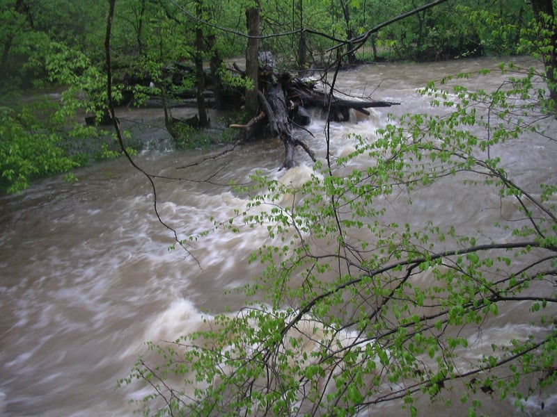
Below Stave Mill Road is some more rapids, like one we call Man Made Rapid: a bunch of large rocks that span the creek which look like someone put them there. The last time I tried to run this section, Floyds Fork was so high that it backed up almost all the way to Stave Mill Road. I refer to this section as "Lower Cedar Creek" and it's 12 FPM.
Upper Cedar Creek:
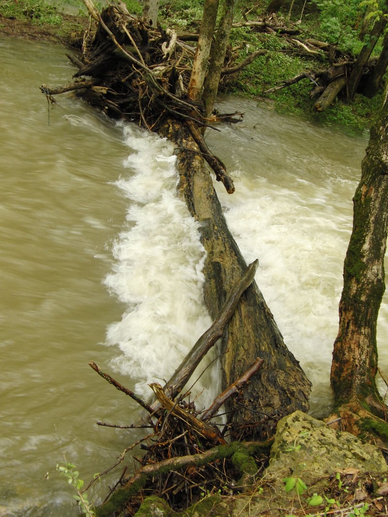
From Cedar Creek Road (near Johnson School Road) to Thixton Road is a cool run except for the amount of log strainers. I refer this stretch as "upper Cedar Creek" and it's 12.5 FPM. The only time I have ever run the upper is when it looks like a bare minimum run from the Cedar Creek Road (near Johnson School Road) bridge. I would exercise extreme caution if you choose to run the upper at any sort of high level, and I personally do not recommend doing such. Check out the photo of the strainer on upper Cedar Creek at 2.1 feet. I recently hiked downstream from Independance School Road and saw 3 massive deadly creekwide strainers, and I remember having to do constant portages in that area in the past.
FAQ:
\\* How is the water quality? - Poor due to the wastewater treatment plant at the beginning of the run. It's not too bad, not anywhere as bad as some of Louisville's creeks, but I recommend a nose plug.
\\* Is it good for beginners? - That all depends on what the level is, what section you run, and how much of a beginner are we talking here. The scenic section would be good for beginners with some decent boat control. The main WW section has two rapids that require good maneuvering. The entrance rapid is one, and The Cove rapid is the other. This creek is hard to maneuver in because it's so narrow and has so many tight turns. We used to run upper Cedar Creek at very low levels and scrape down it. As long as it's barely running, it's pretty darn safe. You can get a better idea what the rapids will look like on the upper from the Fairmont Road bridge. The absolute minimum of .78 feet on the main WW stretch should be ok for beginners since you can get out of your boat whenever you want it's so low.
\\* How much rain does it take to get it running? - If the ground is already saturated, half an inch could make it runnable. Usually it takes an inch of rain. During the summer if it rains an inch it will rise and fall rapidly. There is a slight delay in the gauge after it rains; the first time I ever went to run the main WW stretch it had rained super hard and it took us 30 minutes or more to get to Thixton Road. It looked like it was running great but when we got to Cedar Creek Road (near Zoneton Road) it was practically bone dry. My brother thought it was a different creek and that I didn't know what I was doing, and we went home. Later I checked it out and it was the right creek, the water just hadn't got there yet, and it ended up running at 1.5 feet too. I have noticed after a heavy rain it can take as much as two hours for the flooded waters on Little Cedar Creek to get to the gauge on Cedar Creek at Thixton Ln. Note there is a visual MSD foot gauge at Thixton road. It's downstream from the bridge on river left.
\\* Can you run Cedar Creek above Cedar Creek Road (near Johnson School Road)? - Right before Cedar Creek Road (near Johnson School Road) is government owned property that is off limits to the public. You can see a sign that says so from the bridge. Bardstown Road to the government property looks to have a lot of strainers and not much action. I might do that run someday just to do it, but my guess is that it's not worth the effort.
Here is a video I made at .78 feet / 30 CFS: https://www.youtube.com/watch?v=7IjYjptXoGg
I wrote a trip report for one of our trips here: http://www.vikingcanoeclubforum.org/phpBB3/viewtopic.php?f=2&t=5637
Update: Feb, 2018: I ran Cedar Creek's main WW stretch to the Stave Mill parking spot at 2 feet. There were two great easy surf waves before the Entrance Rapid. All of the class !+'s were upgraded to II's just like I always thought they would be. I was gonna shoot some phone footage of Turtle Rapid(the easiest rapid of the run) and my friend yelled back "it looks crazy" so I immediately put my phone away lol. There is a lowhead driveway in the middle of the run but it was just a large creekwide standing wave with a little bit of ww crashing towards you. The Stave Mill section has a 20 foot tall cliff on your left, CAUTION: it's undercut and it sucks you towards it, keep a safe distance away from it, it's not Elkhorn Creek!!!
Rapids in this Run (4)
Playspots (5)
Hazards & Portages (6)
Caution: The following locations may require scouting or portaging. Always check current conditions.
Difficulty
Class II
Length
12.4 mi
Gradient
15 ft/mi
max 20
Rapids
4
6 Hazards
Access Points
Shuttle Info
To quickly get to the main WW stretch takeout there is two different ways to do it depending on where you're coming from.
From Preston Highway turn on Old Preston Highway and then turn on Zoneton Road (state hwy 1116). Either turn right on Stave Mill road, cross the bridge and park on the right, or continue on Zoneton Road, cross a bridge and park on the left.
From Gyne Synder I like to take the Beulah Church Road exit. Go south on Beulah Church Road until it dead ends with Cooper Chappel Road. Go left here. Go until you get to a stop sign turning right to stay on Cooper Chappel. The road turns in to Cedar Creek Road. Drive down it for quite a ways. It will make a gradual 90 degree right turn and then a sharp 90 degree left turn. After that the road will make another sharp 90 degree left turn. If you make that turn you will be on Thixton Lane. If you awkwardly go strait there you will stay on Cedar Creek Road. Drive until you cross a bridge and check out The Entrance Rapid from it. Keep going until it dead ends and turn right on Zoneton Road. Go until you get to the next major bridge parking on the right before the bridge, or keep going and turn left on Stavemill Road, go over the bridge and park on the right.
To get to Cedar Creek Road from Zoneton, just drive about 1 mile southeast on Zoneton and then turn left on a street with a brown picket fence next to it. I don't think there is a street sign.
Either park at the next bridge or continue on and turn right at the stop sign so that you are on Thixton Road which goes to a bridge. Go across the bridge and turn right and ask the neighbors if you can park there.
Difficulty Classes
I Easy
II Novice
III Intermediate
IV Advanced
V Expert/Extreme
VI Unrunnable
Current Conditions
5-Day Forecast
Whitewater data from
American Whitewater
American Whitewater