Clare Road to Downerville
Linked via: Nhdplus created 95% confidence Synced 6mo ago
Gauge Conditions
Runnable: 1,100.0 – 6,000.0 CFS
This range of flows is based on a recommendation from Squires' book. The upper limit of the range is a rough guess.
Data from American Whitewater & USGS
Run Map
Description
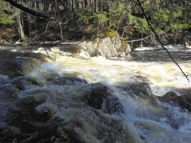
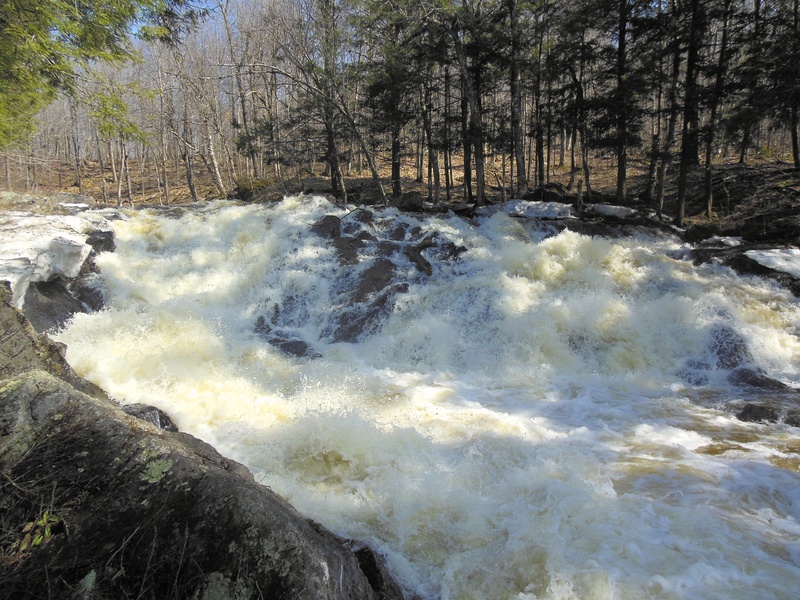
Most of this run is II-III, according to Squires' book, broken up by 40-50-foot Harper's Falls about 3 miles downstream of the Clare Road putin. Squires also points out that, if this is running, some of the V runs in the area will also be going.
The start of the section begins with a flatwater section that turns into mostly read and run class III wavetrains while dumping elavation before Harper's Falls. After the falls, there is one class III ledge followed by some class II/III wavetrains with some flatwater inbetween to finish off the run.
It is important to scout for wood, especially in early run off periods.
A longer section can be paddled if you head past Downerville take out and enter into the main section of the Grass and head down to the Russel take-out.
For a quicker paddle, which leaves out the upper section above Harper's Falls is possible too. For this section, when leaving the Downerville Take out, make a right and travel along the dirt road for 2-3 miles. On your right will be a DEC parking area with a yellow gate. Park here and hike (.5miles) along the trail to Harper's Falls, where you can put on and paddle the lower section.
Canton - Cranberry Lake Area Reaches
Boland Creek Elm Creek
Grass (1. Lampsons Falls to Downerville) Grass (2. Downerville to Russell)
Grass (3. Morley to Massena)Grass (4.Woods Bridge Road to Route 47)
Grass, Middle BranchGrass, North Branch
Grass, Upper South BranchGrass, Lower South Branch (Twin Falls)
Oswegatchie, E. Branch (2.)Oswegatchie, E. Branch (3.)
Oswegatchie, W. BranchPlumb Brook
Google Map of New York Whitewater
New York Whitewater Paddlers Facebook Group
Rapids in this Run (1)
Waterfalls (1)
Hazards & Portages (1)
Caution: The following locations may require scouting or portaging. Always check current conditions.
Difficulty
Class II-III(V+)
Length
3.7 mi
Gradient
35 ft/mi
Rapids
1
1 Portage
Access Points
Shuttle Info
Squires also suggests that very adventurous paddlers might want to put in 2.5 miles upstream, near the camps about Pelky's Falls (another big drop, which would require scouting). See new section on Gleason Rd. to Clare Rd.
Put in at Clare Rd. bridge (3.8 m. south of Russell-Pierrpont Turnpike, 4 m. north of Middle Branch bridge). Squires suggests putting in north of the bridge at a town building; saves some flatwater.
**Take Out:** (same take-out as running Lampson-Downerville) On Route 24 just north of the town of Russell boaters will see a NY state sign for Downerville, a no-longer existent town at the confluence of the N. branch of the Grasse with the Main branch. Coming from Russell, turn right (SE) onto dirt/gravel Donnerville road, this is just before a Transportation facility center, Continue on Donnerville road until you see an old cemetary on left, take the next right. Follow along the beaver pond, staying right at the fork then downhill to confluence. It is about a mile and a half from main road to take-out.
The road is shown on the map is in the wrong spot and is actually above the confluence of the north and main branches not below.
Difficulty Classes
I Easy
II Novice
III Intermediate
IV Advanced
V Expert/Extreme
VI Unrunnable
Current Conditions
5-Day Forecast
Whitewater data from
American Whitewater
American Whitewater