Clear Creek Springs to Wasioto (1 mile)
Linked via: Nhdplus discovery 90% confidence Synced 6mo ago
Gauge Conditions
Runnable: ? – ? CFS
Approximate reading: This gauge is 3.6 miles away on Clear Creek. Use as a general reference only.
Data from American Whitewater & USGS
Run Map
Description
I left the original entry below unedited to preserve the beta for the section mentioned. In 2024 I scouted this area to look for a decent paddling experience and I believe there is more to this run than just the 1 mile listed starting at the college. Upstream from the college is KY190 with a bridge crossing Clear Creek with a quiet area for parking without encroaching in the college grounds. There is a walking/biking trail all the way to the golf course, which adds about 1.7 miles to the run for a total of 2.8 miles. Some bedrock features and large rocks, although smaller feautures than downstream. Very scenic and easy section! Additionally, there is a completely unmentioned stream Little Clear Creek which creates a confluence with clear creek just before you enter the gorge section. Little Clear has a significant drainage area and many very awesome boulder gardens. The put in for this section is south of the college on Little Clear Creek road at the first bridge on your left as you head into the WMA. Some private property adjacent this creek but still affords beautiful scenery and features. Little clear again adds about 2 miles to the run for 3 miles total. Caution as there is a rather large undercut tree where little clear meets KY190 just before the college.
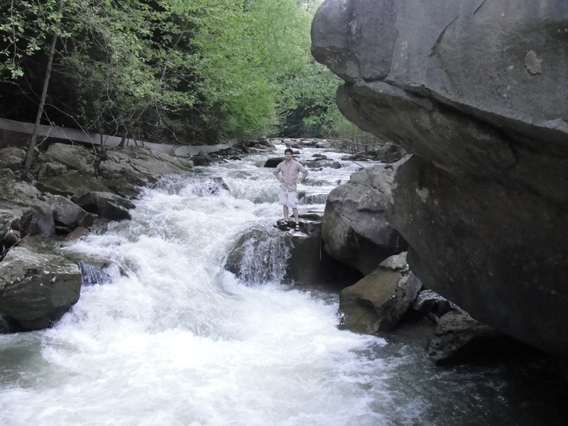
The run starts on the campus of Clear Creek Baptist Bible College. The put-in is right below a small bridge on Holly Hill Road. The first stretch runs behind a large dorm building, until the Clear Creek confluences with the Little Clear Creek. This is the first rapid on the stretch, Genesis (II). This one is a 100 yard section of small drops and ledges, nothing over 2 or 3 ft. After Genesis the Creek enters the gorge section, and is surrounded by rhododendron and Hemlock trees. The class II boogie continues until about 100 yards after the first rustic bridge.
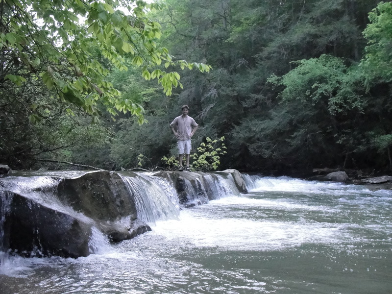
A horizon line will appear, this is where you would want to get out and scout the rapid and the bridge after the rapid for wood and a good line. Chutes and Ledges (IV), is made up of three rapids very closely spaced. The first is a 3-4ft river-wide ledge, this one can be run in most places, but river-left would be best for lining up the next drop. The second drop is a channeled chute between the mountain and some boulders. It can be run straight down the middle. The last drop is similar to the second but wider and less uniform. The chute is best run slightly right of center to avoid the meat of the hole that is formed. After this rapid is a short, swift moving flat section leading to the pool above Gilligan's Island.
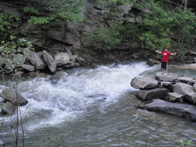
Gilligan's Island (III+) is formed by a rubble dam that is blocking 90% of the creek, except for a 10ft passage on river right. This slide-drop flows directly into a jagged rock perched mid drop. The left of the rock goes to an eddy, but is narrower. The right side goes with the main flow, but has some metal in it. Shortly after Gilligan's is Right Hook (IV). This rapid is a long rocky slide that leads into a diagonal hole that flushes into an undercut boulder. Try to hit the hole as far river-right as possible to avoid getting punched into the boulder. After Right Hook there is class II boogie until the takeout.
Rapids in this Run (1)
Hazards & Portages (2)
Caution: The following locations may require scouting or portaging. Always check current conditions.
Difficulty
Class II-IV
Length
2.9 mi
Gradient
120 ft/mi
Rapids
1
2 Hazards
Access Points
Difficulty Classes
I Easy
II Novice
III Intermediate
IV Advanced
V Expert/Extreme
VI Unrunnable
Current Conditions
5-Day Forecast
Whitewater data from
American Whitewater
American Whitewater