County Rd. 3-12 to Cheat River
Roaring Creek (Cheat River trib.)
Linked via: Nhdplus discovery 90% confidence Synced 6mo ago
Gauge Conditions
Runnable: 7.5 – 11.0 FT
Upper limit for best boatability uncertain. Please help your fellow boaters with a comment or report.
Data from American Whitewater & USGS
Run Map
Run Time Estimate
Select put-in and take-out to estimate time.
Unlock Advanced Trip Planning
See wind-adjusted speed maps, forecast planning, and detailed time estimates.
Sign in to generate an AI timing estimate for this run.
Whitewater timing varies with scouting, portages, and group pace. Use as a planning baseline.
Description
Summary:
WARNING: The river left hillside below the putin was recently logged and the wood situation in the top of this creek is significantly more pronounced because of it. The creek needs to be cleaned out as of April, 2006 and it may take time for debris from the logging operation to fully blow through the upper reaches.
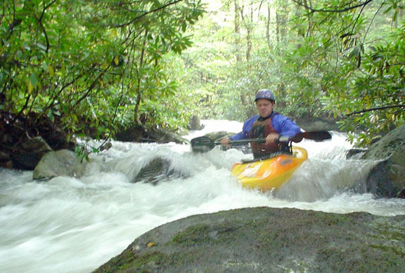
The price of admission to this gem of a rhodedendron flush is an impossibly narrow and fairly steep top section that is scrapy Class IV at lower levels and pushy Class IV when some water is poured into it. The mile-by-mile gradient, courtesy of TopoZone, says it all: 220, 155, 85, 150, 140, 100. This creek seems almost too small when you launch near the roadside tire dump off Brandonville Pike. ItÂs not. But it is steep, blind and you can expect to be dealing with wood. Running the first half mile can be a time consuming endeavor. As the gradient suggests, the creek does ease up. But it never gets very wide, has few comfortable eddies and the rapids rarely let up, even in the easier sections. Overhanging rhodedendron is both a blessing  you can grab it to stop - and a curse  it will take your head off if you donÂt duck fast enough.
This creek invites disagreement over difficulty rating. Running it is a serious undertaking, yet it has a softer side. . The IV rating on this page matches the recent edition of _A Canoeing and Kayaking Guide to West Virginia_ by Walbridge, et. al.
The Rapids:
The steep stretch at the top starts right below the putin and itÂs hard to break out the details here. There are usually a couple trees down, though, so be on the ready. When you portage around them, you might as well scout from river left to see whatÂs downstream. Though the drops are steep and wide, the creek is too small to have many lines. Watch for undercut rocks and a river right sieve halfway through this section. The climax up top is a tight, dynamic hard right to left turn in front of a big boulder.
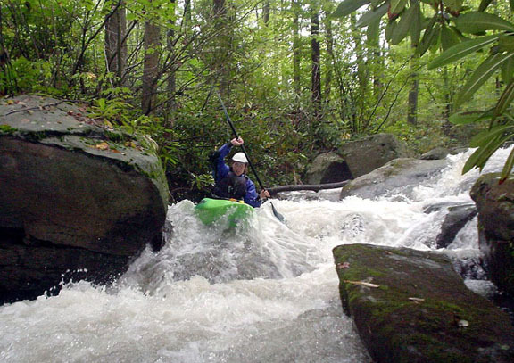
When things ease up the creek speeds through a narrow course with the rhody hanging low. ItÂs still pretty blind and single file with plenty of space between boaters is the only way down. At some point, the gorge opens up and the creeks changes gears for a while. Midway through this section is an island with a low footbridge in the left channel. The landowner has put a nice warning sign on the creek as a courtesy (IÂm betting thereÂs a story behind that). The right channel is an alternative, but you may end up portaging anyway because of wood.
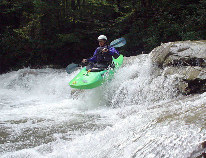
A III+ ledge series marks the beginning of another gorgy section, this time with ledgy characteristics. There is a large submerged tree in the right side midway through this set of drops that pinned a boater in 2003. It was still there in March, 2004. Below here is a little more boogie before a high ledge  6 to 10 feet  must be negotiated. Take a look because the best lines change with the water flow. After a couple slides, there is another larger ledge of about 6 feet which can also be run in different places, depending on the water. Below here are a number of slides and ledgy holes. One of the slides is fairly long and the gradient drop is impressive, so take a moment to look upstream. The creek settles to open boogie for the final stretch down to the Cheat River. Watch for a retentive playhole just above the takeout bridge.
Access:
YouÂll come to the takeout first when driving south to Albright, WV on Rt. 28. Park at the rafting outfitters (you might want to ask if they are busy). Take Coal Lick Road up the hill along the creek (right across from the outfitters). Bear right at the unmarked junction, then turn right onto Brandonville Pike (CR 3-12). Look for a couple pulloffs on the right just up the road a bit. YouÂll know you are in the right place if you see a roadside dump along the creek at one of the pullouts.
Rapids in this Run (1)
Waterfalls (1)
Hazards & Portages (1)
Caution: The following locations may require scouting or portaging. Always check current conditions.
Difficulty
Class IV
Length
5.7 mi
Gradient
139 ft/mi
max 220
Rapids
1
1 Hazard
Access Points
Difficulty Classes
I Easy
II Novice
III Intermediate
IV Advanced
V Expert/Extreme
VI Unrunnable
Current Conditions
5-Day Forecast
Whitewater data from
American Whitewater
American Whitewater