Cranesville Swamp Nature Preserve (Lake Ford Road) to Youghiogheny River
Muddy Creek (Youghiogheny trib.)
Linked via: Nhdplus discovery 90% confidence Synced 6mo ago
Gauge Conditions
Runnable: 100.0 – 1,000.0 CFS
Data from American Whitewater & USGS
Run Map
Run Time Estimate
Select put-in and take-out to estimate time.
Unlock Advanced Trip Planning
See wind-adjusted speed maps, forecast planning, and detailed time estimates.
Sign in to generate an AI timing estimate for this run.
Whitewater timing varies with scouting, portages, and group pace. Use as a planning baseline.
Description
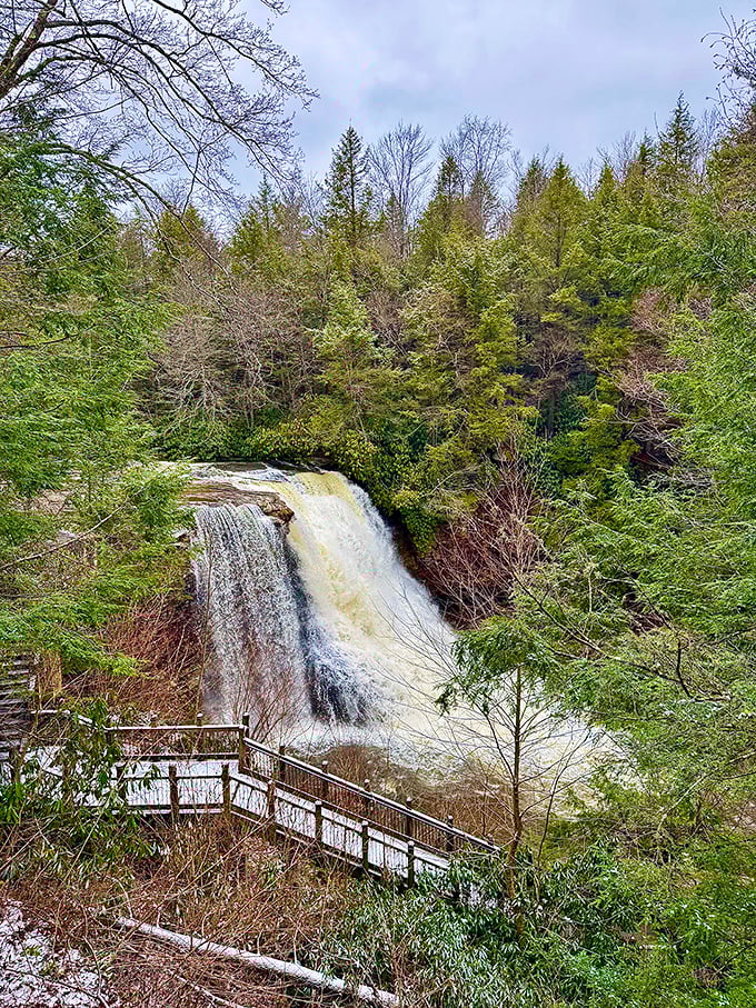
Be sure to scout the takeout before you run this thang. You don't want to get washed over Muddy Creek Falls, the highest waterfall in the state of Maryland.
Lat/longitude coordinates are a SWAG, from TopoZone.
Other related or nearby streams:
Lower Yough (Class III)
Bear Creek (Class IV)
Deep Creek (Class IV-V)
Top Yough (Class IV-V)
Upper Yough (Class IV-V)
Middle Yough (Class II)
Waterfalls (1)
Difficulty
Class I-III(V+)
Length
5.8 mi
Gradient
67 ft/mi
max 150
Rapids
0
Access Points
Difficulty Classes
I Easy
II Novice
III Intermediate
IV Advanced
V Expert/Extreme
VI Unrunnable
Current Conditions
5-Day Forecast
Whitewater data from
American Whitewater
American Whitewater