Crawford (SH 317) to FM 3047 (7 miles)
Linked via: Proximity 95% confidence Synced 6mo ago
Gauge Conditions
Runnable: 3.8 – 15.0 FT
Minimum flow taken from Texas Whitewater and confirmed by paddler beta. Maximum flow estimated from paddler beta.
Data from American Whitewater & USGS
Run Map
Run Time Estimate
Select put-in and take-out to estimate time.
Unlock Advanced Trip Planning
See wind-adjusted speed maps, forecast planning, and detailed time estimates.
Sign in to generate an AI timing estimate for this run.
Whitewater timing varies with scouting, portages, and group pace. Use as a planning baseline.
Description
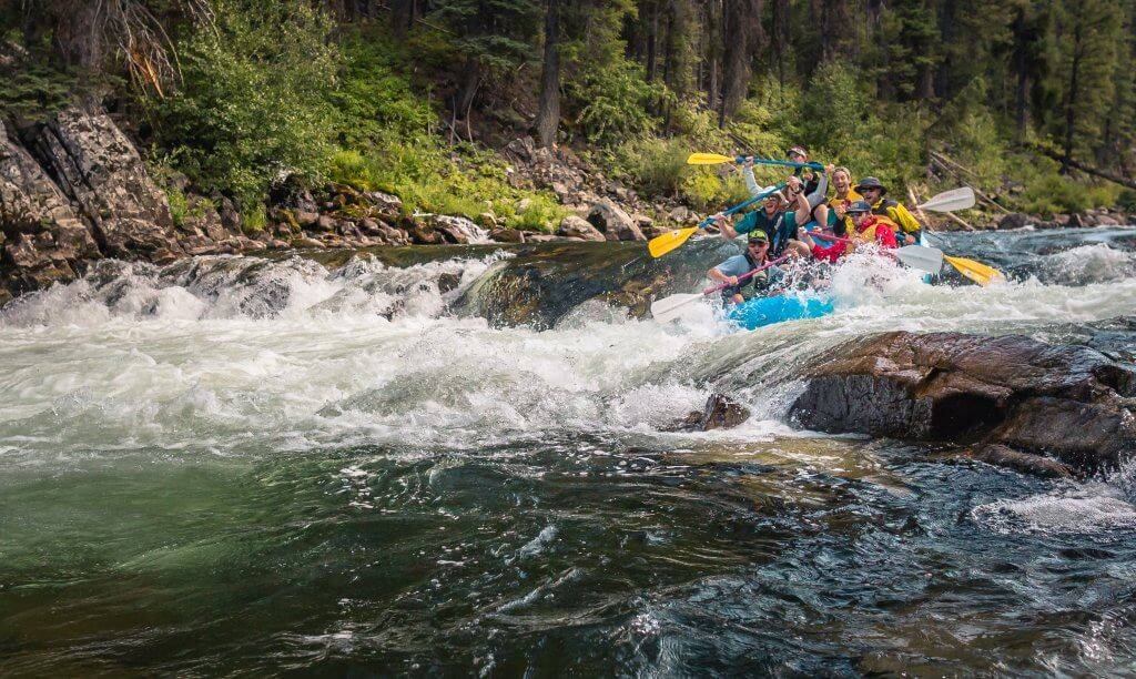
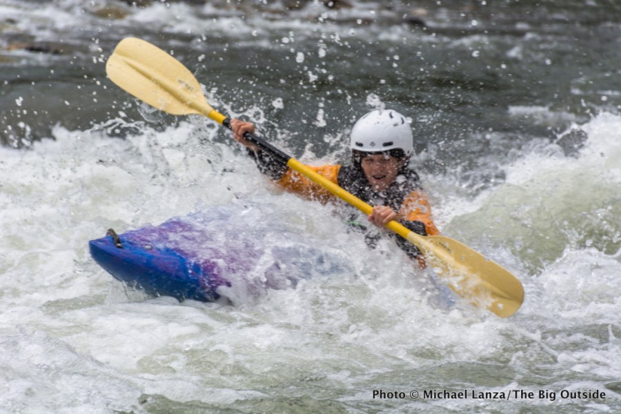
When it's in, the Middle Bosque makes for a great playboating run. Both Texas Whitewater and local paddlers suggest 3.8' as the minimum runnable level (below that, you may be scraping bottom and/or walking.) Beta from paddlers suggests that the river generates a lot of play features below 5'. At higher levels, some of those features wash out, but the ones that are left become more optimal. Beta suggests that, above 9', river-wide waves form that are big enough for 3-4 boaters to surf simultaneously. The river is known to have been run-- and still playable-- as high as 13-14'.
Distance and gradient measured using GIS tools in 2015.
Rapids in this Run (4)
Playspots (1)
Hazards & Portages (1)
Caution: The following locations may require scouting or portaging. Always check current conditions.
Difficulty
Class II-III
Length
7.0 mi
Gradient
11 ft/mi
Rapids
4
1 Hazard
Access Points
Difficulty Classes
I Easy
II Novice
III Intermediate
IV Advanced
V Expert/Extreme
VI Unrunnable
Current Conditions
5-Day Forecast
Whitewater data from
American Whitewater
American Whitewater