D. Ohio Edison Dam to Cascade Valley MetroPark
Linked via: Proximity 95% confidence Synced 6mo ago
Gauge Conditions
Runnable: 400.0 – 3,000.0 CFS
Data from American Whitewater & USGS
Run Map
Run Time Estimate
Select put-in and take-out to estimate time.
Unlock Advanced Trip Planning
See wind-adjusted speed maps, forecast planning, and detailed time estimates.
Sign in to generate an AI timing estimate for this run.
Whitewater timing varies with scouting, portages, and group pace. Use as a planning baseline.
Description
Shuttle Directions
There are multiple options for setting shuttle on this section. I prefer to park at the take out and hike the High Bridge Trail to the dam. Other than the steps at the beginning, it’s mostly flat for the ~1 mile hike, but I’m carrying a Jackson so your opinion may differ!
Directions to the putin(s):
Take OH Rt. 8 to Howe Ave. exit and head west. At the light turn right on Front Street. If you want to run the right side of the falls, cross the bridge and turn left at the next light into the Gorge Metro Park parking lot. Follow the trail to the observation deck.
If you don’t want to run the falls (or want to run the left side), turn left into the small parking lot before the bridge. This is the beginning of the High Bridge trail that will take you to the dam. Just pass the dam on your right (~100 feet) will be a trail to the river.
Another putin option is to stay on Howe Ave and go straight at the first light (Front St.). Howe Ave turns into E. Cuyahoga Falls Ave. at this light, go past Swensons, turn right at the next light on Clifton Ave. Take Clifton until it dead ends into Riverside Dr. Street parking is available on Clifton Ave. walk to the intersection of Clifton/Riverside and turn right. Look to your left for the trail to the dam. The trail can be steep and muddy near the end and puts you on the High Bridge Trail at the top of the dam.
Directions from the putin(s) to the takeout:
From the light at Howe and Front Streets, proceed SW past Swensons (on left) down E. Cuyahoga Falls Ave. for ~1.3 miles. Turn right at the light on Howard St. (Liberty Harley on your left) and head north. At the second street turn left on Uhler Ave (west). Go ~0.5 mile to the intersection of Cuyahoga Street (4-way stop) and turn right. Proceed ~0.3 mile to the park entrance for the Chuckery Area, turn right. Drive all the way to the last parking lot. From this parking lot you can take either the High Bridge Trail to the putin or the short trail to the river at Peck Road hole. The river side trail can be used to hike up to State Road (blue suspension bridge) for park and play options.
River Issues
A permit is required for accessing this section of the river. Metro Parks Serving Summit County requires one valid permit (annual issuance) in each group of 6 paddlers. A PDF version of the kayaking permit can be downloaded from here and you can fax your completed permit to (330-867-4711) for approval and issuance.
River Beta
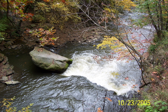
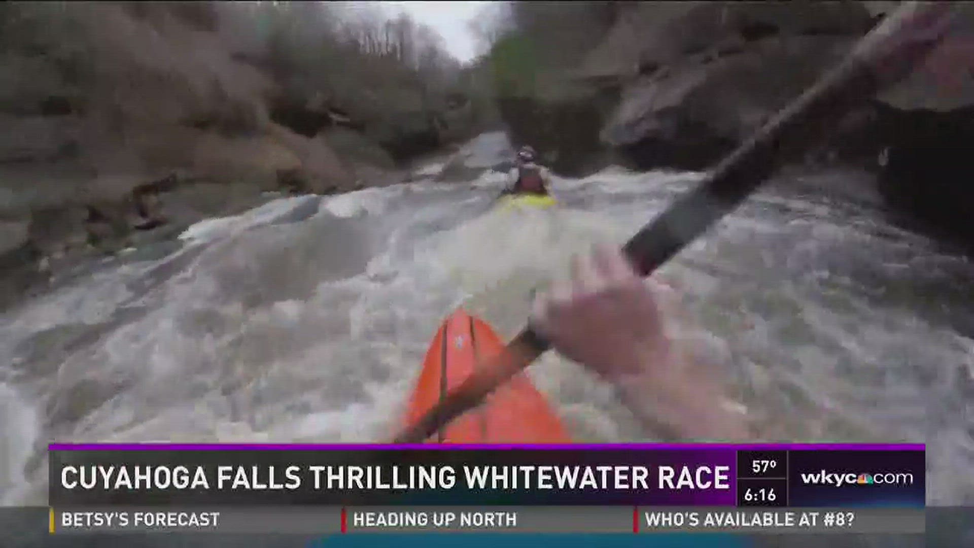
This is a shallow river underlain by shale/sandstone layers which create ledge drops, numerous surfing waves, and foot entrapment hazards. Eddies can be scare in some sections and swimmers can have a hard time depending on depth (flows). The main hazards are strainers which can come and go after rain events and water quality which can degrade during heavy precipitation due to several CSO discharges in the watershed. This is a fun section that offers little to no warm up and a playful set of surfing waves when it’s running (usually during Spring, and after big rains). The real fun begins about 800 cfs when this section is Class III-, but at 1400 cfs it begins to get that bigwater feel. Once the level reaches 2000 cfs, the river gets a push to it and the rating increases to Class IV-; so bring your ‘A’ game to handle the fast flow below the dam. There is plenty of surfing but you have to take most of it on the fly and a lot is at the beginning.
If you want to run the falls (original Cuyahoga Falls namesake) the put in is on river right, below the observation deck. The shelf next to the pylons is the best option for dropping the falls. Stay right to avoid the large pinning rock at the center of the falls!
After to falls, you want to be left of center as you enter the first rapid since the right side is shallow. A large eddy is on your left after you punch through this first hole. This eddy is the alternate put in for those who don’t want to run the falls or when the level is too high for a safe run of the falls. Take a few rides at this spot and contemplate the view of the dam and think about what if?
As the river bends, it is mostly quick water with several eddy’s on the left and 2 new (2010) large rocks on the right. It is nice and swirly behind these rocks at all levels, and when they are padded with water boofs are good with enough speed. Next up is the largest rapid on this section. Butterfly Rock is a river-wide hole that is trashy and has caused some good paddlers to swim, so pick your lines carefully. At lower levels (
Rapids in this Run (2)
Hazards & Portages (1)
Caution: The following locations may require scouting or portaging. Always check current conditions.
Difficulty
Class II-III
Length
1.3 mi
Gradient
50 ft/mi
Rapids
2
1 Hazard
Access Points
Difficulty Classes
I Easy
II Novice
III Intermediate
IV Advanced
V Expert/Extreme
VI Unrunnable
Current Conditions
5-Day Forecast
Whitewater data from
American Whitewater
American Whitewater