Dault's Falls (PnH or up to 6.8 miles)
Linked via: Nhdplus discovery 90% confidence Synced 6mo ago
Gauge Conditions
Runnable: ? – ? CFS
Approximate reading: This gauge is 5.9 miles away on Dault's Creek. Use as a general reference only.
Data from American Whitewater & USGS
Run Map
Run Time Estimate
Select put-in and take-out to estimate time.
Unlock Advanced Trip Planning
See wind-adjusted speed maps, forecast planning, and detailed time estimates.
Sign in to generate an AI timing estimate for this run.
Whitewater timing varies with scouting, portages, and group pace. Use as a planning baseline.
Description
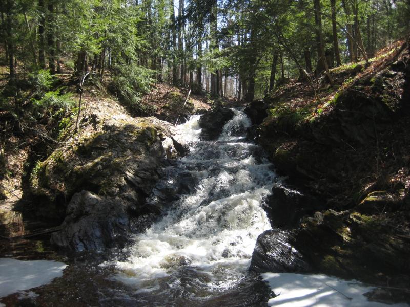
We are aware of runs of this small tributary of the Falls River in L'Anse. We cannot attest to how much of the creek was run, I.E., whether it is just a 'park-and-huck' of Dault's Creek Falls or if some longer stretch might be reasonably runnable.
Gradient starts 0.8 mile down from Herman Road in Herman, and averages near 140FPM for the next 3.5 miles, eases back to 50-ish for 1.5 miles before Dault's Falls, then hits about 124FPM for the final mile. However, the drainage area at the our listed/theoretical putin (at the head of the gradient) is 5.2 square miles. At Dault's Falls, it has increased to 9.1 square miles (and 9.33 sq.mi. at listed/theoretical take-out on Hwy.41).
On something this small, expect that it will take a lot (of rain or snowmelt or both) to make it run. Also expect that deadfall and snags will be a serious concern. (It is likely that anyone who does this once will not be eager to do it again.) We have listed a take-out on Hwy.41, but have no idea if a run to there is really feasible, nor whether adequate parking/access is available there. Downstream of the highway, the creek passes through L'Anse Golf Club (unknown clearance at golf-cart bridges) before its confluence with Denomie Creek, which later joins the Falls River not far upstream of the put-in for that run.
In general, one might expect it to 'go' only when rivers around L'Anse are running large.
A couple of photos (and minor non-boating description) is available at:
Anyone with more specific information is encouraged to help out your fellow boaters by providing a comment below.
Waterfalls (1)
Difficulty
Class IV
Length
5.7 mi
Gradient
115 ft/mi
max 185
Rapids
0
Access Points
Difficulty Classes
I Easy
II Novice
III Intermediate
IV Advanced
V Expert/Extreme
VI Unrunnable
Current Conditions
5-Day Forecast
Whitewater data from
American Whitewater
American Whitewater